Colorado Weather: Expect Gradual Clearing Sunday, Much Warmer Starting Monday
DENVER (CBS4) - The storm that brought light snow to much of Colorado on Saturday is now moving through Texas with snow as far south as the far northern suburbs of Austin and Houston. Here at home our Sunday morning began with low clouds, fog and flurries for many of us living east of the Continental Divide. A clearing trend will take over by tonight.
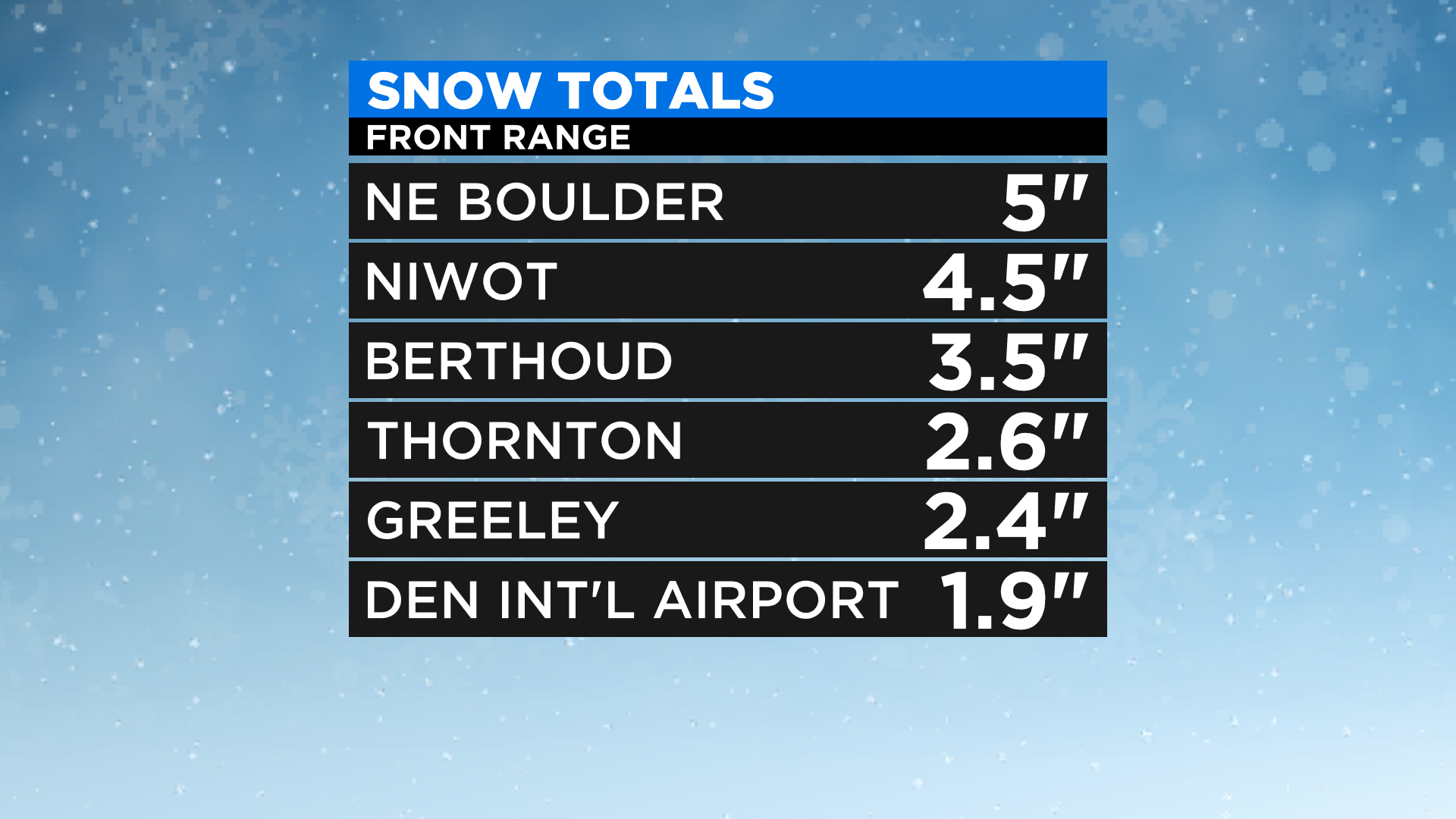
Overall snow totals were on the light side from this storm. Most locations along the Front Range reported anywhere from 1/2" to 3" of snow. We did have a couple of spots in the 4-5" range in parts of Boulder County and Larimer County.
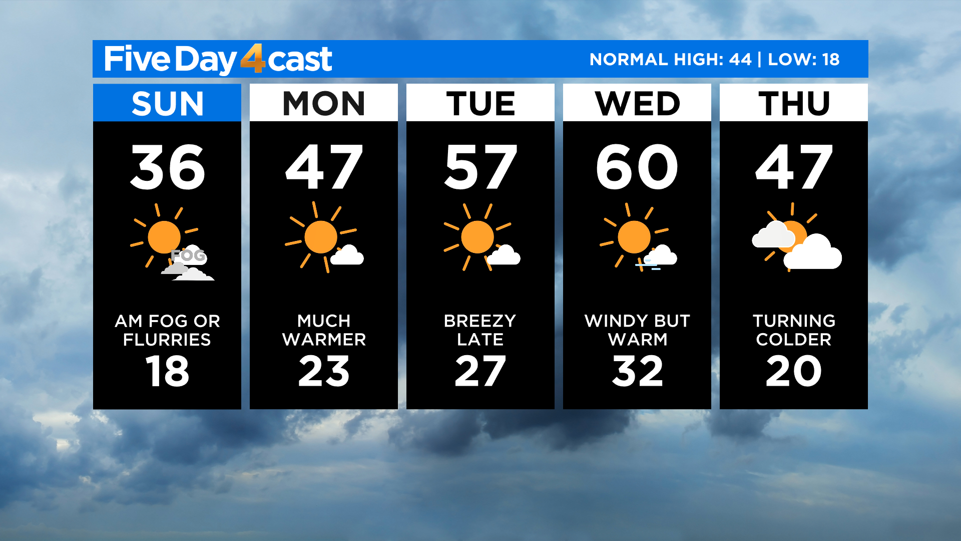
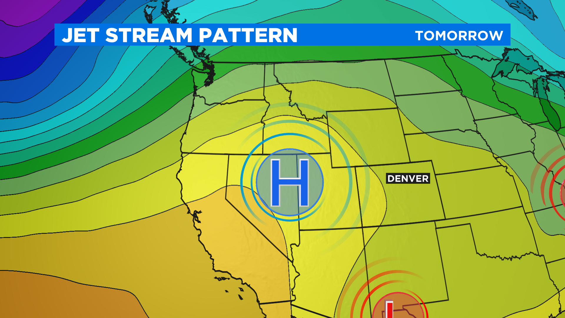
High pressure moving into the state will stay in control for the next few days. That means a big warming trend as a much warmer flow of air comes in from the west. By the middle of the upcoming week Denver will approach 60 degrees.
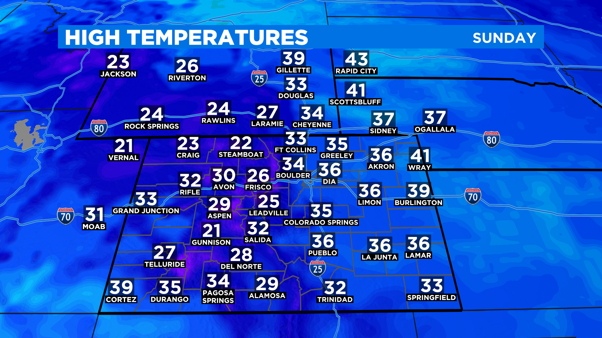
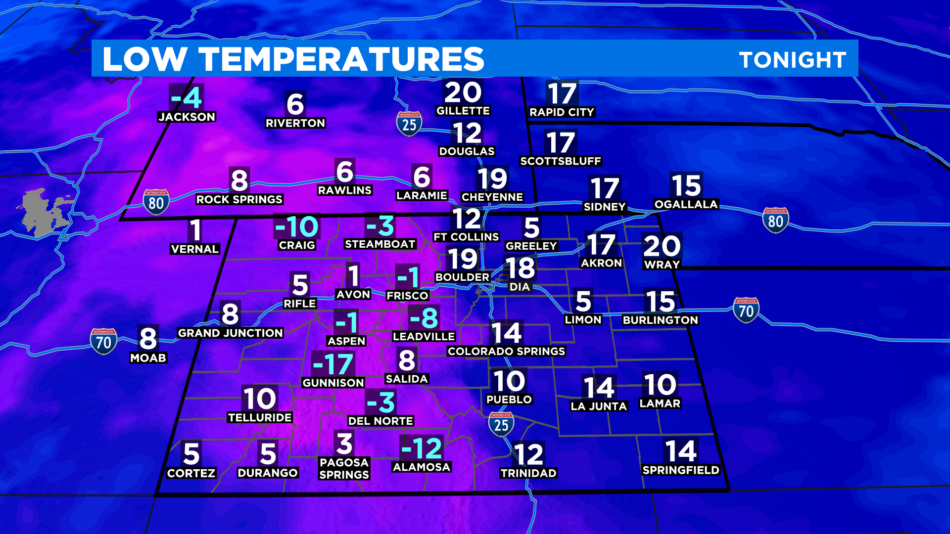
Highs today will be in the 20s and 30s just about statewide with some higher mountain valleys staying in the single digits and teens due to an inversion. With clearing skies for tonight it will be cold with most mountain areas expected to fall below zero. We'll see single digits and teens elsewhere.
In the week ahead a new storm system will approach the state on Wednesday. As a result it will turn very windy around the region. Colder air filters in starting Thursday and we could be talking more snow by Saturday. Stay tuned to see how the week evolves!