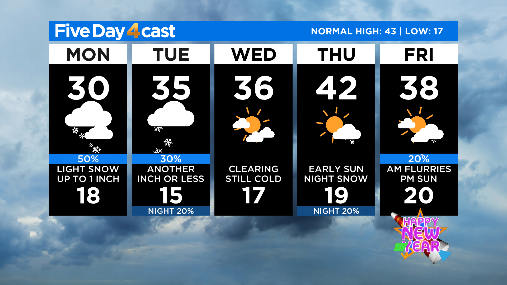
Denver Weather: Colder With Areas Of Light Snow Becoming Widespread Into Evening
DENVER (CBS4) - The last week of 2020 will bring areas of snow and much colder temperatures to Colorado. It's all part of a big storm system that moved into California early this morning.
Most locations across Colorado have reached their high temperature for the day thanks to extensive cloud cover. For Denver that is right around the 30 degree mark. A few places in extreme southern Colorado have managed to warm into the lower 40s and we have mostly 20s in the mountains.
Areas of light snow with occasional moderate bursts will continue into the evening hours along the Front Range and on the eastern plains, especially to the north and east of downtown Denver. Accumulations will be light in the city of Denver with only an inch or two expected at this time. But totals will be a bit higher along the south side of the Cheyenne Ridge in places like Loveland, Fort Collins and Sterling.
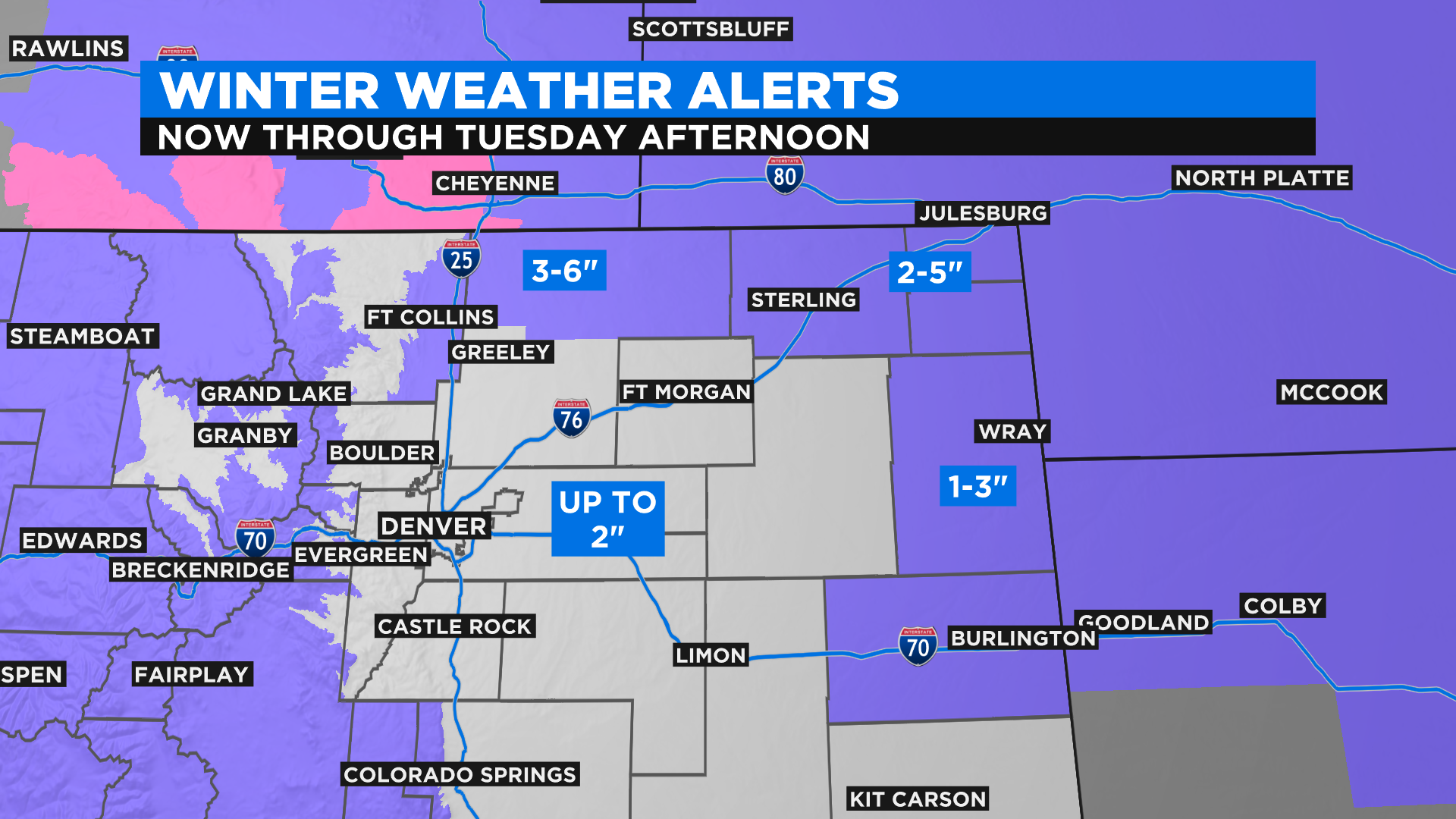
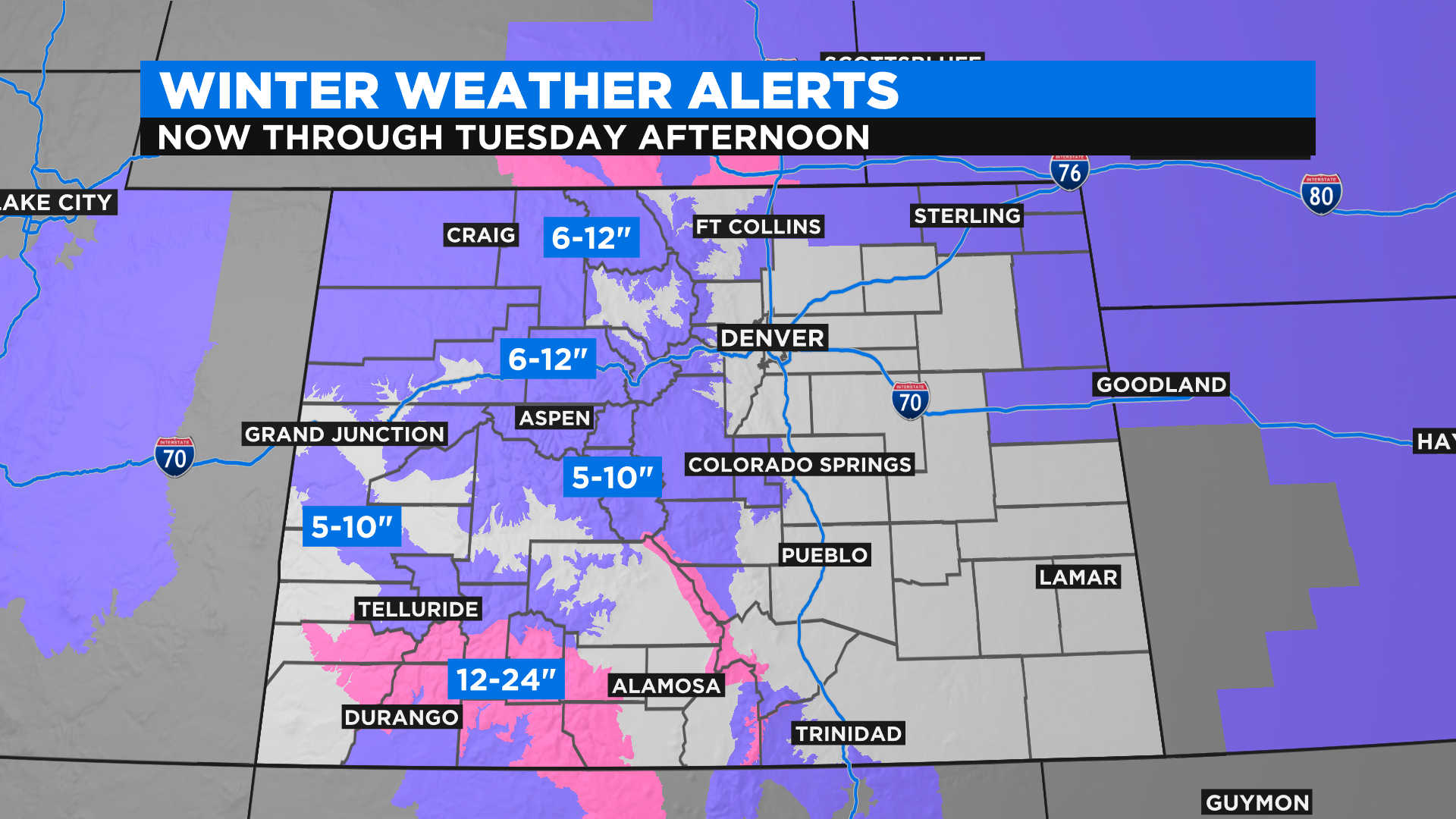
In the mountains the snow will be moderate to heavy at times and it could be accompanied by gusty winds. The National Weather Service has issued several winter weather alerts for the high country.
RELATED: Avalanche Watch Issued As Snowstorm Could Trigger Widespread Avalanche Cycle
Snow totals on the map below are for higher mountain peaks and passes. Totals will be lighter in the valleys.
We'll see a brief break on Wednesday and Thursday before another weak weather system arrives. It will bring more snow to the mountains and the chance for a few light snow showers to Denver early on Friday.