Colorado Weather: Mountain Snow Returns By Sunday Night, Lasts Into Tuesday
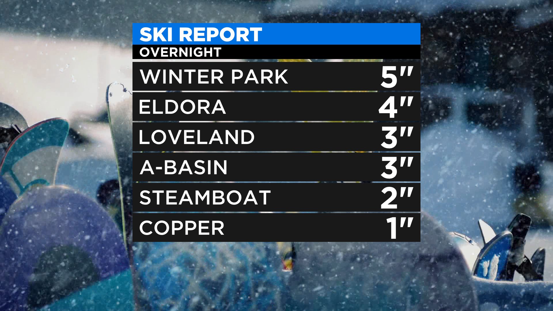
DENVER (CBS4) - A fast-moving cold front blasted across Colorado overnight with some gusty wind and a few areas of light snow. Most of that was confined to the higher terrain where a few ski areas in the northern and central mountains picked up a little accumulation.
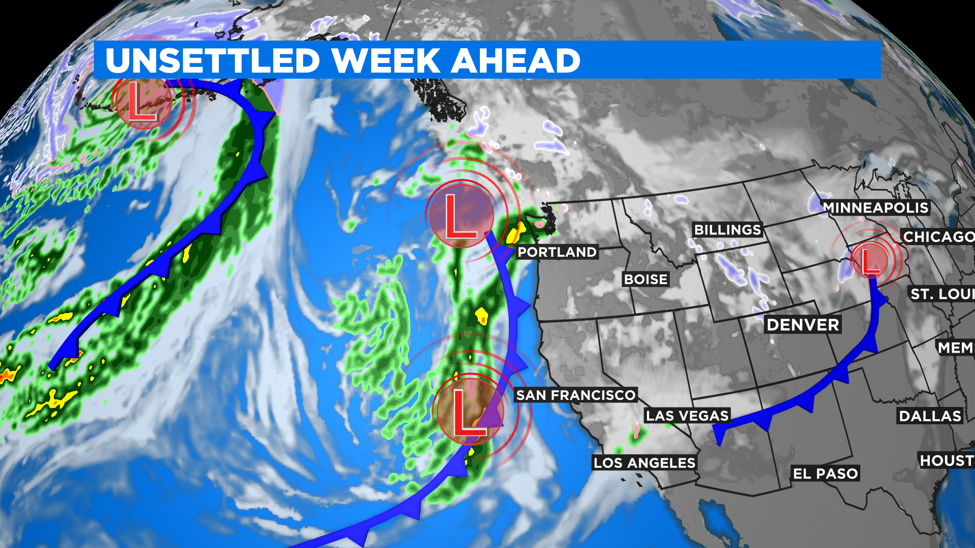
Behind last night's cold front we will see two more cross the state during the week ahead. The next one will arrive tonight into Monday with colder temperatures and widespread mountain snow. The third one should be here sometime around New Year's Day.
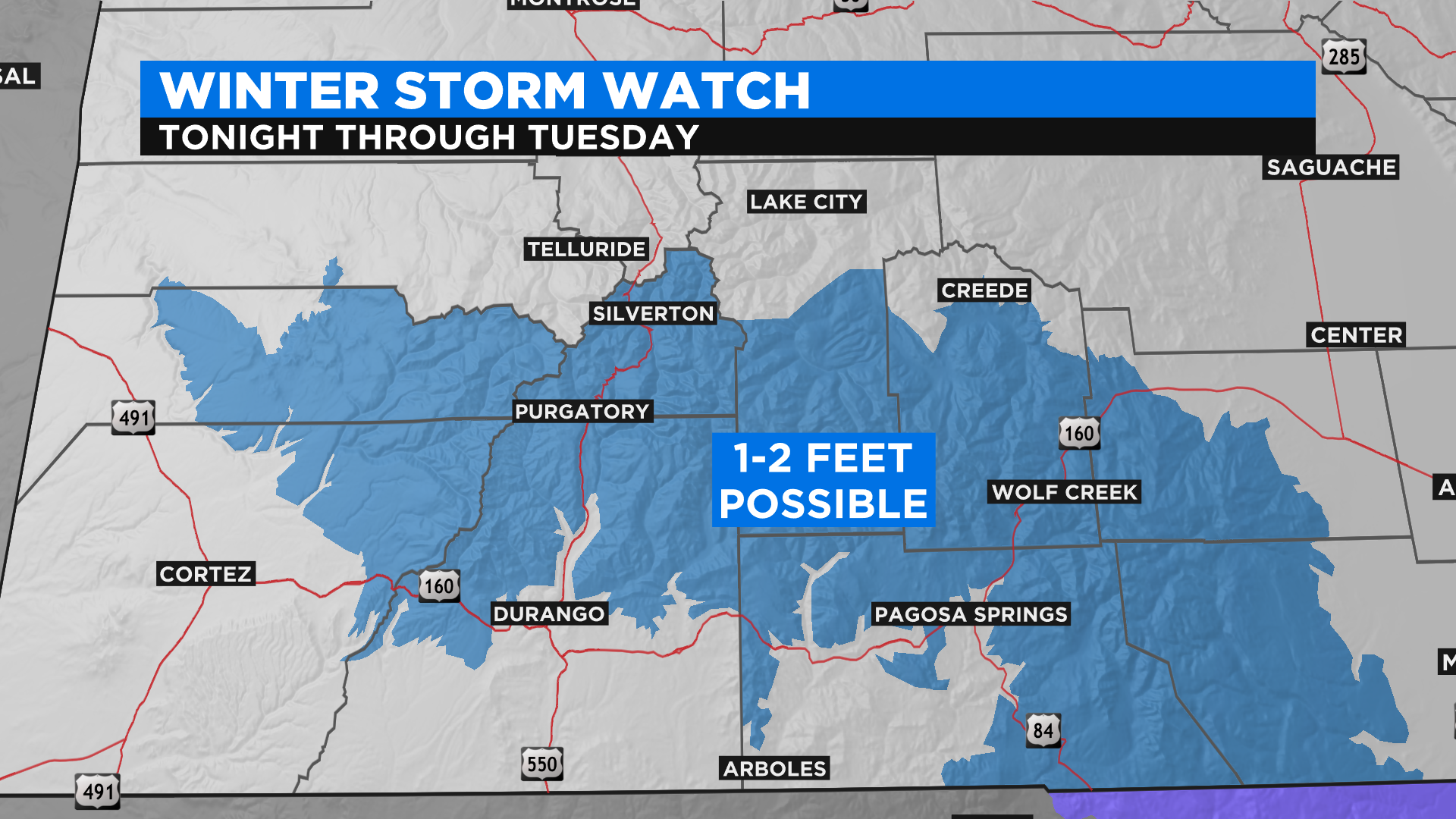
The heaviest totals from our next weather maker will come out of the San Juan Mountains in southwest Colorado where totals could be measured in feet for places like Purgatory and Wolf Creek. The National Weather Service has issued a Winter Storm Watch for that part of the state.
The rest of Colorado's high country will see totals under a foot but there could be isolated pockets that get close to that mark. At this time there are no additional weather advisories in effect but that could change by this afternoon as the storm gets closer.
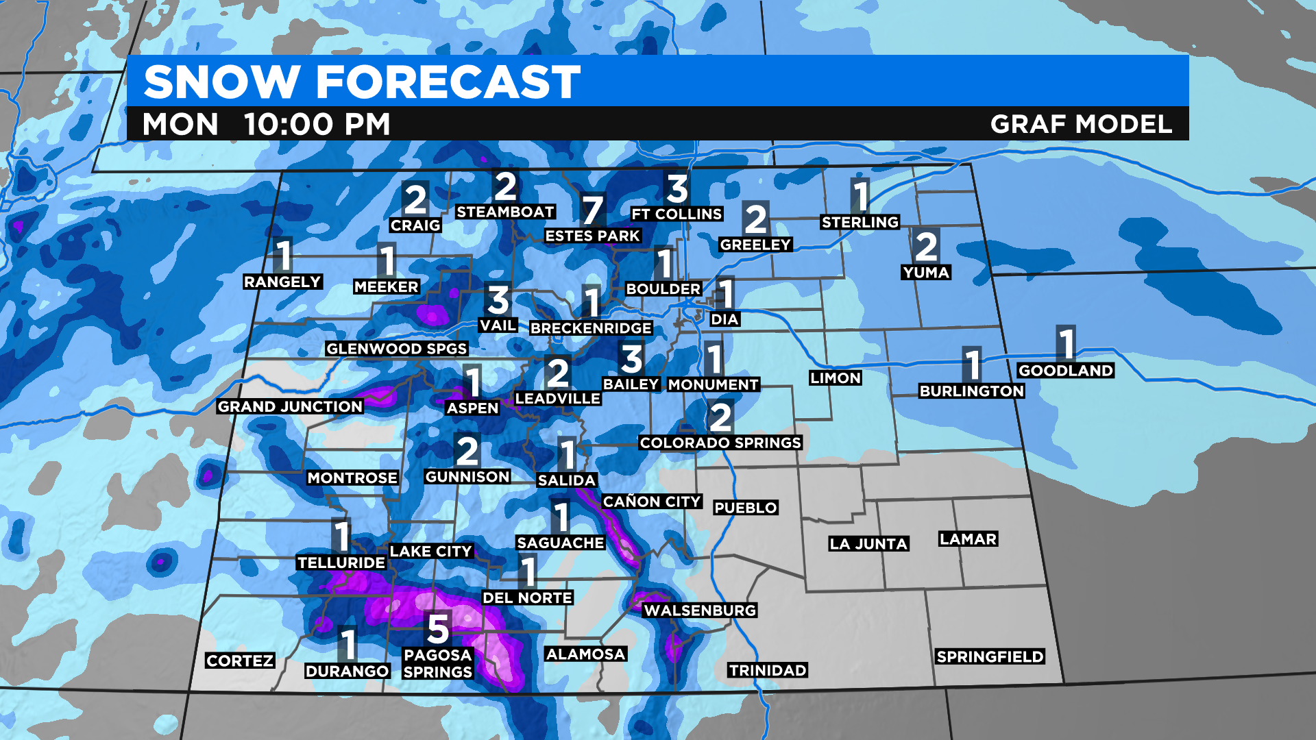
Light snow is also expected in Denver and on the eastern plains starting sometime Monday morning and lasting into the evening. Overall totals will be on the light side but some slick travel will be possible.
RELATED: Denver Weather: Snow Expected Monday With Next Storm Moving Into State