Denver Weather: Snow Set To End Friday Afternoon, Cold Night Ahead
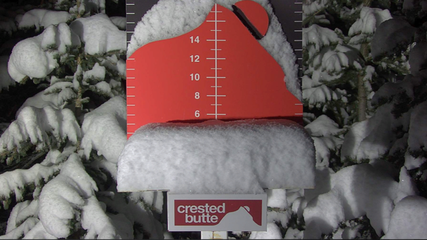
DENVER (CBS4) - The latest winter storm to hit Colorado has brought 2-6 inches of snow to most ski areas and under 1 inch to most of the Denver, Boulder, and Fort Collins areas.
Snow started at lower elevations Friday morning and the chance for snow will continue through mid-afternoon. Accumulation will be limited with most areas around Denver and Boulder getting no more than 1 inch of snow. Roads should also be warm enough below 6,000 feet for most snow to melt on contact.
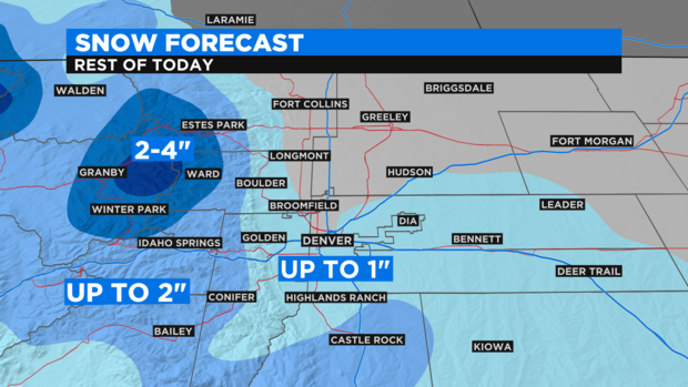
Areas above 6,000 feet on the south and west sides of the metro area could see slightly higher accumulation with up to 2 inches including along the Highway 285 corridor above Morrison. And a few spots above about 7,500 feet in Boulder and Larimer Counties could get up to 4 inches of accumulation.
The snow should end completely at lower elevations no later than 4 p.m.
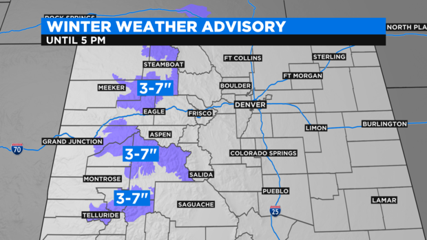
Elsewhere, the mountains of Summit County should get no more than 1-4 inches of snow while mountain areas farther west including The Flat Tops, the Rabbit Ears Pass area, the Grand Mesa, and the northern San Juan Mountains will get a total of 3-7 inches. These locations are under a Winter Weather Advisory until 5 p.m. Friday.
The storm responsible for the snow will clear the state Friday night and allow a ridge of high pressure over California to gradually move east.
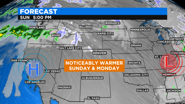
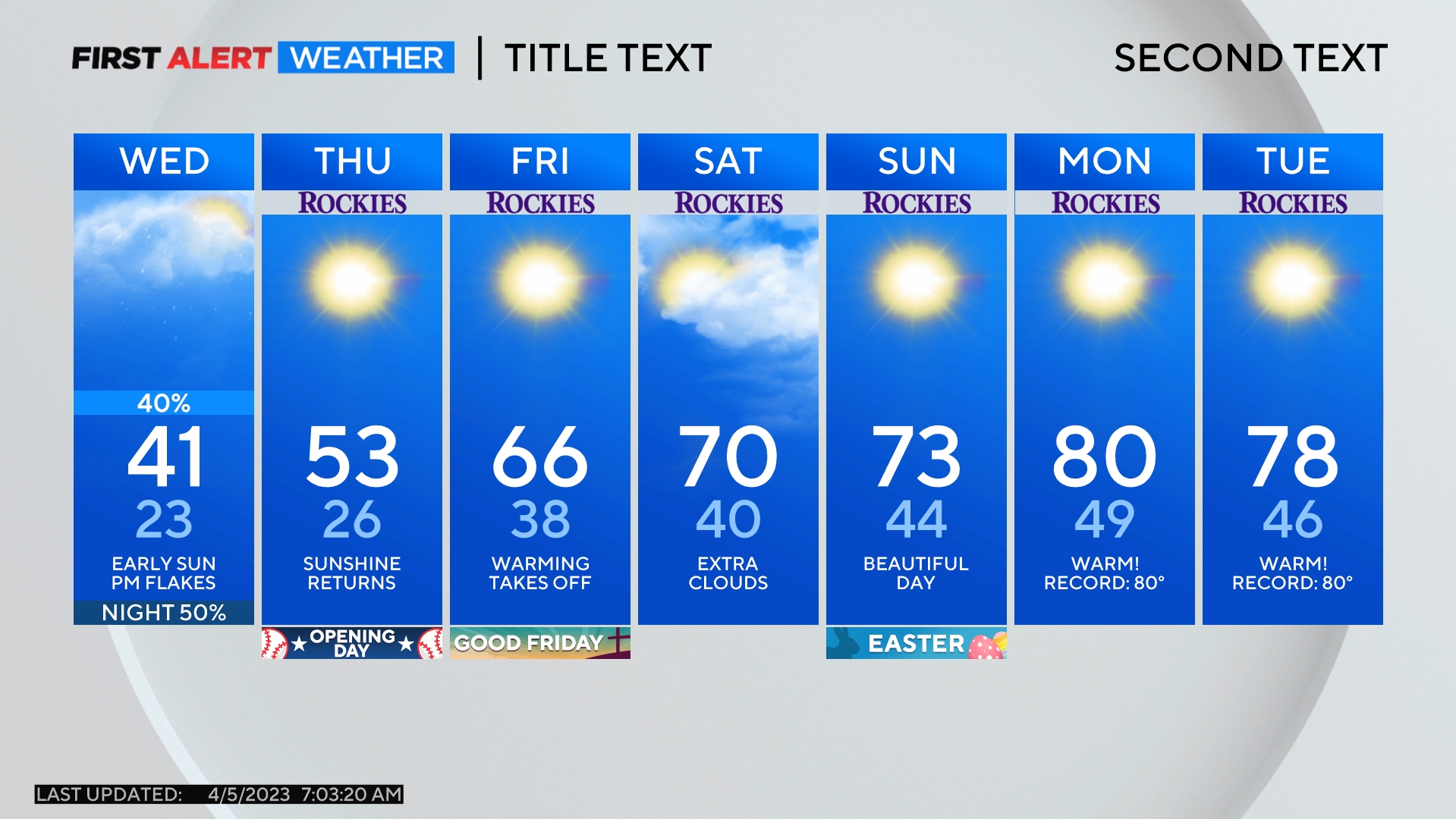
The result be will somewhat warmer temperatures on Saturday and then a noticeably warmer day on Sunday with highs near 50 degrees in the metro area.