Colorado Weather: Storm Set To Slam The Mountains With Wind And Snow, Wind Also Reaches Denver
DENVER (CBS4) - A storm racing toward Colorado from the northwest will reach the state Friday night causing widespread snow and wind in the mountains. Most of the moisture will stop short of reaching the Denver metro area. It's a different story with the wind.
Snow will initially develop by late Friday evening in the mountains including along Interstate 70 above Georgetown. The snow will intensify through the night and the heaviest snow is expected Saturday morning.
A Winter Weather Advisory starts in the mountains at 9 p.m. Friday and continue through 8 p.m. Saturday for up to 10 inches of snow. The highest amounts will generally be found over the mountains west of Vail Pass.
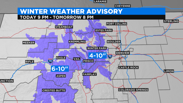
In addition to the snow, wind gusts could reach over 70 mph at the top of the higher peaks and passes. The combination of the wind and snow will cause blowing snow, drifting snow, and limited visibility along most mountain roads including sections of I-70, US-40, and Highway 285.
Travel will likely be slow in the mountains on Saturday. Road closures and/or major traffic backups are possible.
The northwesterly trajectory of the storm means very little, if any, moisture will be able to reach Denver. There is a small chance for a quick rain or snow shower in the metro area Saturday morning but chilly and blustery weather will be the bigger story at lower elevations.
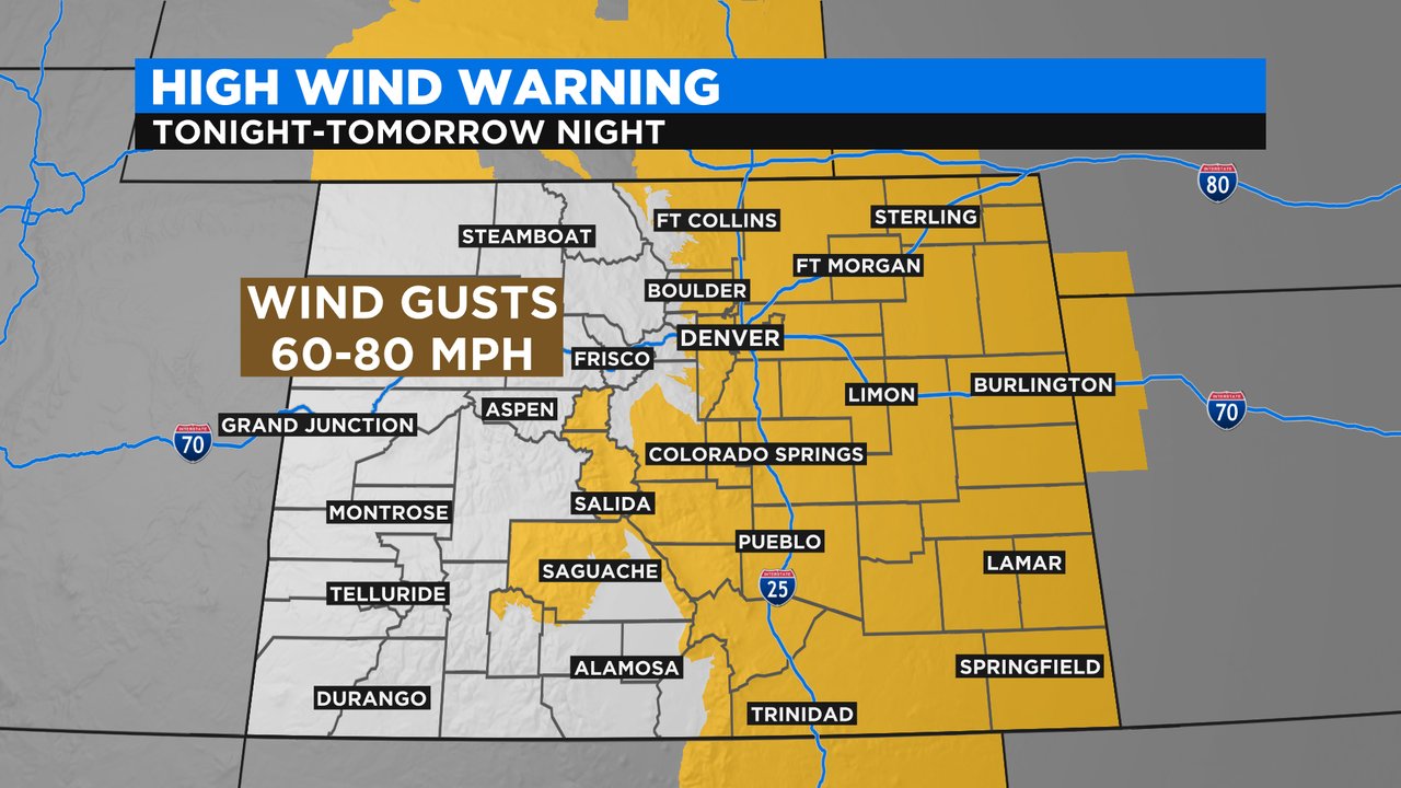
A High Wind Warning has been posted for all areas east of the mountains for wind gusts up to 65 mph.
So while the Front Range will be mainly dry, it will be cold and windy! Temperatures will drop back into the 30s and 40s in the metro area on Saturday after highs near 60 degrees on Friday. The wind will make it feel even colder.