Denver Weather: One More Day With Chilly Temperatures, Mountain Snowstorm Ahead
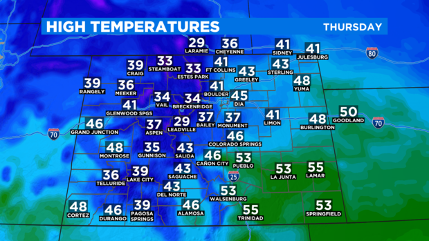
DENVER (CBS4) - Thursday will be the fourth consecutive day along Colorado's Front Range with temperatures staying far below normal. Noticeably warmer weather will arrive on Friday.
The normal high temperature in Denver during the second week in November is in the mid 50s. The Denver area has been consistently 5-10 degrees below normal since Monday. And not much will change on Thursday with highs only in the mid 40s around Denver, Boulder, and Fort Collins.
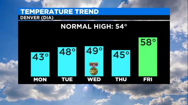
It will stay cooler than normal across the vast majority of the state on Thursday.
Light mountain snow is possible in the morning while the afternoon should be dry with gusty winds in the high country.
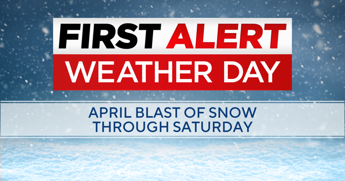
From Thursday afternoon through Friday afternoon it should be dry almost statewide. Then a stronger storm will arrive Friday night causing widespread snow in the mountains that will continue into Saturday and Saturday night. Very gusty winds will also be found in the mountains during this time causing blowing and drifting snow. Visibility will be limited on many mountain roads including portions of I-70 and road closures are possible.
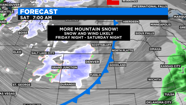
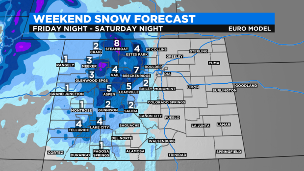
In terms of snow accumulation, most areas above 9,500 feet will get 4 to 8 inches of accumulation with highest amounts from Summit County northwest to the Steamboat Springs area.
Because of the westerly trajectory of the storm, Denver and the Front Range will get very little, if any, precipitation. That said, a few isolated rain or snow showers can not be ruled out on Saturday in the metro area. It will also be breezy and cooler again at lower elevations this weekend behind a cold front the storm will push across the metro area Friday night. Then much warmer weather will develop next week.