Brief Friday Wildfire Relief In Colorado Before Fire Danger Surges Saturday
DENVER(CBS4) - Our first of two cold fronts was a welcome shot of moisture and cooler temperatures in Colorado.
With a shot of drizzle and light flurries over the Front Range helping to slow fire progression across northern Colorado. In addition, to the moisture the wind flow behind the front on Friday morning dropped dramatically from the gusts earlier in the week.
The relief will be short-lived however, as we get closer to the weekend an approaching low pressure trough will bring in a strong pressure gradient and overhead jet stream Friday into Saturday.
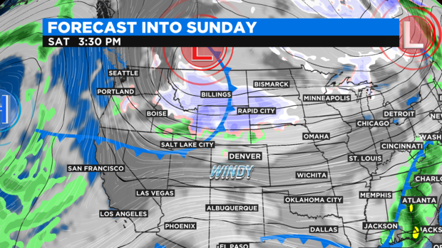
This will bring back strong winds over all of the states mountains and foothills.
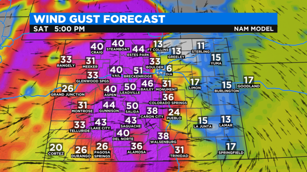
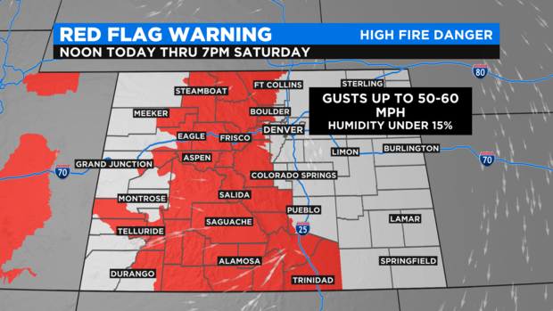
There is a Red Flag Warning in place from Friday afternoon thru Saturday night for high fire danger returning ahead of the Sunday weather change.
Saturday night into Sunday morning the 2nd bigger cold front blasts thru the region. This front will have a lot more moisture and cold Arctic air! Snow amounts will be significant.
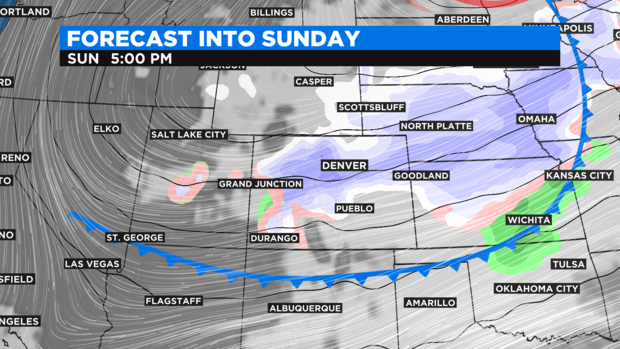
At this time it looks like the possibility of 3 to 6 inches for the the Denver metro area and 6 to 12+ inches for some the mountains and foothills. Including some of the major fire zones burning in northern Colorado.
RELATED: Drivers Discouraged From Traveling To Colorado's High Country This Weekend
With still two days out those snow amounts could change. We will have up to the minute updates here at CBSDenver.com, on CBS4 and on CBSN.