Denver Weather: Break For Firefighters Before Wind Returns To Foothills Overnight
DENVER (CBS4) - Colorado is split down the middle today with two different air masses in place. It's all thanks to a cold front that moved in from the north and east overnight. Here's what that front looked like at 8 am Sunday.
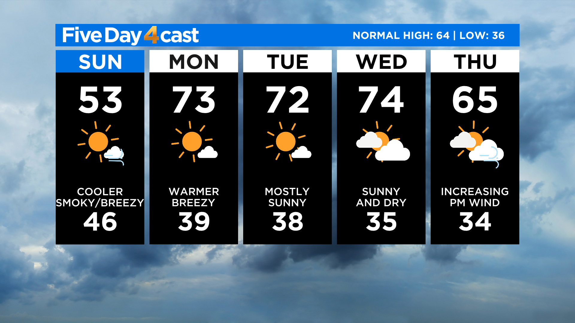
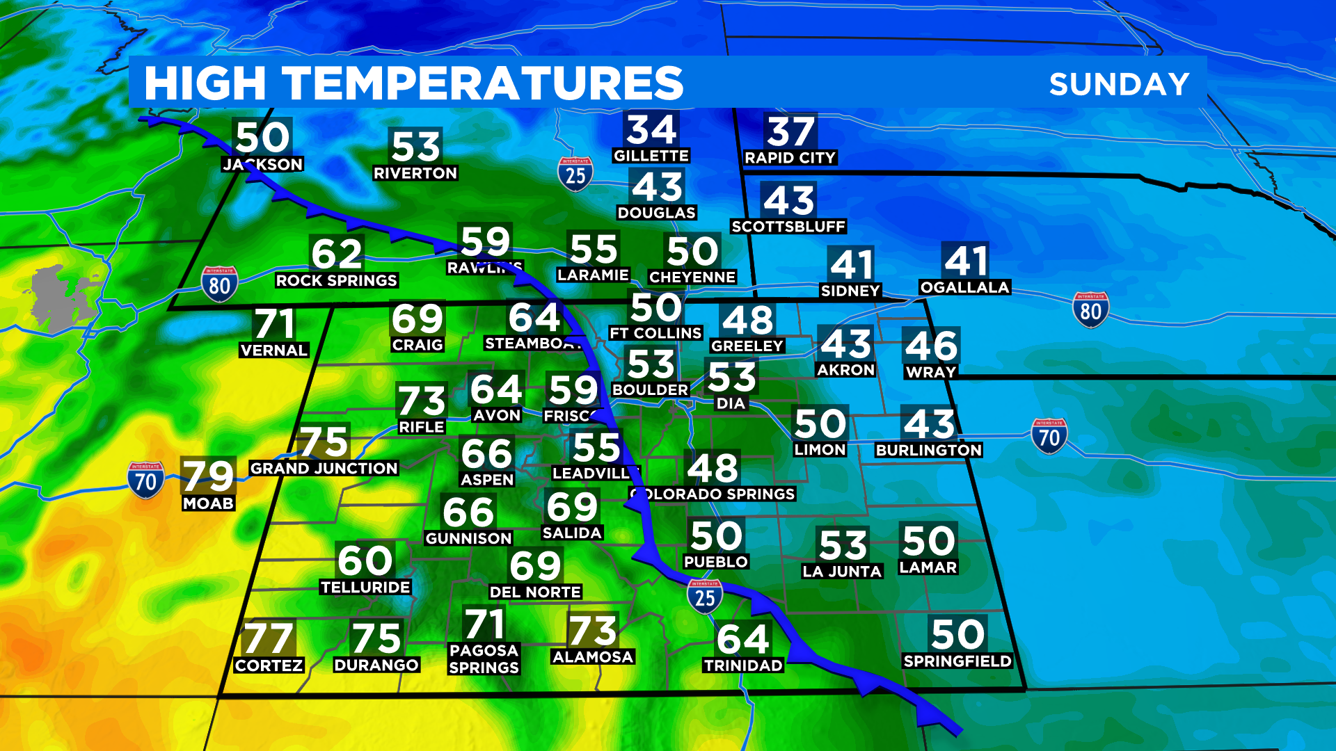
The cold front will sit along the Front Range mountains and foothills through the morning and into the afternoon hours. That means some help for those fighting the Cameron Peak Fire and CalWood Fire with cooler temps, higher relative humidity and areas of drizzle, fog and low clouds.
Western Colorado will not feel this front so it will be much warmer and dry west of the Continental Divide with 60s and 70s. That means little to no relief around the East Troublesome Fire. Meanwhile far eastern Colorado will not see anything above the 40s this afternoon.
Unfortunately by tonight strong westerly winds are forecast to kick in once again and that will push the cooler, more humid air mass off to the east. Our new week will begin with warm and dry conditions once again. We may have another strong cold front arrive by Friday and it may keep cooler weather in place for the entire upcoming weekend.