Denver Weather: Warm, Windy And Dry With Areas Of Dense Smoke At Times
DENVER (CBS4) - Happy Saturday! Get ready for a little bit of change in the hours ahead.
We have a strong cold front lurking off to the north of us and that is going to keep the wind machine going all day long. That means extreme fire behavior remains a huge concern around the Cameron Peak Fire and East Troublesome Fire.
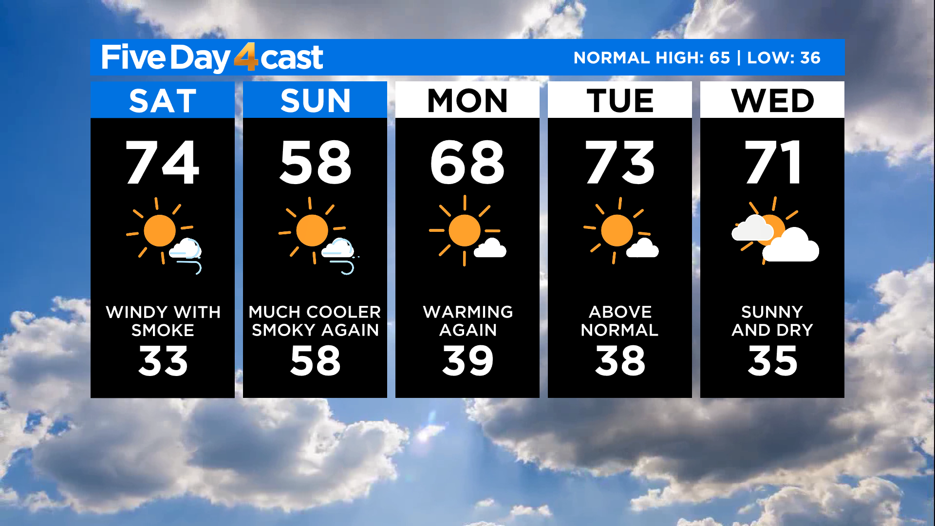
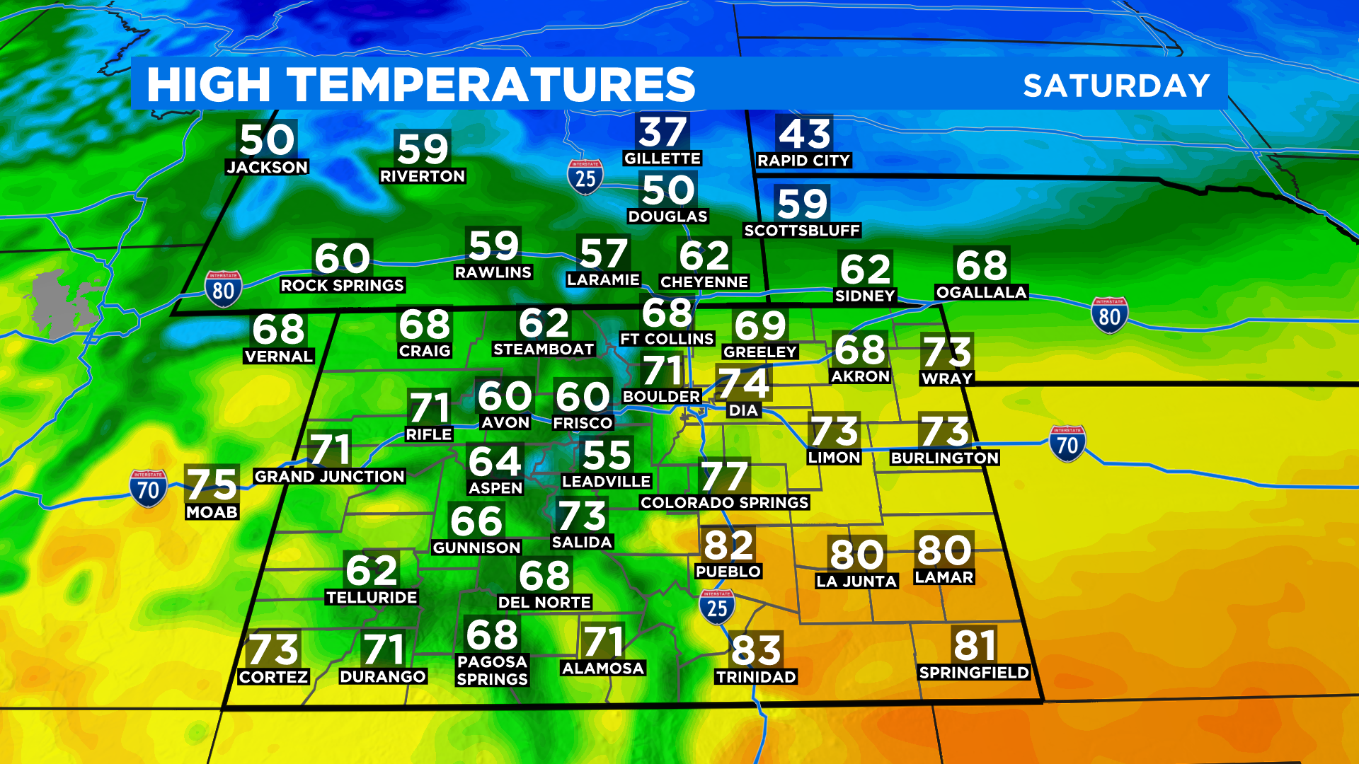
Ahead of the front it will be very warm with temperatures running as much as 10 degrees above normal for this time of year. In Denver we are expecting an afternoon high in the lower 70s.
With strong and gusty winds expected today the fire danger will remain extreme for many areas. Winds will blow from the west and northwest throughout the day.
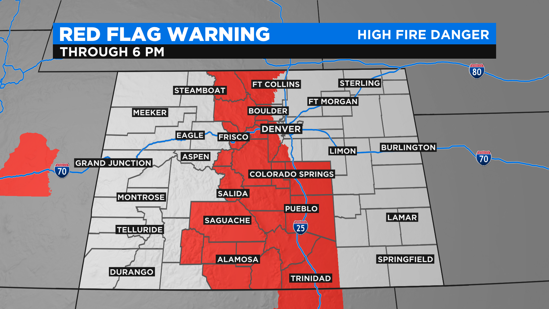
The National Weather Service has issued a Red Flag Warning until sunset for all areas between the Continental Divide and Interstate 25. This means current fires could have explosive behavior and any new fires could spread rapidly.
RELATED: 'Extreme Fire Behavior' Expected At Cameron Peak Fire On Saturday
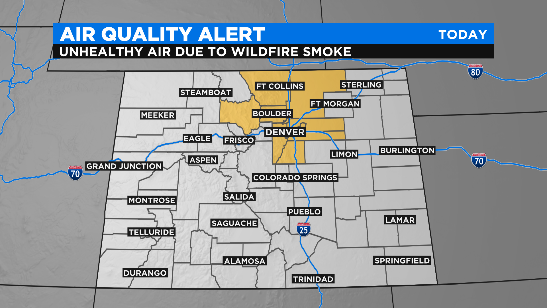
Dense smoke will be a big issue for areas downwind of the fires through this evening. We think the thickest plumes of smoke will be located between Denver and Fort Collins.
There is an air quality alert through 4 pm for everyone along the Front Range Urban Corridor between Castle Rock and Fort Collins, as well as in adjacent counties.
Temperatures cool down significantly for Sunday behind the cold front. Highs in Denver should only reach the mid to upper 50s. But the above-normal temps return as soon as Monday with highs right back into the 60s and 70s.