New High Wind Event Could Cause More Extreme Fire Behavior In Northern Colorado
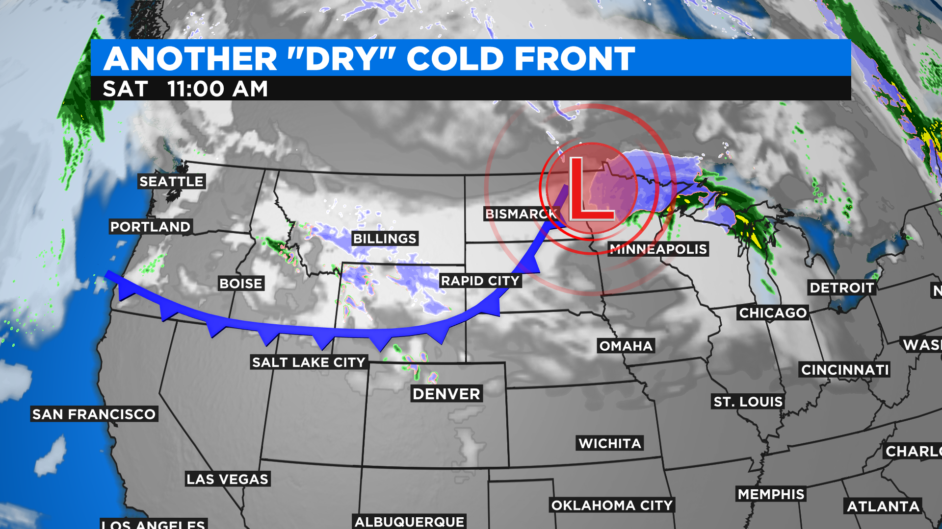
DENVER (CBS4) - There's bad news in the weekend weather forecast for the active wildfire zones in northern Colorado. A new high wind event is possible starting Friday night and lasting through the day on Saturday. Below is a snapshot of potential wind gusts by Saturday afternoon.
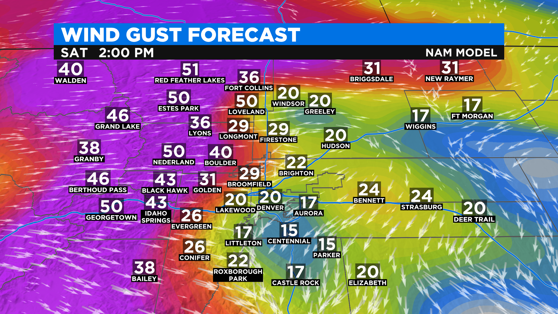
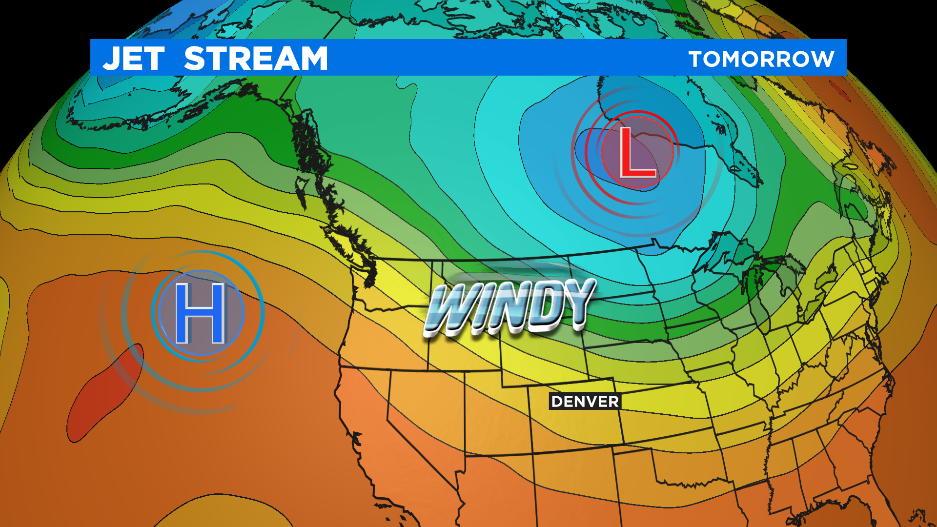
The set up is very similar to what we saw on Wednesday when the Cameron Peak Fire made a 17-mile run across the foothills of Larimer County. A powerful jet stream overhead will combine with a strong cold front at the surface to create an extended period of high wind. The strongest wind will blow from the west initially before turning more northwest over the course of the weekend.
For Denver and most of the Front Range this means more large plumes of smoke are expected along with poor air quality. At this time we think the worst conditions will be along and north of Interstate 70 but it will all depend on fire behavior as conditions change.
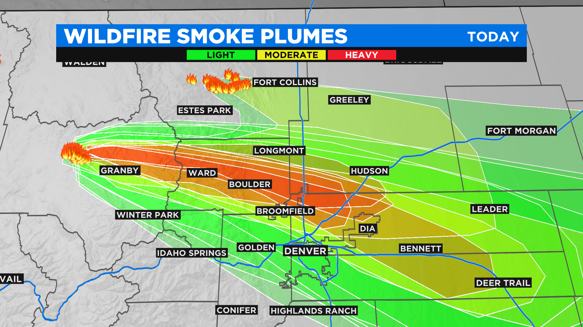
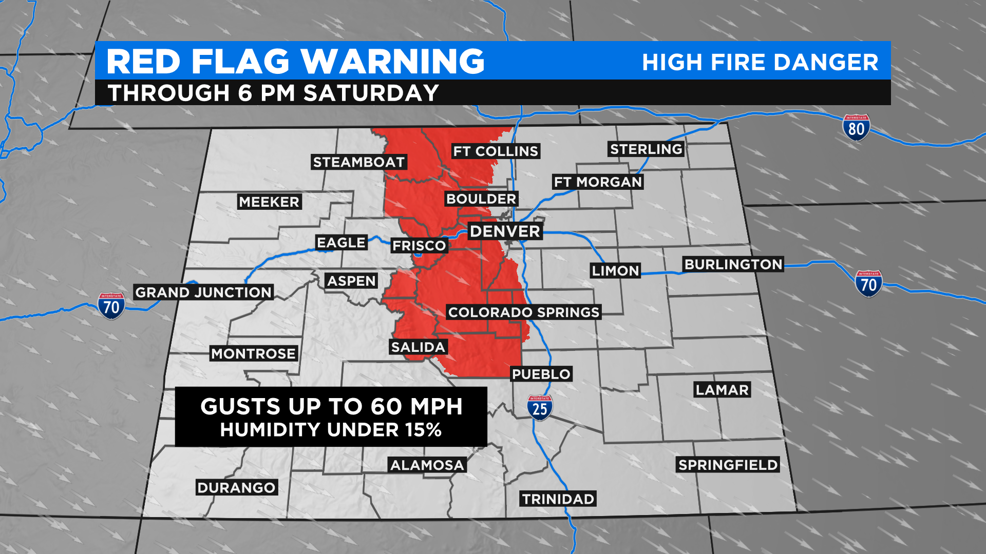
The National Weather Service has a Red Flag Warning in effect for a large part of the mountains and foothills of north-central Colorado through sunset on Saturday. Conditions will be prime for extreme behavior with current fires and rapid growth should any new fires develop.