Colorado Weather: Continued Smoky, No Relief In Sight For Area Wildfires
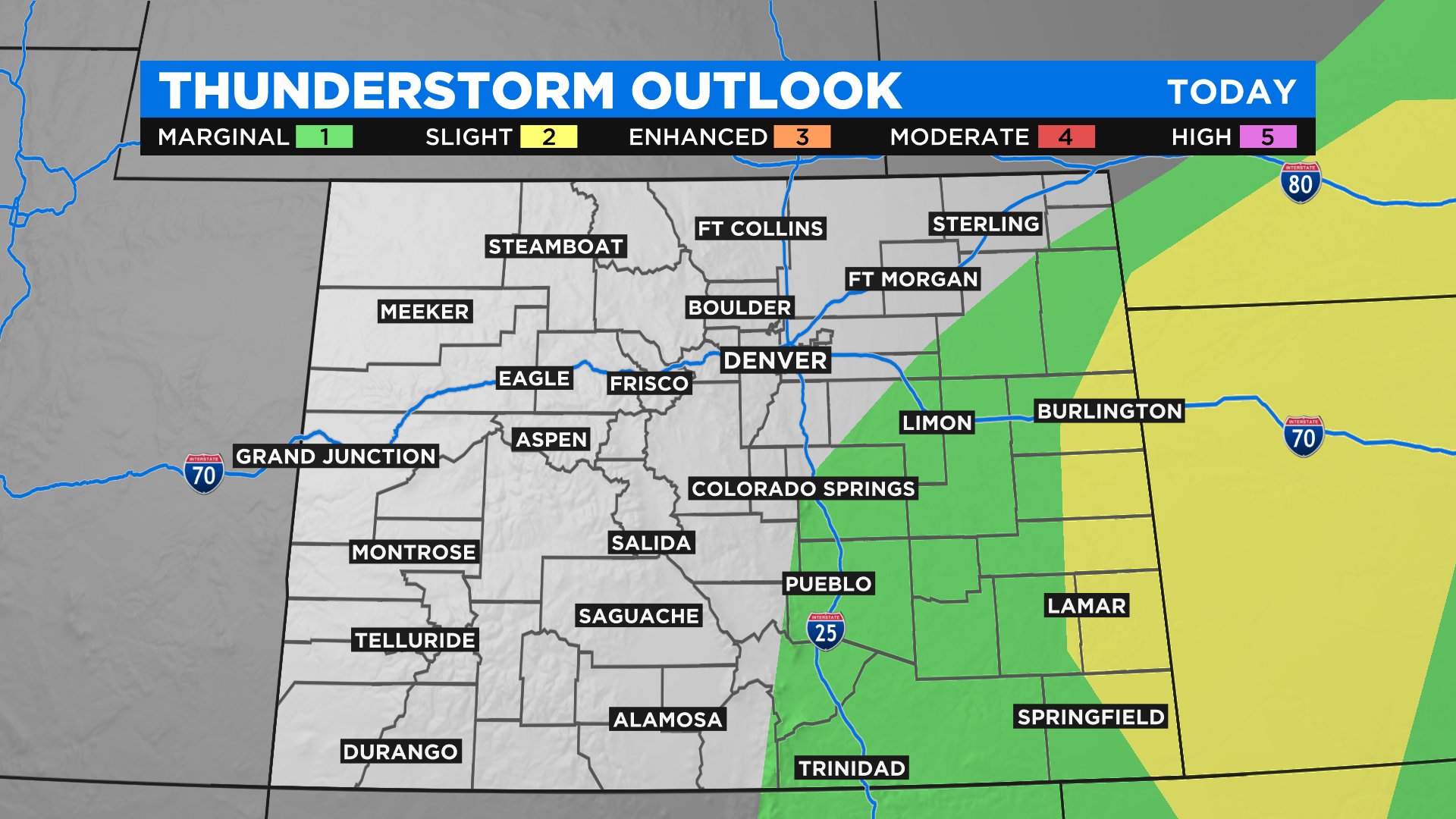
DENVER (CBS4) - Sunday's forecast is basically a repeat of Saturday with more hot and dry weather in store. We will see some scattered afternoon and evening thunderstorms on the eastern plains and just like yesterday a few could turn severe.
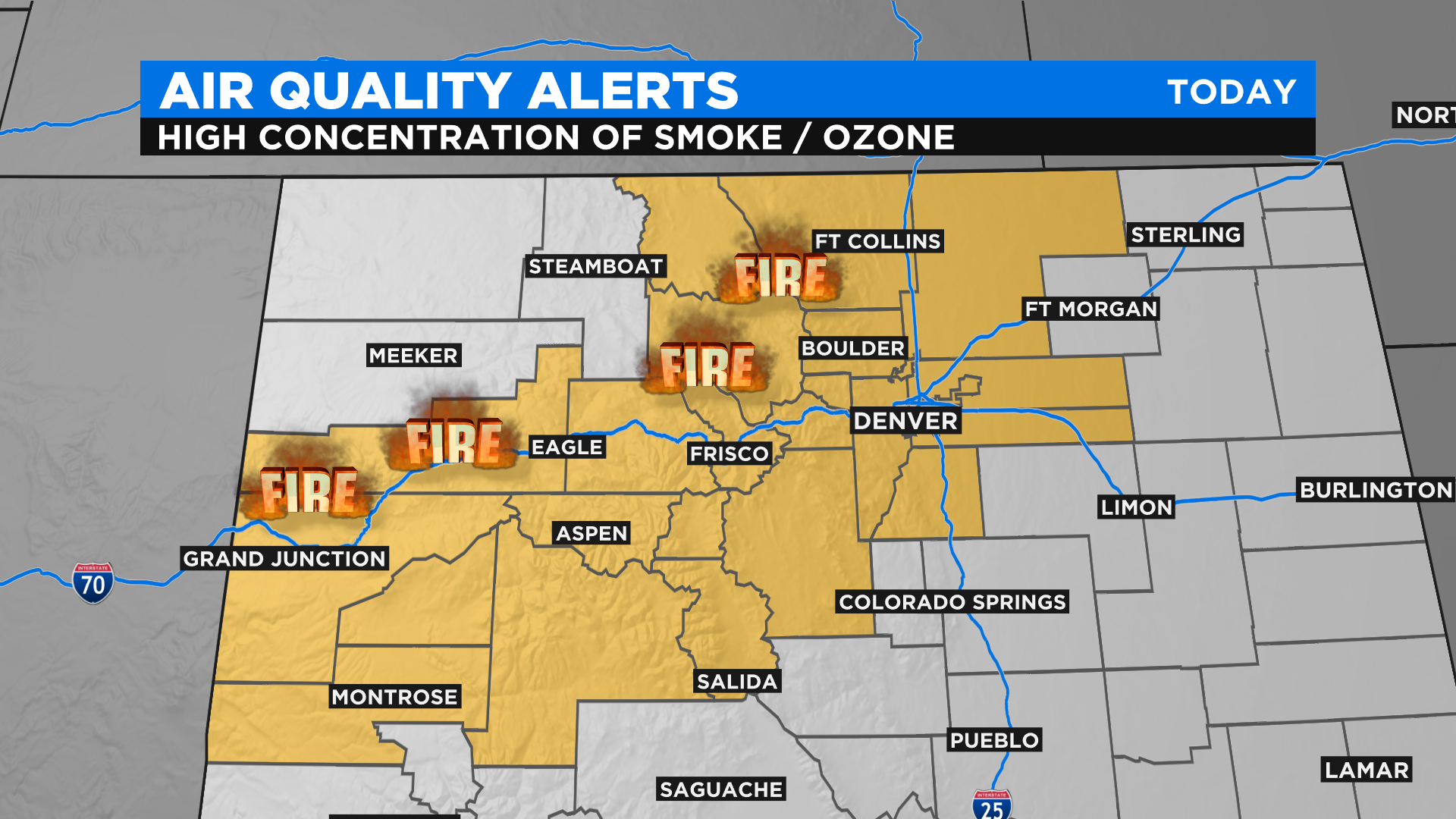
Air quality will remain a top concern for a large part of the state due to high levels of wildfire smoke. In addition we have high levels of ozone in Denver and along the Front Range.
Denver and the I-25 corridor as well as the adjacent foothills could see a little break in the smoke by Sunday afternoon as the winds shift from the west to the east. It may not clear the smoke out entirely but should help nonetheless.
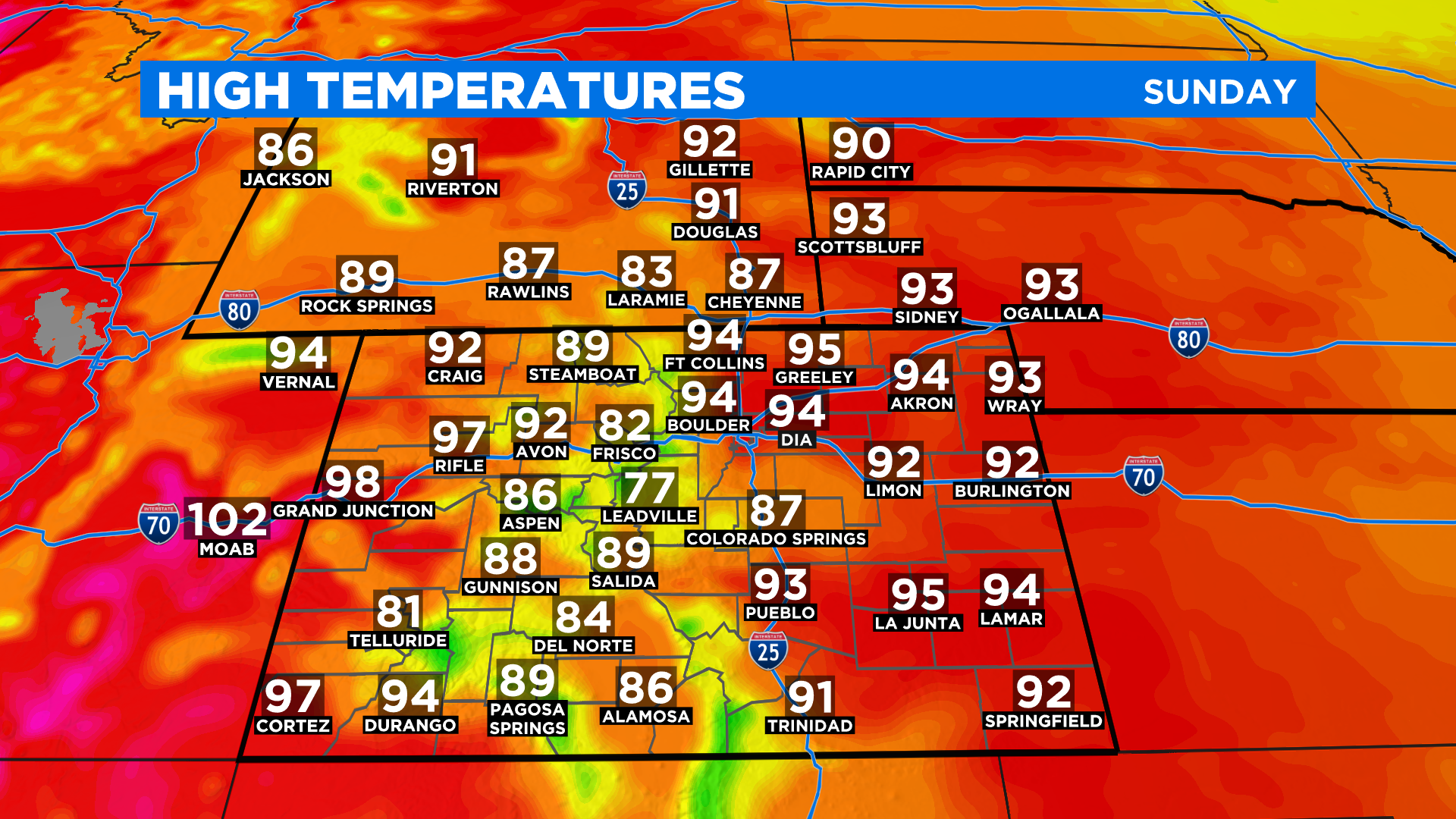
Today will make Day 56 in Denver with a high hitting 90 degrees this year. That will put us in the top 5 on the list of all-time 90 degree days in a single season. It looks like we have the potential to hit 90 degrees for the next week.
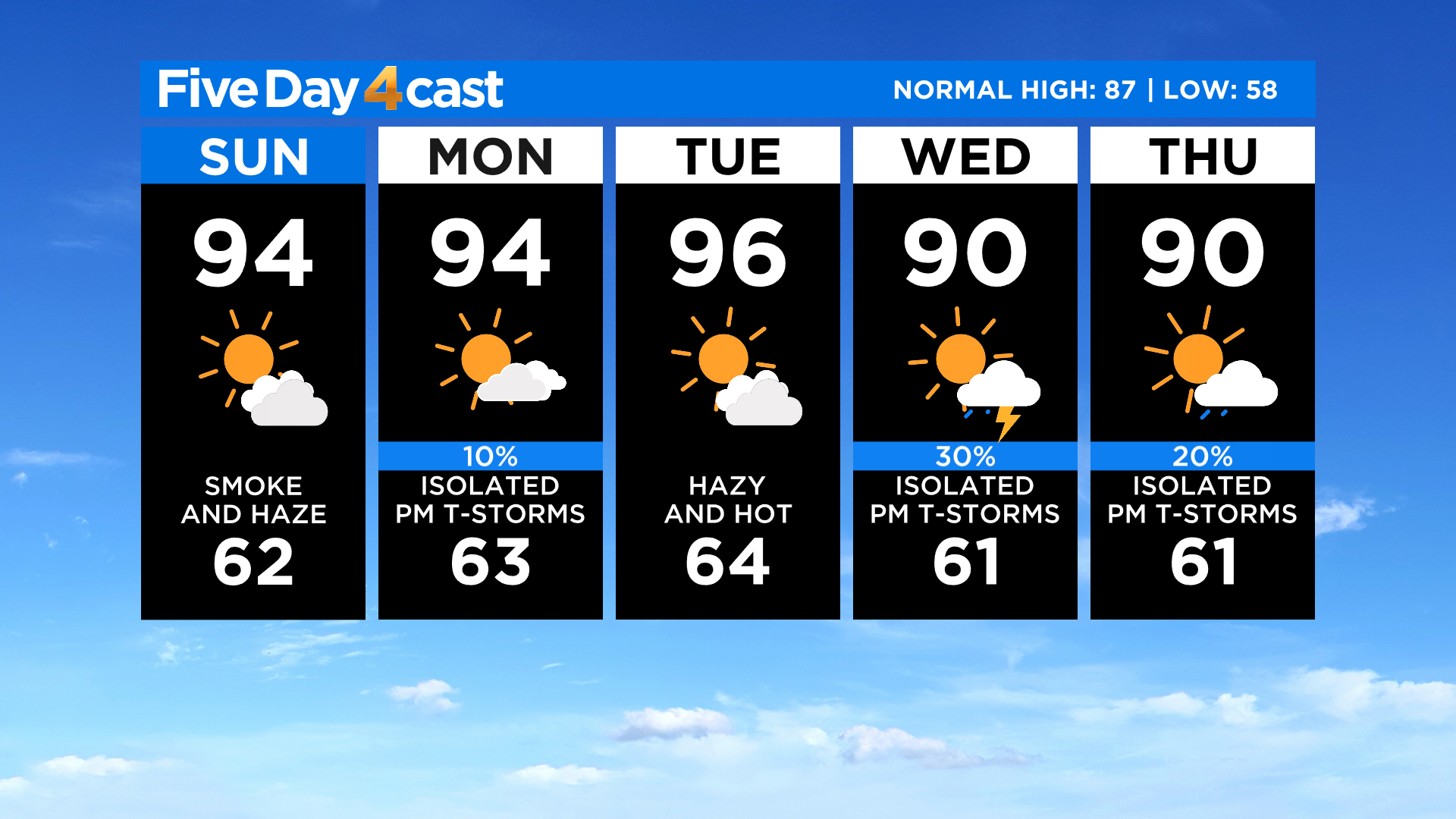
I wish we could offer a major change to this weather pattern and some relief for area fires. But nothing like that is on the horizon. However, we will see a slight chance for thunderstorms come back into the forecast over the next few days. Right now it looks like Wednesday could deliver the most coverage. Fingers crossed!
RELATED: 'We Already Have Our Stuff Packed': Communities Near Colorado Wildfires Watching With Anxious Hearts