Severe Storms Possible In Colorado Today: Covered Parking Recommended
DENVER (CBS4) - A surge of moisture moving into Colorado from Kansas and Nebraska on Tuesday will make it feel unusually humid. And as the usual July thunderstorms develop in the afternoon, the extra humidity should cause at least a few thunderstorms to become severe.
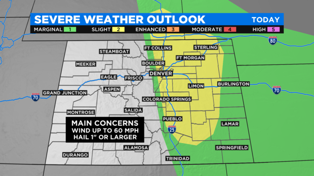
The threat for severe weather technically includes the entire Interstate 25 corridor from Fort Collins to Pueblo and everywhere in between. But most weather models are honing in on the Palmer Divide in Douglas and Elbert Counties as having the highest risk. That said, severe thunderstorms are still possible farther north and especially up to Interstate 70.
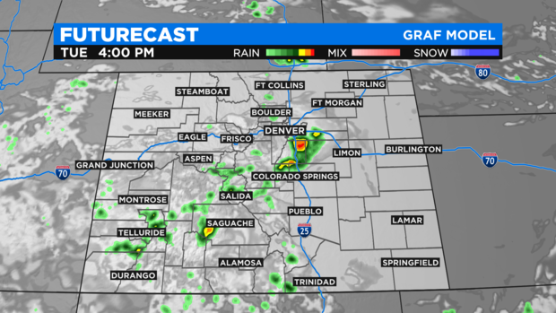
Thunderstorms should initially develop mainly in the foothills of Jefferson, Park, and Teller Counties no later than 2 p.m. The storms will then move slowly east and that is why the threat appears highest in Counties like Douglas and Elbert. By 7 p.m., most storms are expected to be far to the east of the I-25 corridor.
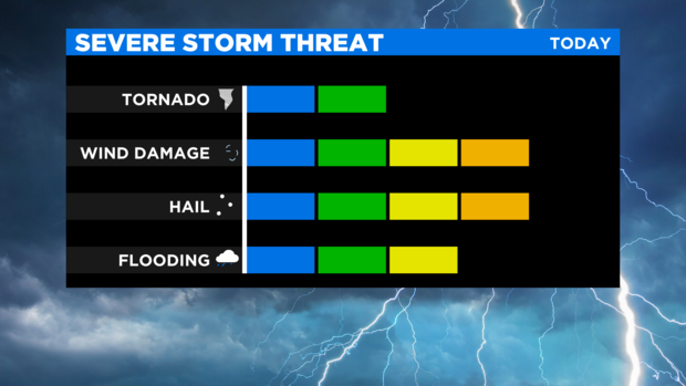
The primary severe weather concerns are hail at least 1 inch in diameter (covered parking recommended!!) and wind up to 60 mph. Lightning and a threat for at least minor flooding will also exist.
Somewhat drier air will return to Colorado on Wednesday and therefore the chance for thunderstorms is lower. And any severe weather in Colorado on Wednesday should be limited to the far Eastern Plains (east of Limon and Fort Morgan).