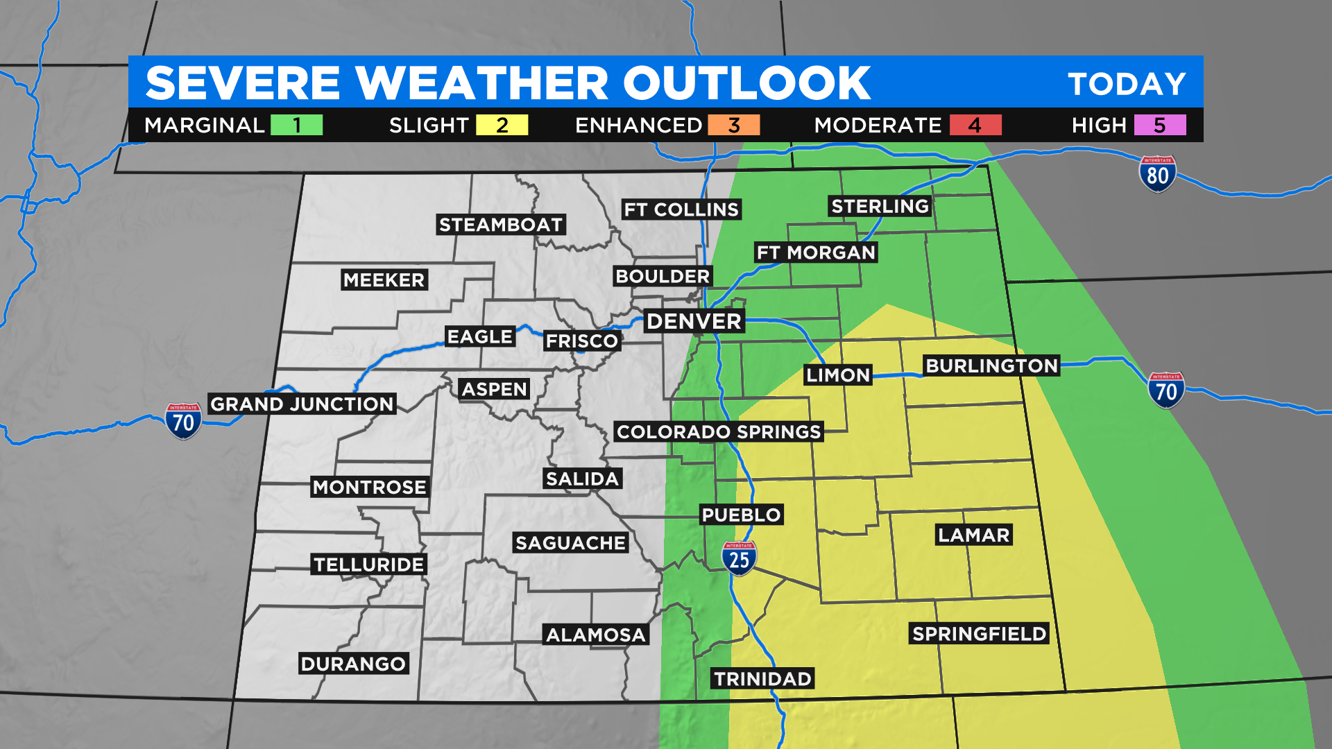
Colorado Weather: Better Chance For Storms Today, Some Could Be Severe On Plains
DENVER (CBS4) - An area of disturbed weather will cross Colorado today and that will create more widespread cloud cover than we've seen in recent days. It will also mean the chance for scattered afternoon storms and some of those could be strong to severe along and east of Interstate 25.
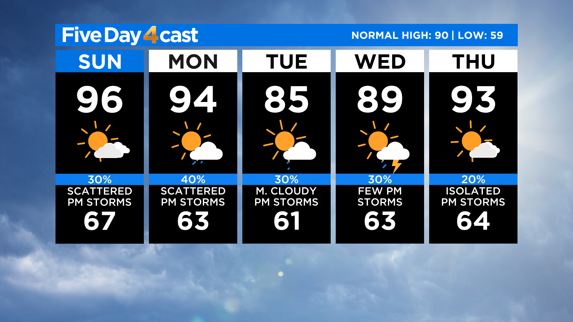
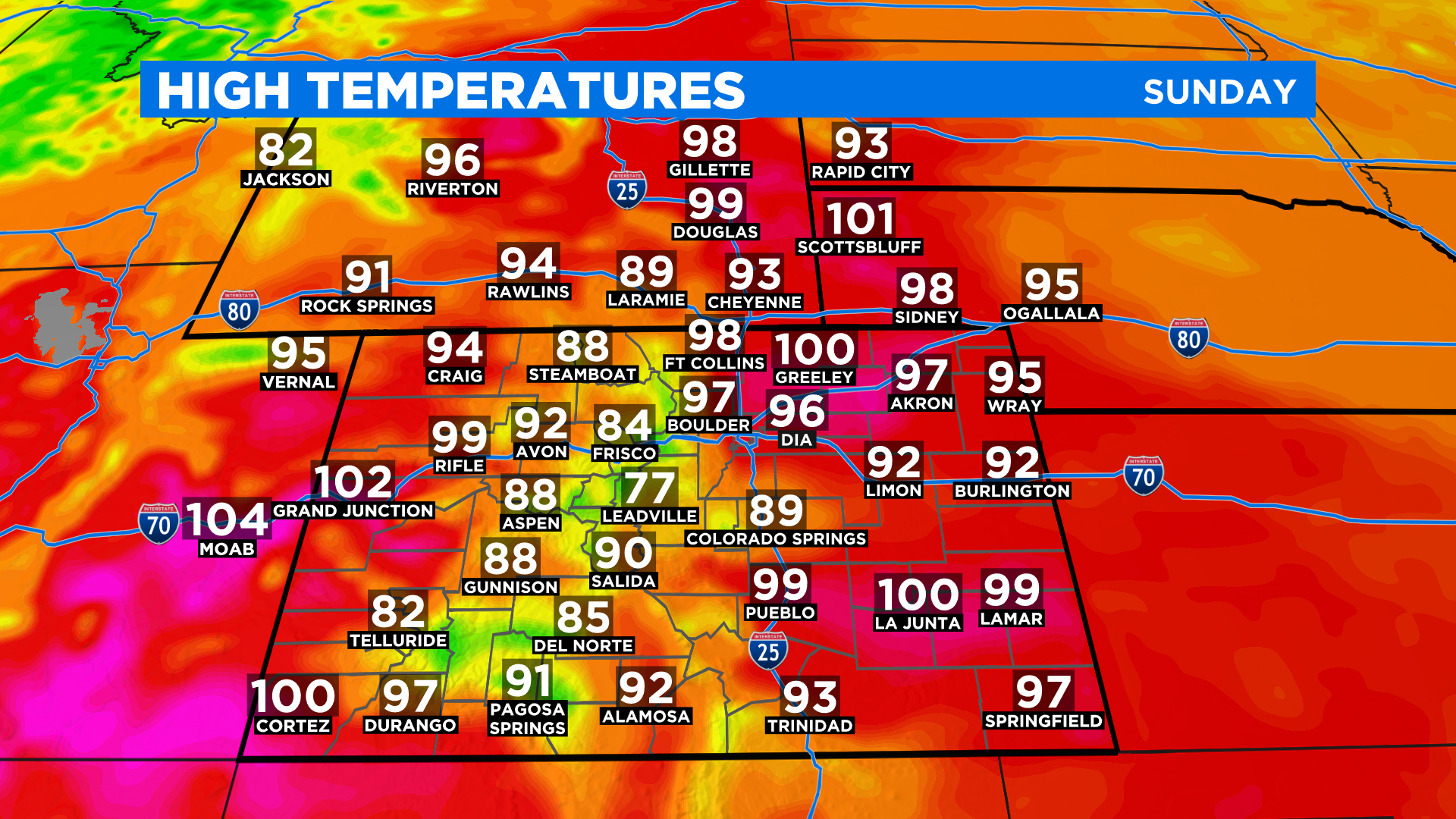
Unfortunately many will miss out on any potential rain but hopefully most of us will see enough clouds by afternoon to get a little relief from the heat. We expect widespread 80s and 90s once again with a few places near the 100 degree mark. One wild card with the temperature map below is places that get a lot of cloud cover early may end up being just a few degrees cooler.
Looking ahead by Monday night and early Tuesday a relatively strong cold front should push into the state as a deep trough of low pressure moves through Canada. Because of the close proximity of high pressure to the south it will most likely turn windy around the region.
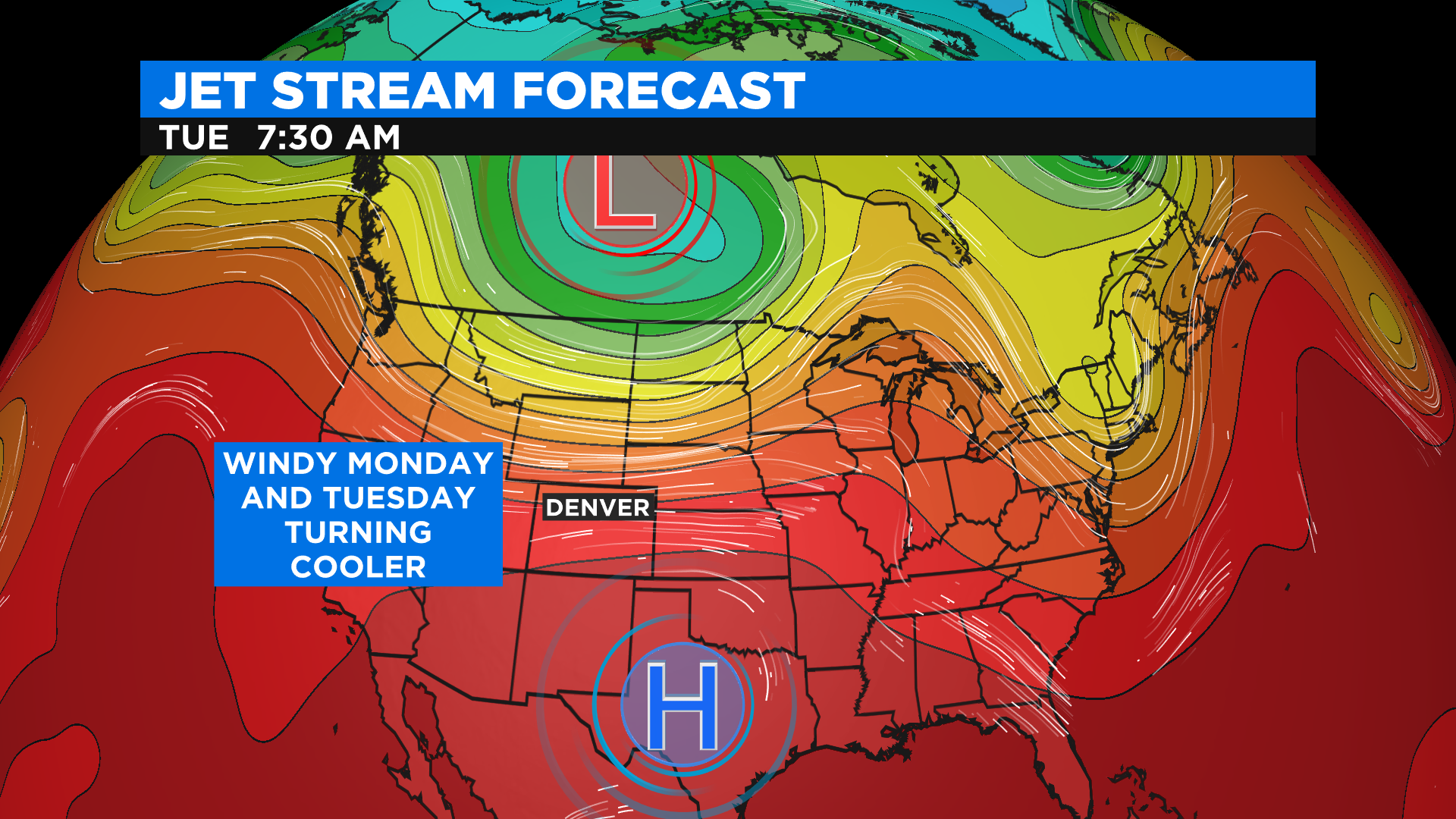
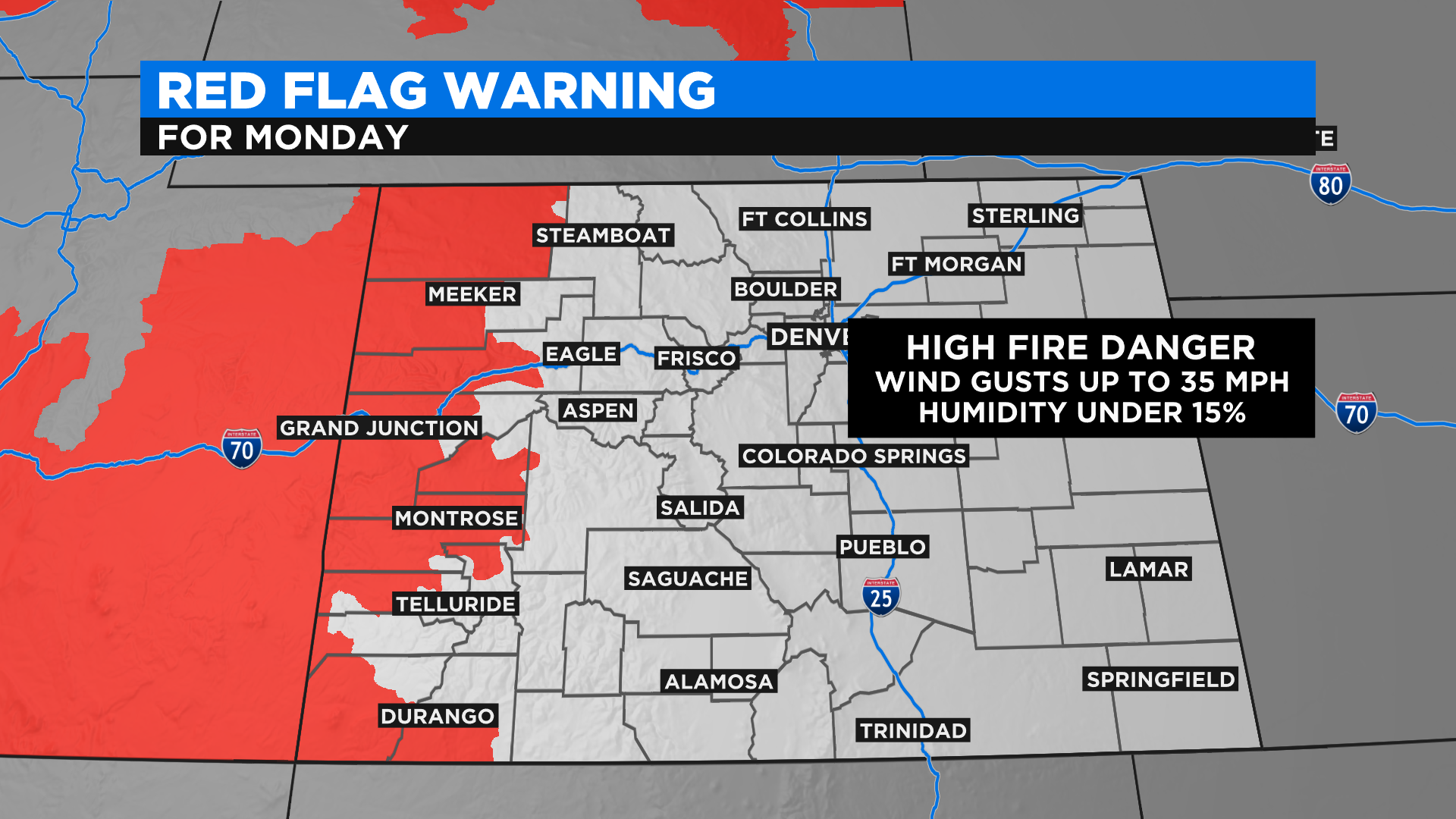
Due to the ongoing drought and warm temperatures the wind we expect to develop is not good news for area fire danger. Conditions could become extreme Monday on the western slope where there is already a Fire Weather Warning (Red Flag) in effect.
The week ahead will feature better chances to see scattered afternoon showers and thunderstorms as well as a short-lived cool down by Tuesday. Denver could break its 90-degree streak which currently stands at 10 days in a row. (July 2-11)