Denver Weather: Severe T-storm Watch For All Of Eastern Colorado
DENVER (CBS4) - Several SEVERE THUNDERSTORM WARNINGS HAVE BEEN POSTED ACROSS DOUGLAS, ELBERT AND EL PASO COUNTY. For storms that have produced pea size to ping pong ball size hail in certain areas from Castle Pines down to Monument and out to Parker.
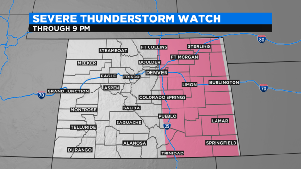
A SEVERE THUNDERSTORM WATCH is in effect for for the majority of Colorado's Front Range and Eastern Plains thru 9pm Friday.
It has been a largely quiet severe weather season so far in the Denver metro area particularly when it comes to hail. That could change Friday afternoon with the first bona fide threat for large hail in several weeks.
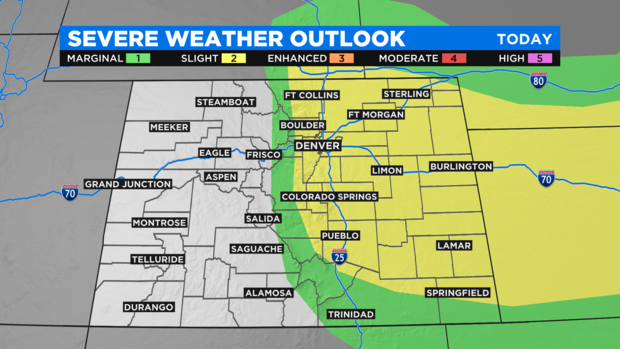
A "slight risk" for severe weather has been officially declared for Denver and the Front Range as well as most of the Eastern Plains. On a scale that goes from 1 to 5, "slight risk" is 2 and is highlighted in yellow on the map below.
In addition to the chance for thunderstorms producing hail up to 1 inch diameter, storms could also produce winds gusts up to 60 mph, frequent lightning, minor street flooding, and perhaps a few isolated, weak tornadoes.
As of late Friday morning, weather models were honing in on the south metro area for the most significant hail threat. Jefferson County south of I-70, Arapahoe County west of I-25, and all of Douglas County has the highest chance for seeing damaging hail. Of course any location along the Front Range could get hail on Friday and covered parking is recommend whenever possible.
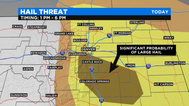
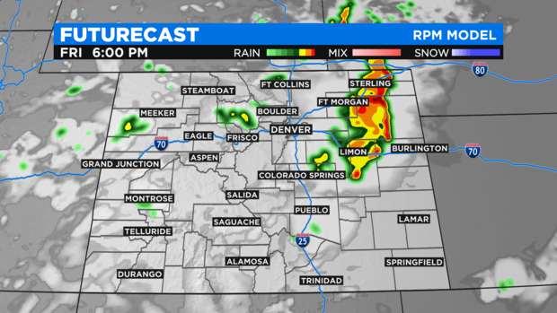
The timing for the storms in the Denver, Boulder and Fort Collins areas should span 5 hours between 1 p.m. and 6 p.m.
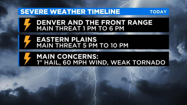
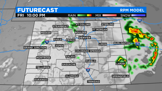
Meanwhile, the Eastern Plains should see a line of thunderstorms move from west to east during the evening hours. At 4 p.m., many of the storms should be just east of the Denver metro area and should reach the Limon and Fort Morgan areas no later than 6 p.m.
By 10 p.m. the storms should be east of the Kansas and Nebraska state lines.
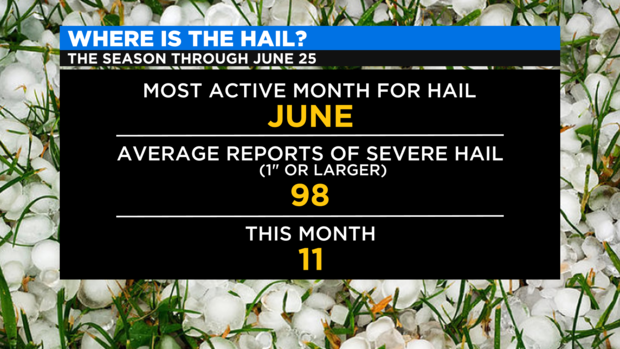
Any reports of severe hail (defined as hail 1 inch or larger) or tornadoes on Friday will be added to lists that are running far below normal this season. When it comes to hail, Colorado averages nearly 100 reports of severe hail in June. Through June 25, the total number of reports this month is just 11 including a report of 1 inch hail near Bristol in Prowers County on Thursday.
Looking ahead to the weekend, there is a small chance for severe storms mainly on the Eastern Plains Saturday afternoon. There is also a chance for thunderstorms in the Denver metro area Saturday afternoon but the threat for severe weather currently appears small west of Limon and Fort Morgan.
As the chance for thunderstorms gradually decreases through the weekend, temperatures will increase with highs back in the 90s after a reprieve in the 70s and 80s.