Colorado Weather: Fire And Ice With Mountain Snow, Tremendous Wind, High Fire Danger
DENVER (CBS4) - A storm set to sweep across Colorado will bring snow to higher elevations, high fire danger to the southern half of the state, and very windy conditions statewide.
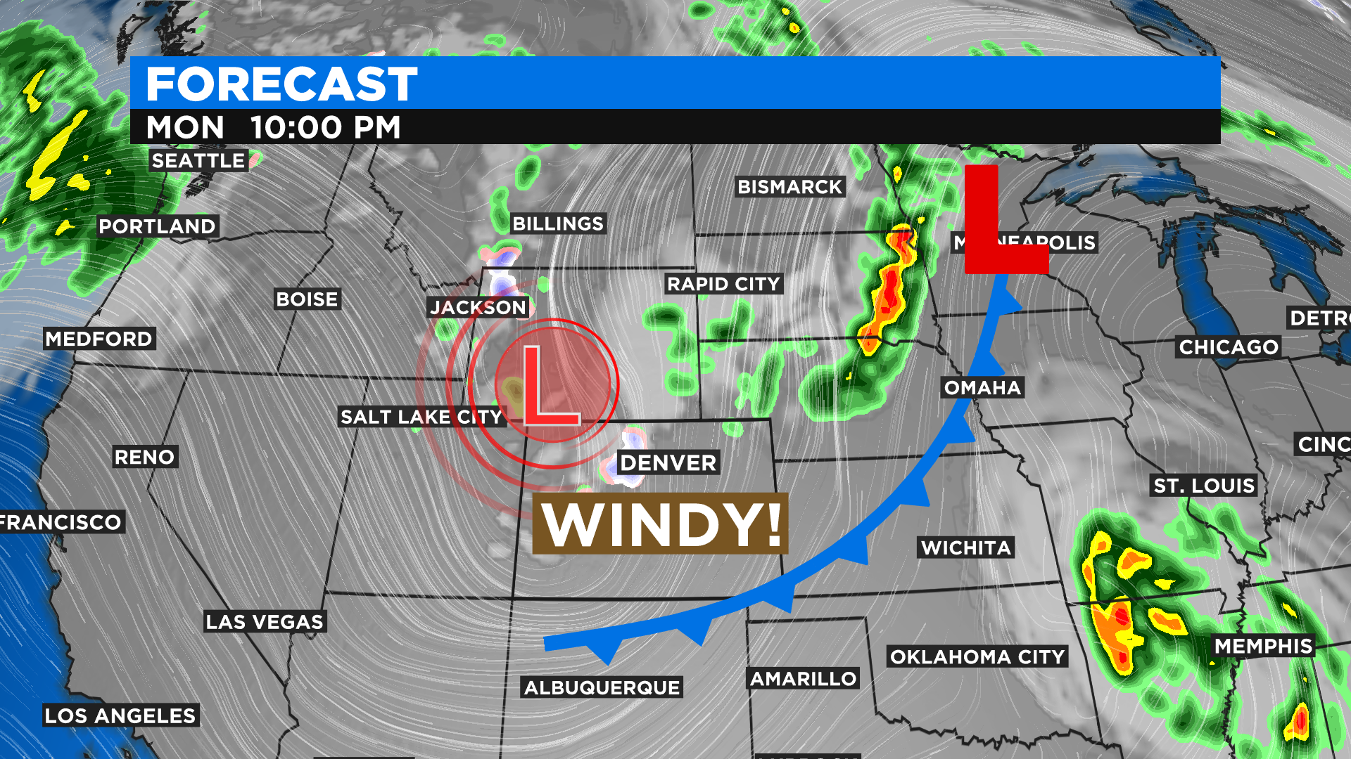
The storm was moving out of Idaho Monday morning and heading straight for Colorado. The biggest issue in most areas will be the wind with gusts up to 60 mph including in the Denver metro area.
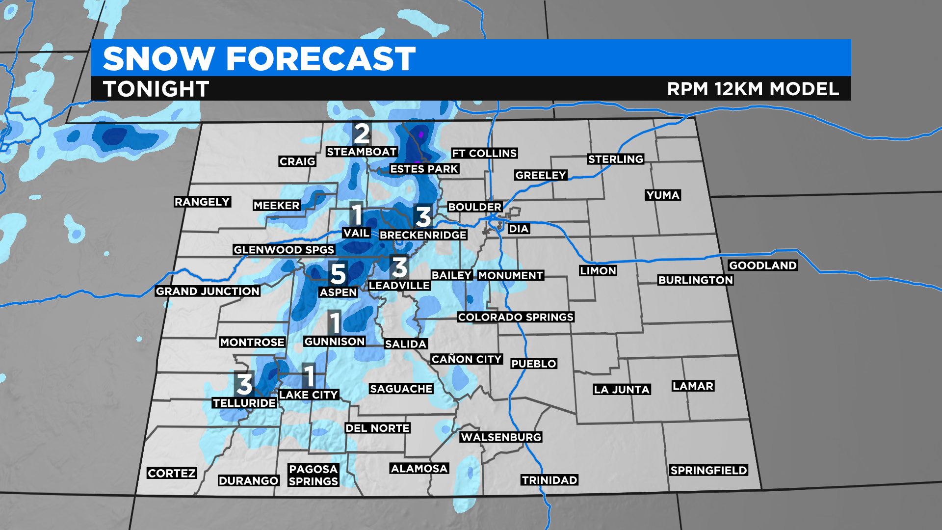
A couple of cold fronts associated with the storm will also push temperatures low enough for widespread snow in the mountains Monday night. Accumulation will average 2-4 inches above about 9,000 feet with higher and lower amounts possible.
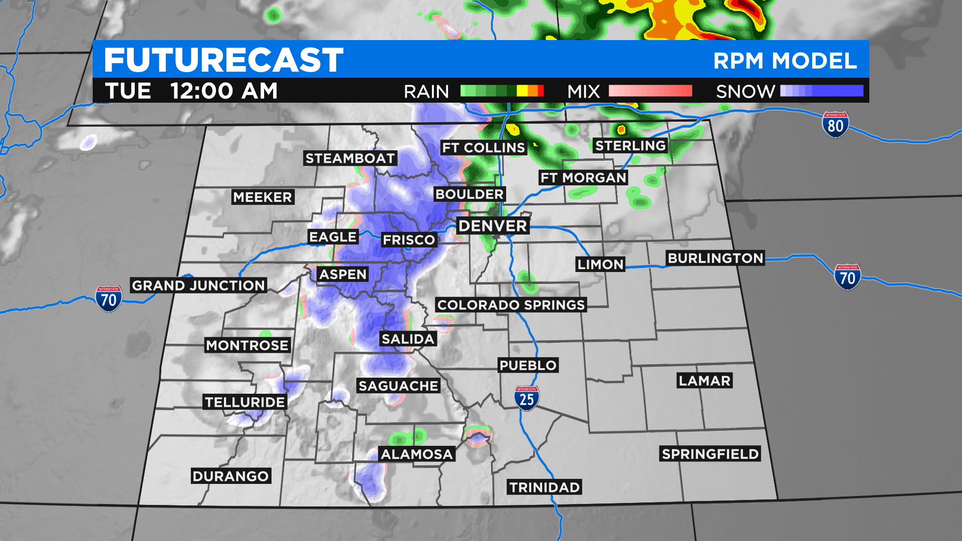
For Denver and the Front Range, temperatures will drop into the 40s Monday night so while it will be chilly for June, any precipitation will stay rain. The chance for rain at lower elevations is about 50% along the Interstate 25 urban corridor and higher on the Eastern Plains. Most of the rain will be after dark and will continue into Tuesday morning especially for areas east of the Denver metro area.
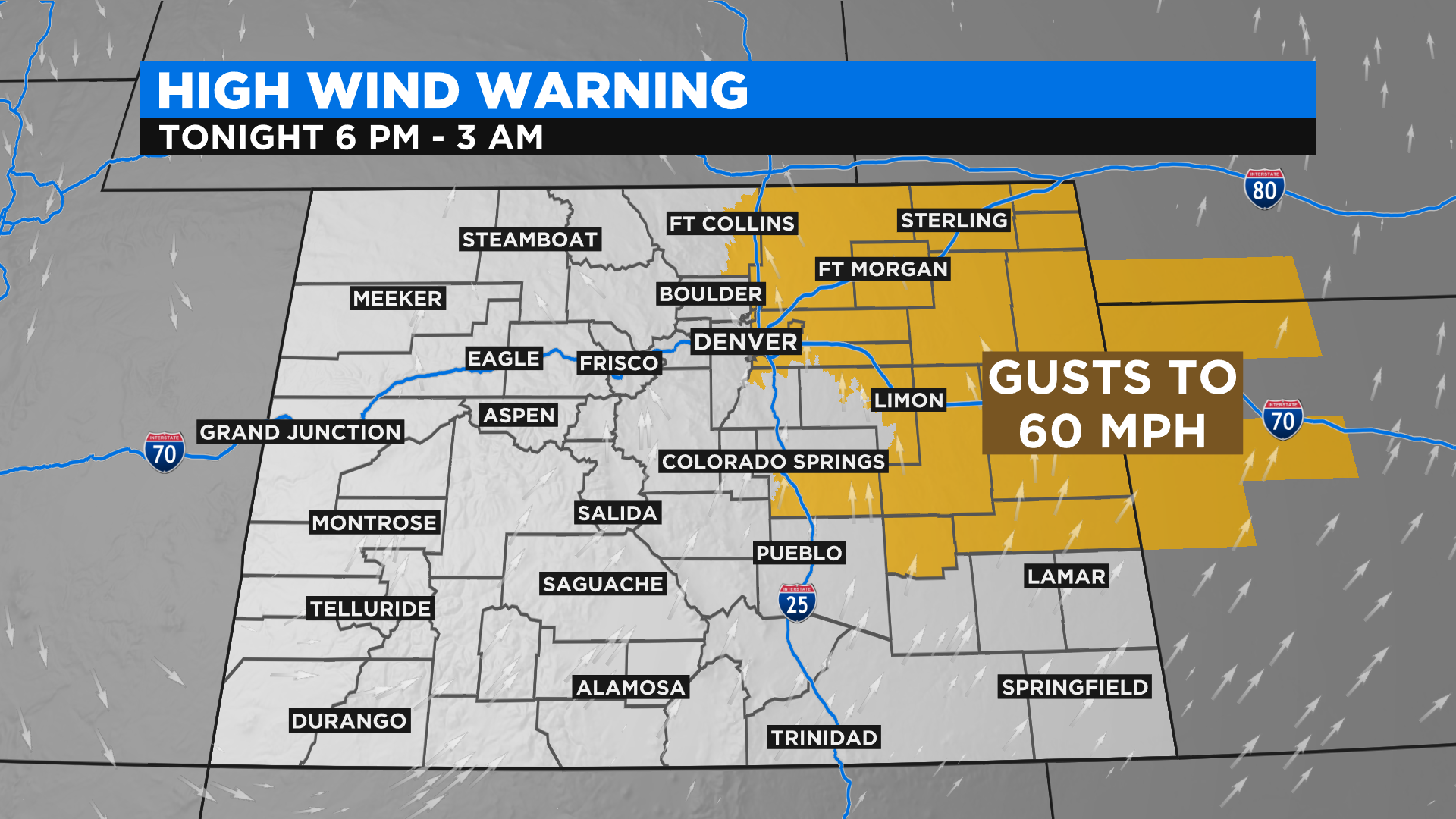
Anticipating the very gusty winds, a High Wind Warning has been issued for most of the metro area plus most of the Eastern Plains from 6 p.m. Monday until 3 a.m. Gusts could reach up to 60 mph which is almost as strong as the wind was on Saturday when damage was reported in many metro area neighborhoods and thousands of homes were left without power.
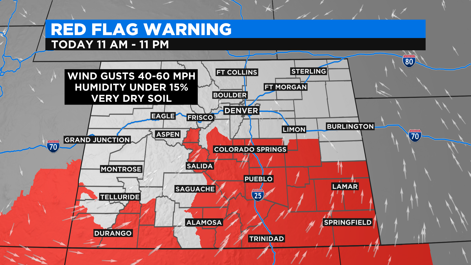
There is also a Red Flag Warning for high fire danger across much of southern Colorado from 11 a.m. until 11 p.m. on Monday. If another wildland fire were to develop, it could spread rapidly.
Looking at the forecast for the remainder of this week, Tuesday will be the coolest day in weeks followed by comfortable conditions on Wednesday and a return to summer-like heat for Thursday and Friday.