Denver Weather: Snow, Wind And 50 Degree Temperature Drop Arrives Saturday Night
DENVER (CBS4) - Who's ready for a drastic change in the weather? A powerful spring cold front is now less than 24 hours away from Colorado. It will be moving in from the north Saturday evening with a huge drop in our temperatures along with wind and snow for Easter Sunday.
RELATED: Easter Now Expected To Be The Coldest And Snowiest In 90+ Years
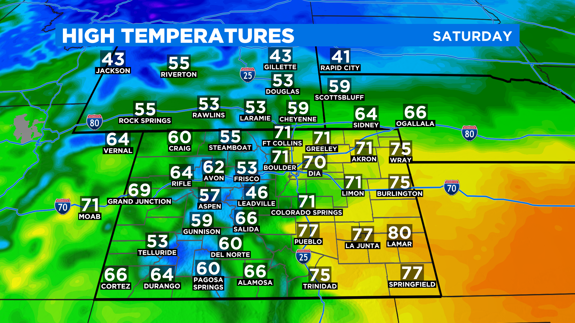
If you need to get out and do stuff around the house today it should be nice and warm ahead of the front. But the wind will be gusty at times. By this afternoon clouds will be increasing from the north and there is a chance to see scattered showers or thunderstorms pop up anytime after 3 pm.
Tonight rain showers are likely. They should mix with and change to snow overnight. The forecast for your Easter Sunday calls for off-and-on snow along with windy conditions. The high in Denver will struggle to reach the upper 20s.
The heaviest snow with this storm will fall in the north-central mountains and foothills where the National Weather Service has issued a Winter Weather Advisory. Those will go into effect late tonight and last through the day tomorrow.
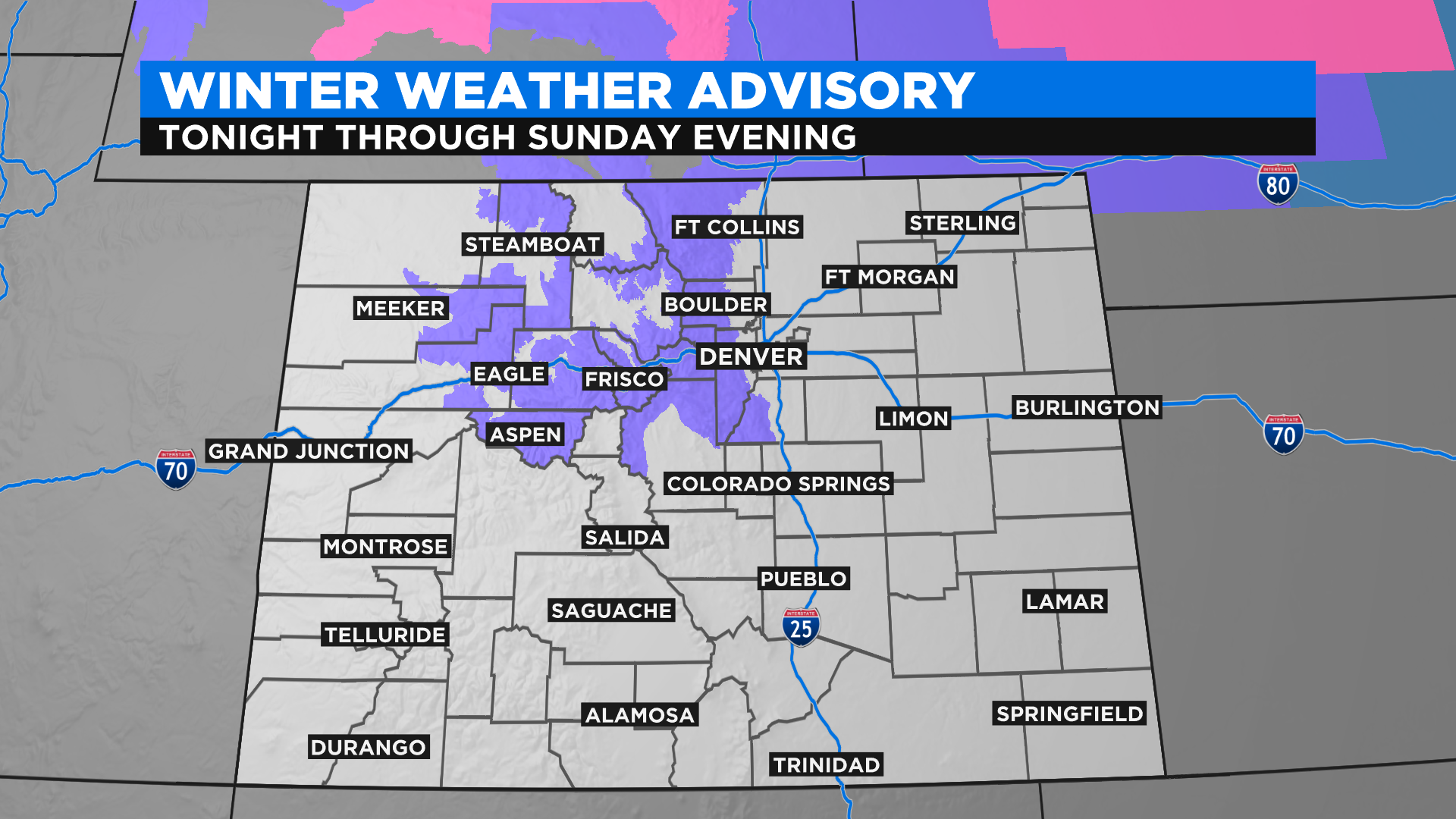
This storm won't produce widespread large snow totals but some places in the advisory above could get close to a foot of snow. I think when all is said and done we will see a lot of 4 to 10 inches totals in the mountains and foothills.
In the Denver area and along Interstate 25 we expect many places to end up with 1 to 4 inches with little to no accumulation on the far eastern plains. There could be a few pockets along the Front Range Urban Corridor that get into the 3 to 6 inch range. The northern San Juan Mountains in southwest Colorado could also get up to 6 inches in spots.
The model below was run at 7 a.m. on Saturday. While it will change with each new run as the cold front gets closer and closer, we don't expect anything changes that are too drastic at this point. But be sure to watch CBS4 news tonight at 5pm to get the latest update from Meteorologist Dave Aguilera.
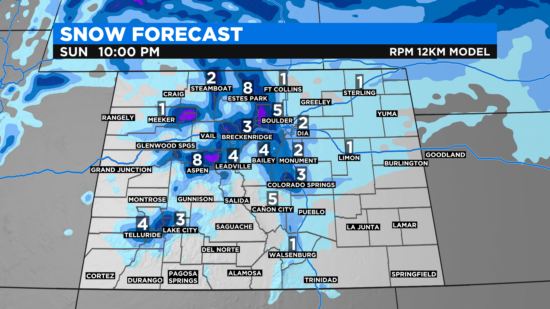
Spring snow totals are difficult to predict because the sun angle is so much higher now and the days are longer, plus the ground is warmer. So if a particular location has a forecast of 4 inches of snow (falling from the cloud) ... it may never fully measure to that amount on the ground.
Looking ahead we will see a week full of below normal temperatures as we enter into a very unsettled weather pattern. There will be a chance for scattered rain or snow showers just about each and every day as little pockets of disturbed air move over the state.