Colorado Weather: Statewide Snowpack Near Average
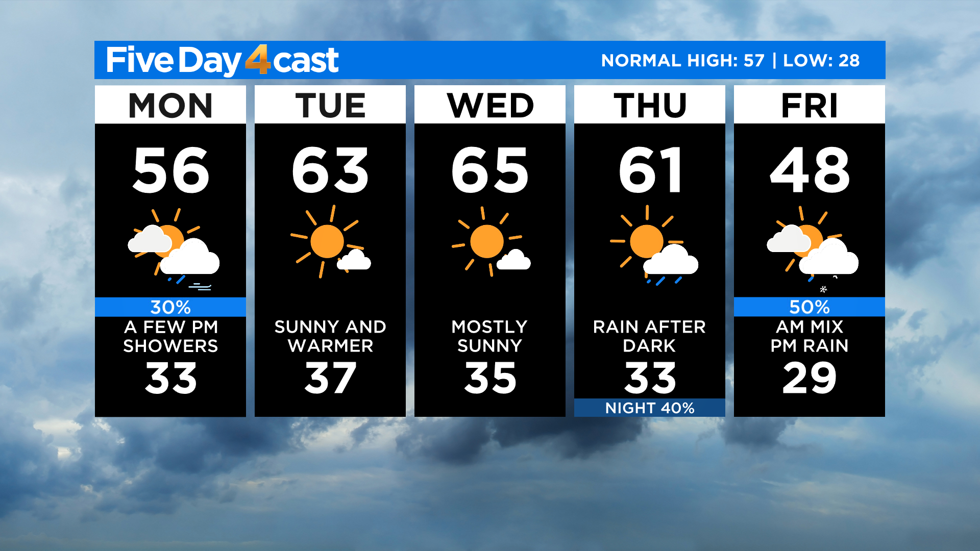
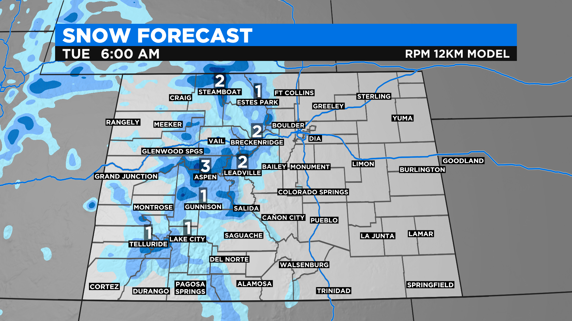
DENVER (CBS4) - A weather system that was spinning near Las Vegas early Monday afternoon will bring more snow showers to the mountains Monday night as it moves to the northeast. There are no watches, warnings or advisories in effect for the snow but some places could see up to four or five inches of fresh powder.
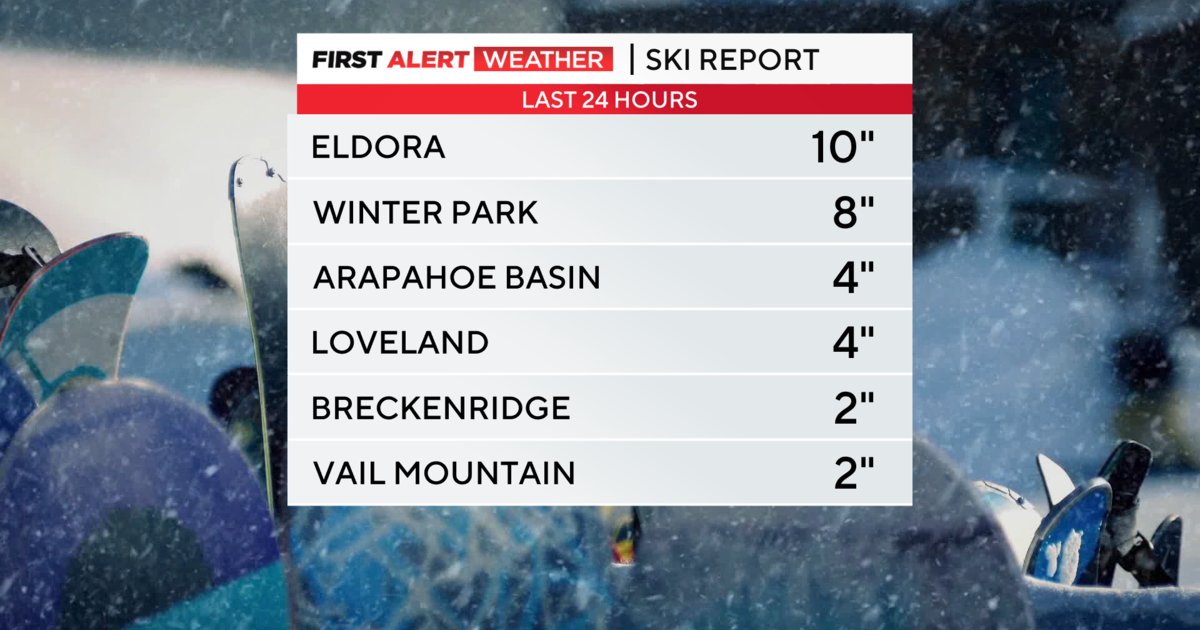
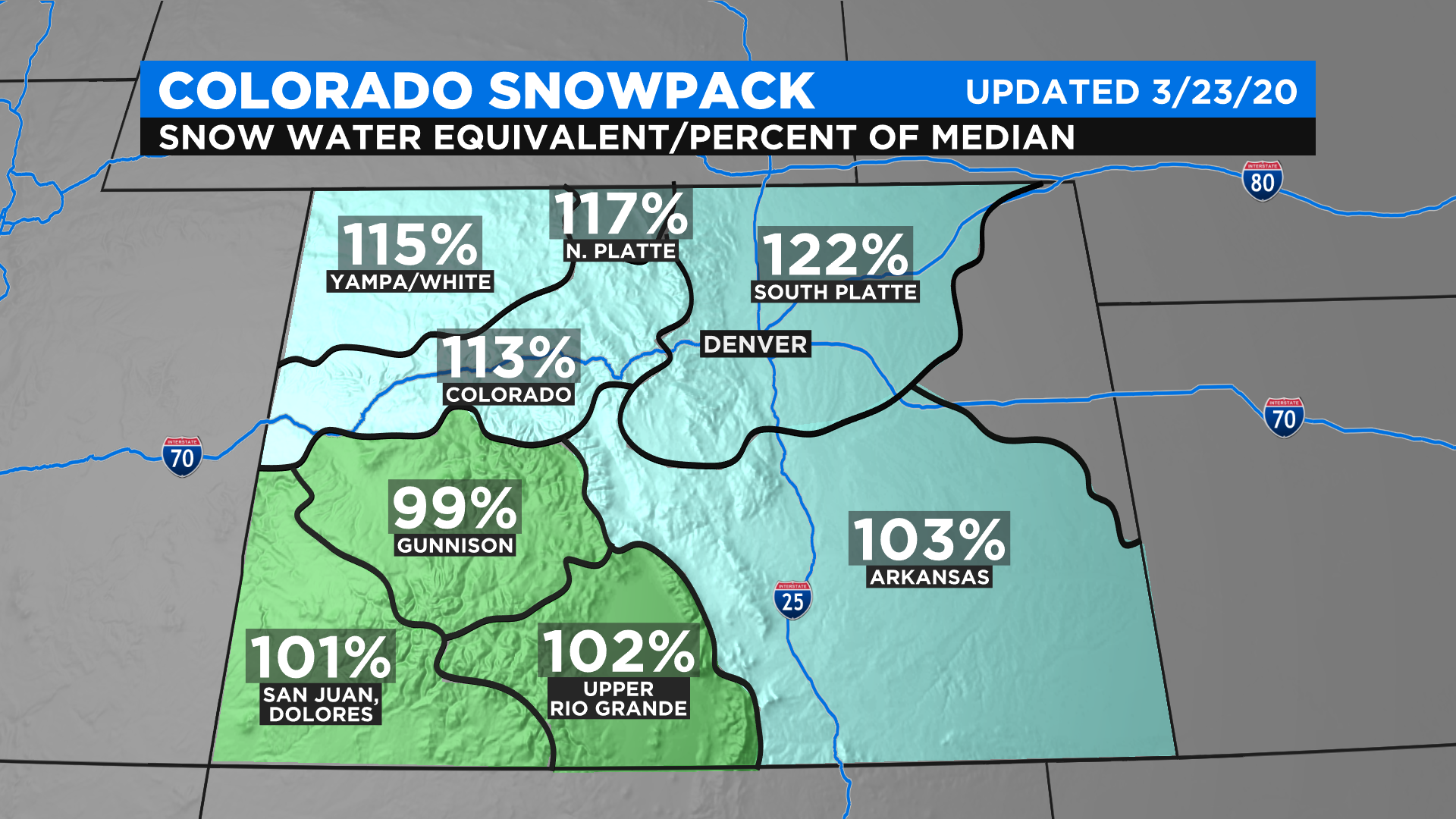
Snow fell off and on over the past weekend in Colorado's high country and it helped to boost statewide snowpack numbers just a few notches. In fact every major river basin is now above 100 percent of average except the Gunnison River Basin which was sitting at 99 percent.
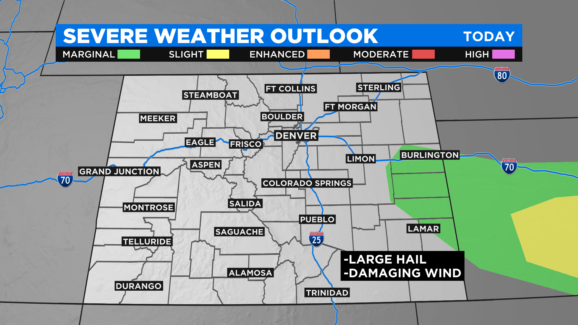
While snow is expected Monday night in the mountains there is the potential to see a few strong to severe thunderstorms on the eastern plains. If any storms manage to develop in our state the main threats will be large hail and damaging wind gusts.
A stretch of quiet weather is anticipated Tuesday and Wednesday before a new storms moves into the state starting on Thursday. It will bring snow back to the high country and a chance for rain to Denver and the eastern plains by Thursday night. There is even a chance for the rain to mix with or change to snow across lower elevations by Friday morning so stay tuned to see how things evolve.