Denver Weather: Another Quick Shot Of Snow Possible Wednesday Night
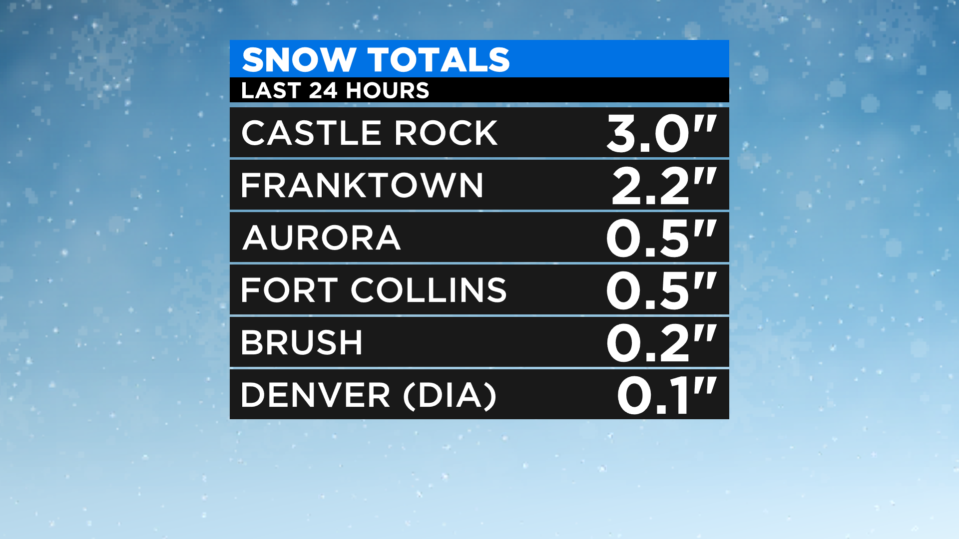
DENVER (CBS4) - Here we snow again, potentially! We have another fast-moving, weak weather system set to pass over Colorado tomorrow. Last night's snow event produced light snow in the area with most totals under an inch. A few places did get 2 to 3 inches across Douglas County and Elbert County with even higher totals around Colorado Springs.
Much like we saw yesterday this next round of snow should be a late afternoon or evening event along the Front Range where snow will start to develop around or after sunset tomorrow. We're not looking at much in the way of accumulation because the storm track above us is simply moving so fast. Most places will have the potential to see an inch or two and some may only get a trace.
However, where the best dynamics of the jet stream align with the terrain below we could see anywhere between 3-6 inches of new snow. The best chance for that to happen would be in elevations at or above 6,000 feet or in narrow bands along I-25 that align with the energy overhead.
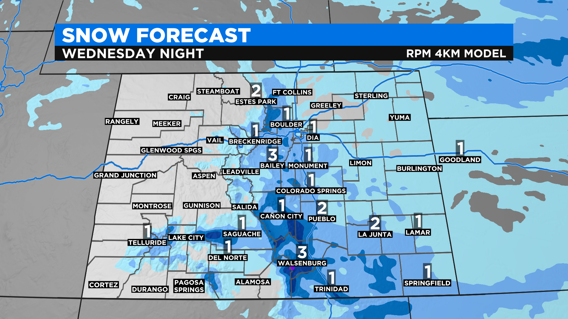
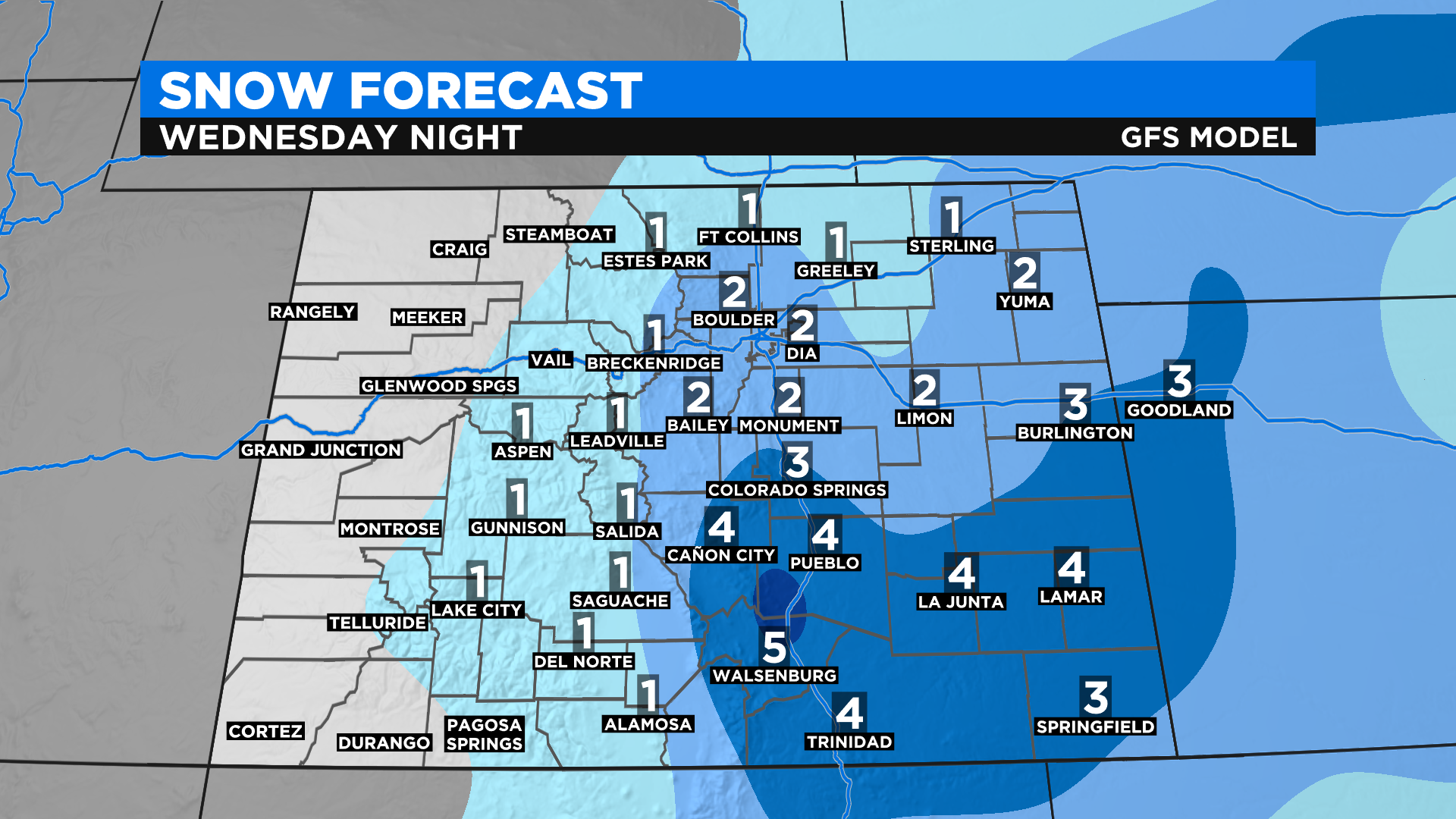
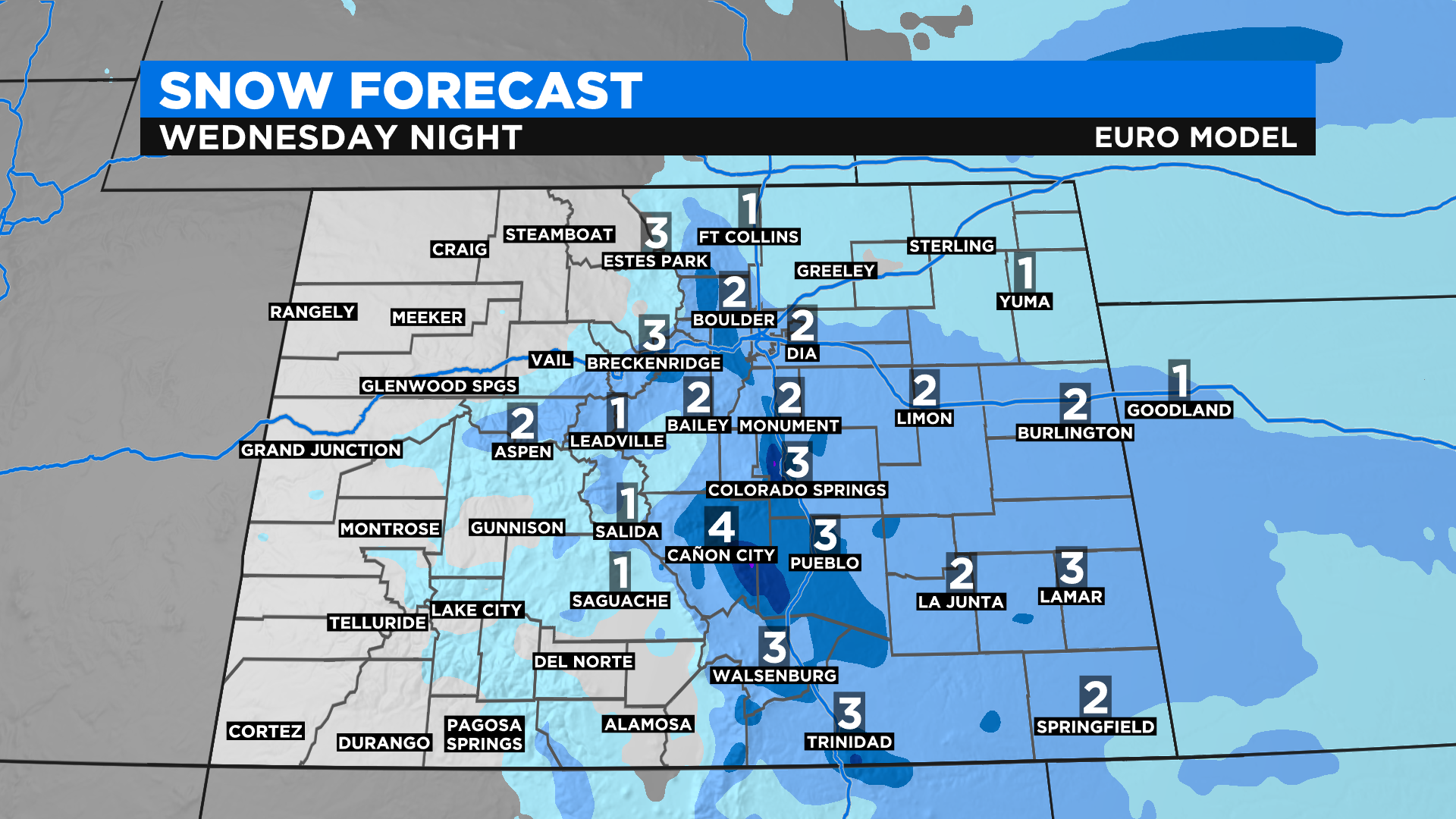
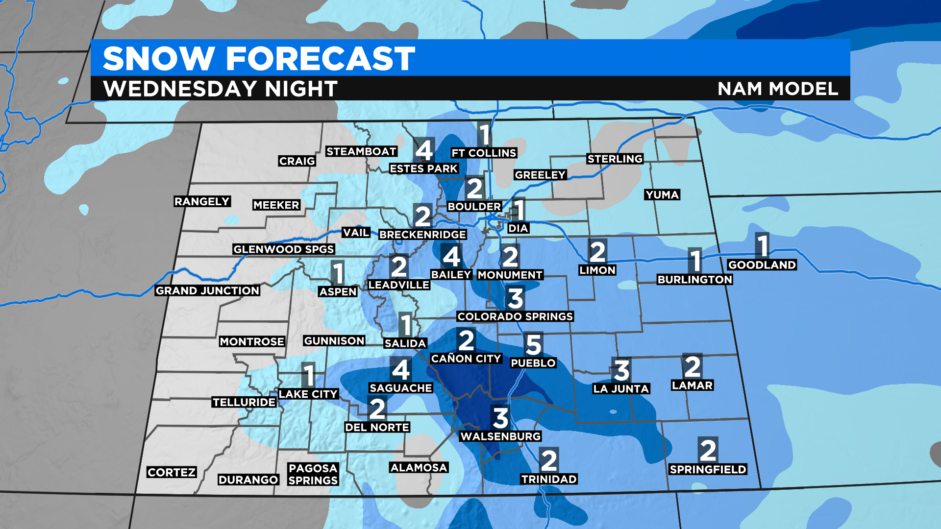
The maps above are 4 different computer forecast models ran early Tuesday morning. As you can see some light snow will also be possible in the mountains and on the portions of the eastern plains. These models can change as the system gets closer to the state so stay tuned to our broadcasts for any updates to the current forecast.
Once this next system goes by we will see some warmer and drier weather for a few days before more stormy weather arrives next week. Right now computer forecast models are hinting at the potential for a cold and snowy end to the month.