Colorado Weather: It's Been Snowing For 5 Days Straight In The Mountains, More Through Tomorrow
DENVER (CBS4) - An active storm track over the Rocky Mountain region has caused scattered snow showers in the Colorado high country since late last week. Some ski areas are approaching 2 feet of snow since the pattern developed and more snow is expected through Tuesday.
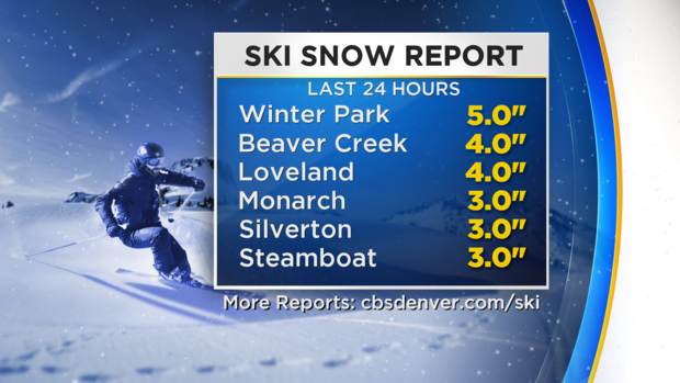
From early Sunday morning through early Monday, virtually every ski area in the state reporting at least an inch of fresh snow. Winter Park reported 5 inches and Beaver Creek and Loveland Ski Area had 4 inches.
A WINTER WEATHER ADVISORY continues for the I-70 mountain corridor west of Vail Pass until 8 p.m. Monday. Ski areas such as Vail, Aspen, and Crested Butte will get another 2 to 6 inches of snow by Monday evening.
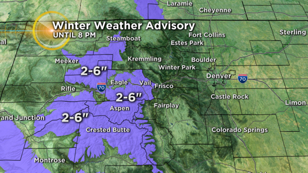
Farther east there are no warnings or advisories for Summit County or the Winter Park area but at least 2 inches of new snow is expected in these areas.
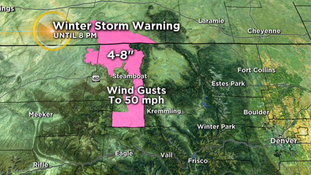
To the north there is a WINTER STORM WARNING for the mountains near Steamboat Springs including Mount Warner and Rabbit Ears Pass. The combination of 4 to 8 inches of snow along with wind gusts to 50 mph will make for difficult travel at times along Highway 40 north of Kremmling.
Meanwhile, the Denver, Boulder, and Fort Collins areas stay dry on Monday but it will be breezy at times. Highs will be in the 40s. Noticeably warmer weather arrives on Tuesday with highs in the 50s. The metro area will then bounce between the 40s and 50s each day through the upcoming weekend with no snow in sight for lower elevations.