Tornado And Severe Thunderstorm Warning Improvements Are Underway
NORMAN, OKLAHOMA (CBS4) - For decades the National Weather Service has warned for tornadoes and severe thunderstorms in Colorado essentially the same way. In addition, the method CBS4 Meteorologists and others use to interpret and disseminate those warnings has also gone mainly unchanged.
Those involved in the current warning dissemination process including broadcasters, emergency managers, and the NWS forecasters themselves generally believe the current warnings work in most cases but not all.
These groups agree improvements are necessary including the need to warn fewer people who are not in the immediate path of dangerous weather, providing longer warning times for specific areas, and communicating the confidence of the specific severe weather threat.
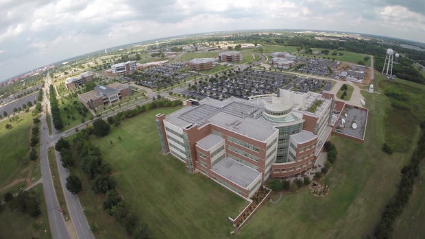
New technologies aimed at making these improvements and others are currently being tested by the NWS and National Severe Storms Laboratory (NSSL) on the campus of the University of Oklahoma.
CBS4 Meteorologist Ashton Altieri was recently selected to be part of the testing and traveled to Oklahoma to participate in the Hazardous Weather Testbed together with other broadcasters from various TV stations across the country. The new concepts for tornado and severe thunderstorm warnings were tested at the fictitious station "KPHI-TV". The signal can only be viewed by researchers involved with the project.
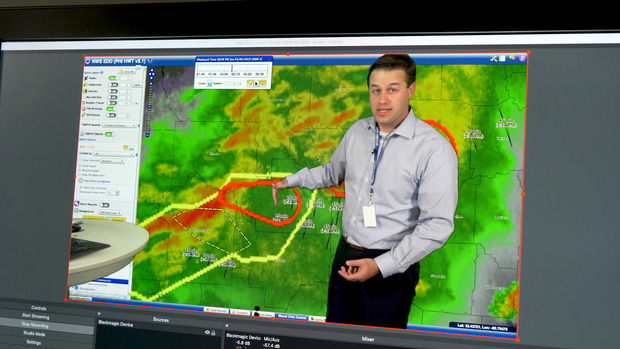
One of those researchers is Holly Obermeier from the Cooperative Institute for Research in Environmental Sciences (CIRES) based in Boulder.
"These are experimental products. They are new types of warnings and we need to make sure broadcasters are able to communicate these products so they're useful. It's important we have someone from Denver here because in Colorado we see tornadoes on the plains, we see severe thunderstorms, we see so much hail", said Holly.

Currently when a thunderstorm is likely producing a tornado or is strong enough to produce wind of at least 60 mph and/or 1 inch in diameter hail, a forecaster at the NWS will issue what is called a "polygon warning" around the storm and in the general path of the storm. These warnings are generally issued for at least 30 minutes into the future and the shape of the polygon generally does not change during this time.
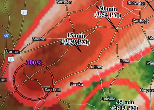
The new types of warnings being tested in Oklahoma are drawn much closer to the storm and the expected path and therefore warn fewer people unnecessarily. This is possible because the warnings are updated at a much faster interval than the currently polygon warnings. The concept is called "Threats-In-Motion" and the NWS plans to have some form of it operational within a few years.