Colorado Weather: Quick Shot Of Snow On The Move Into The Front Range
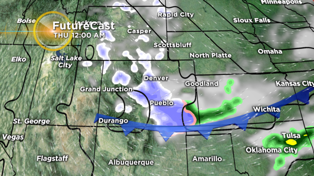
DENVER (CBS)- A surge of cold October air is pushing south across the Rockies and central Plains. This will bring a blast of Winter-like weather across our region before the day ends. At this point, it looks like the bulk of the accumulation in and near the Front Range will be overnight Wednesday into Thursday morning. The map shows the front and heaviest snow at midnight Wednesday evening.
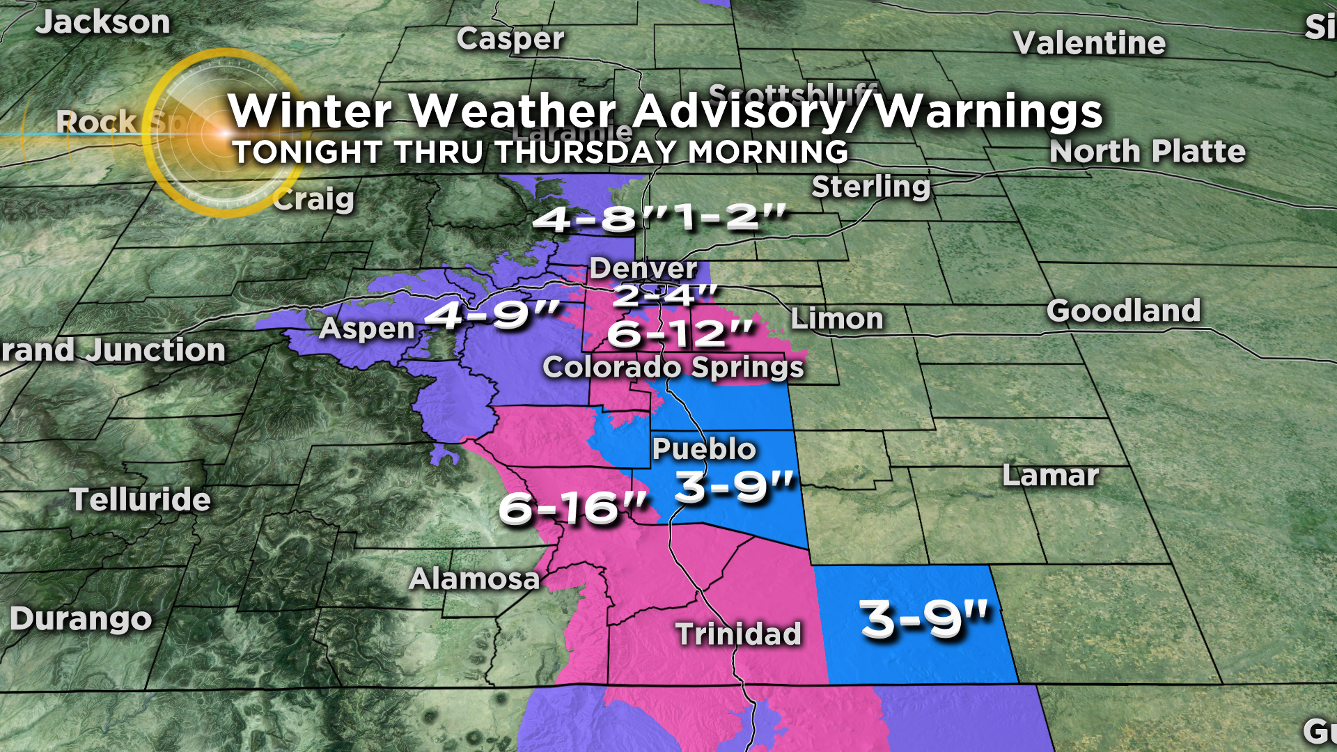
Several areas of the state have a winter weather advisory, winter storm watch or winter storm warning posted for Wednesday night into Thursday morning. The Denver metro area has Winter Weather Advisory in place for 2 to 4 inches of snow. There will be much larger amounts in and near the foothills west and south of the Mile High City. Some isolated spots may see up to a foot of snow!
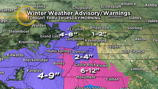
Additional advisories and warnings are also in place for southern sections of the state as well. In fact, some of the Sangre De Cristo Mountains may see 6 to 16 inches of snow by the end of Thursday morning.
The cold front will be a fast mover across the state. The northern part of the state may even see some sunshine by the end of the day on Thursday.