Denver Weather: Numerous Storms Expected Sunday Afternoon, Some Severe
DENVER (CBS4) - You may have noticed a slight chill in the air early this morning thanks a front that passed through the state. I must say it felt quite refreshing while doing the weather this morning in our Outdoor Weather Lab!
Today's weather headline will be thunderstorms so if you need to get things done outside do it early just in case. A potent weather disturbance moving out of Utah will bring stormy weather as it crosses the state. Showers and storms will develop during the late morning hours on the western slope and then push across Colorado this afternoon and evening.
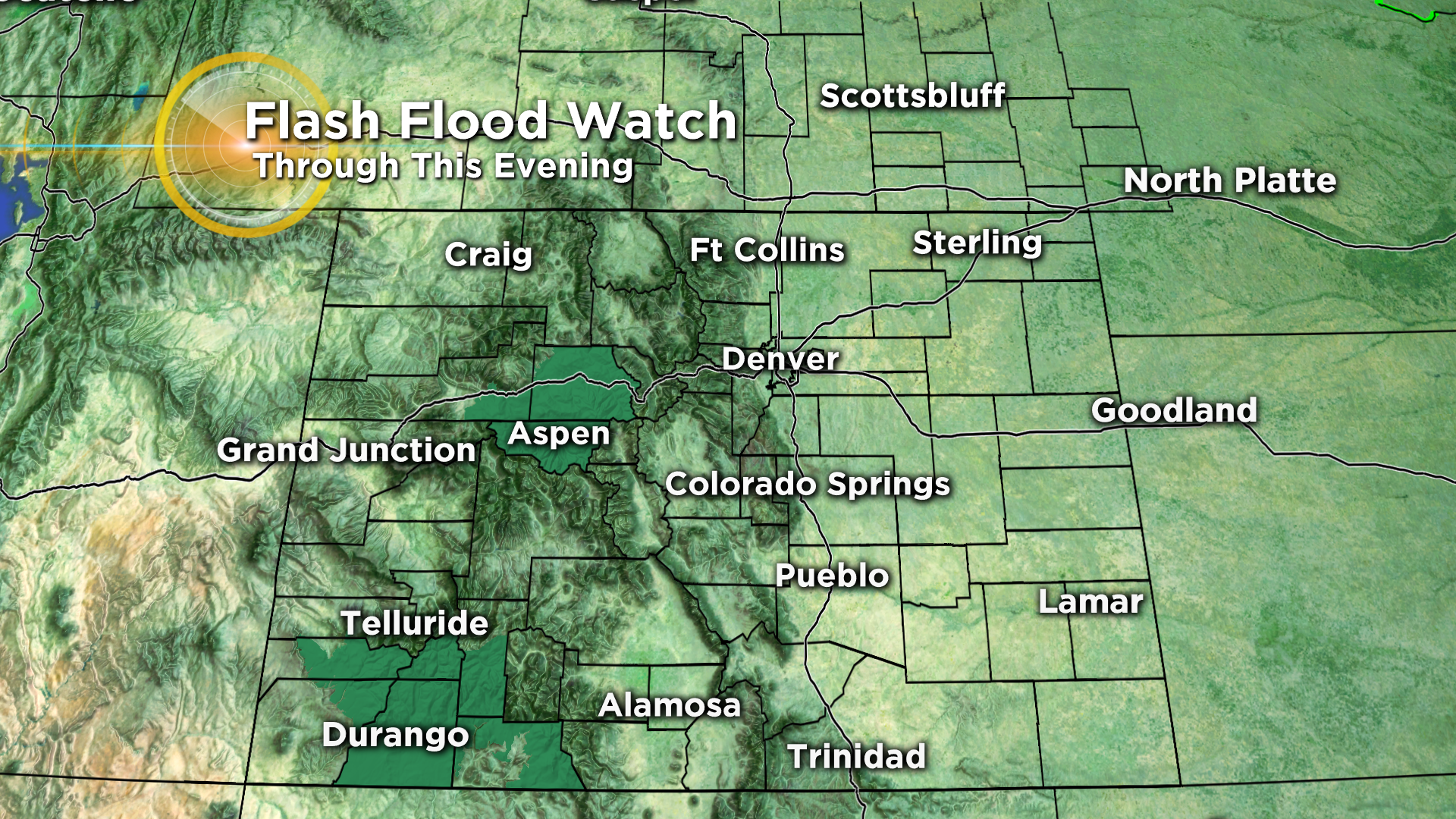
Some of the thunderstorms will have the potential to produce locally heavy rainfall, with up to an inch or more in less than an hour. Because this threat is present around some of our recent burn scars the National Weather Service has issued a Flash Flood Watch for portions of the high country.
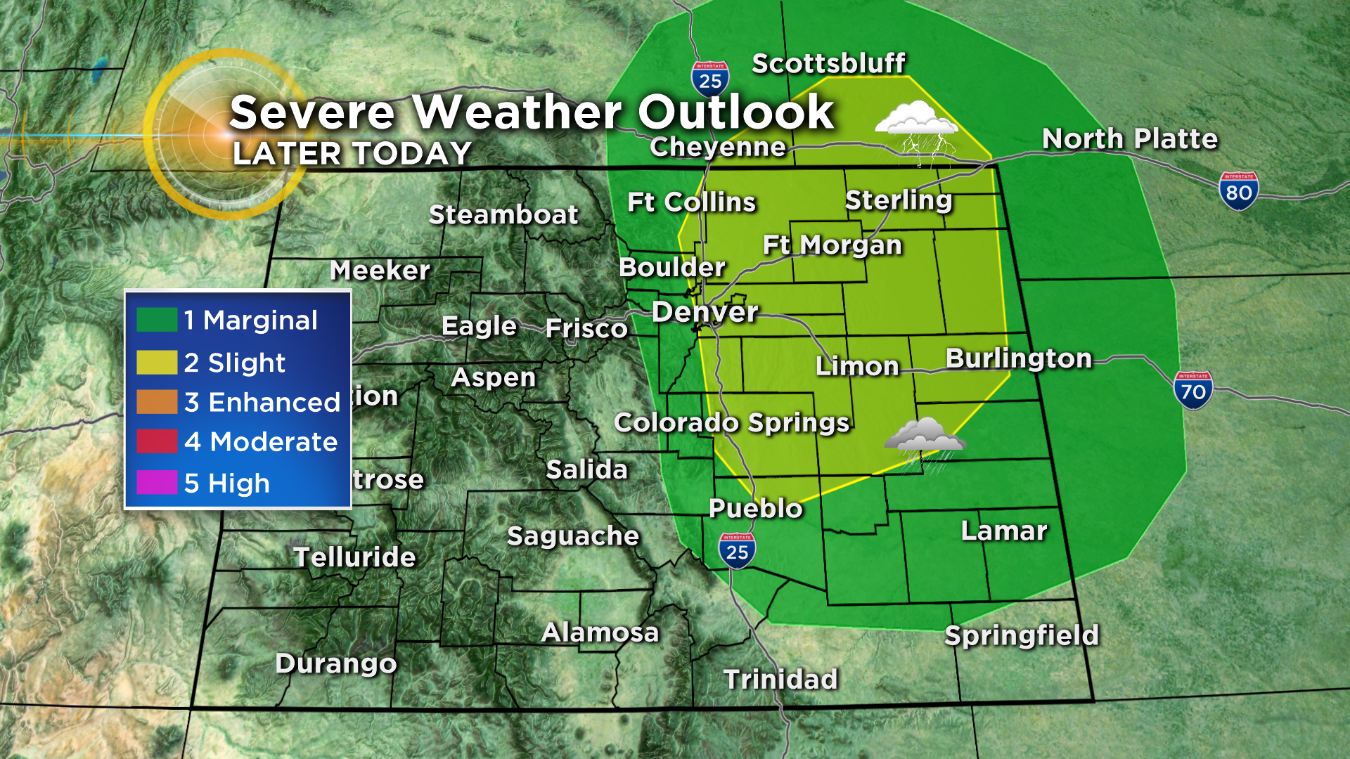
In Denver, along the Interstate 25 Urban Corridor and on the eastern plains there is enough moisture and warm air present to create some strong to severe storms. Large hail and damaging wind will be the primary threats but you can never rule out an isolated tornado. The timing for storms in the metro area will be between 3 and 8pm. They could linger as late as midnight in our far eastern counties.
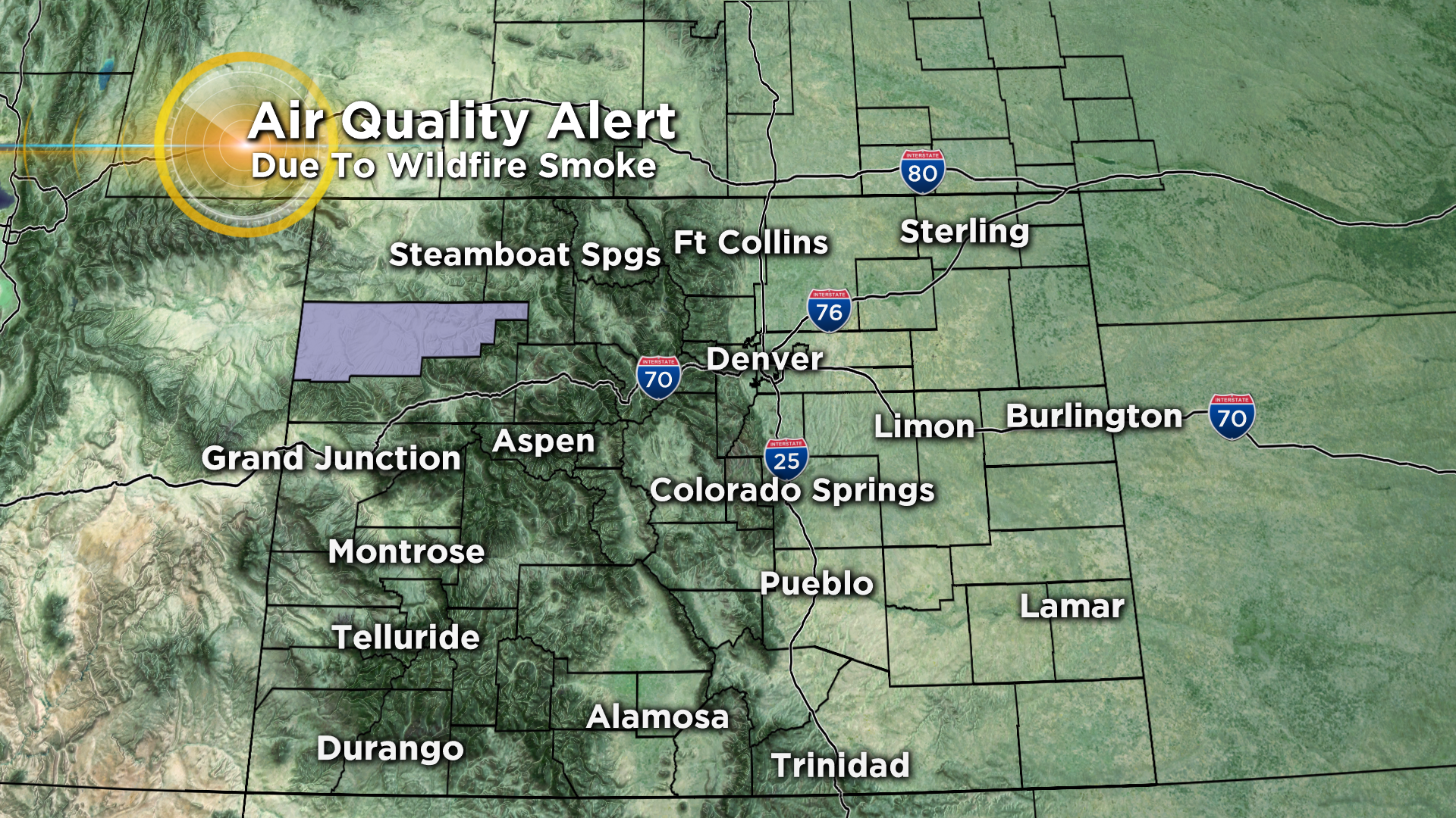
Areas around Rio Blanco County in extreme northwest Colorado will see smoky skies today due to the Hunt Fire burning near Meeker, which has nearly doubled in size since Friday. There is an air quality alert in effect for this part of the state.
Looking ahead at the next 5 days it will be fairly typical for early September with temperatures running at or just a little above normal for this time of year. By Thursday another cool front will knock our temperatures back a few degrees.