Denver Weather: Widespread T-Storms Possible By Saturday Evening
DENVER (CBS4) - A weather disturbance over Utah will move through Colorado today bringing the chance for widespread showers and thunderstorms by late afternoon. Some of the storms will rumble well into the evening.
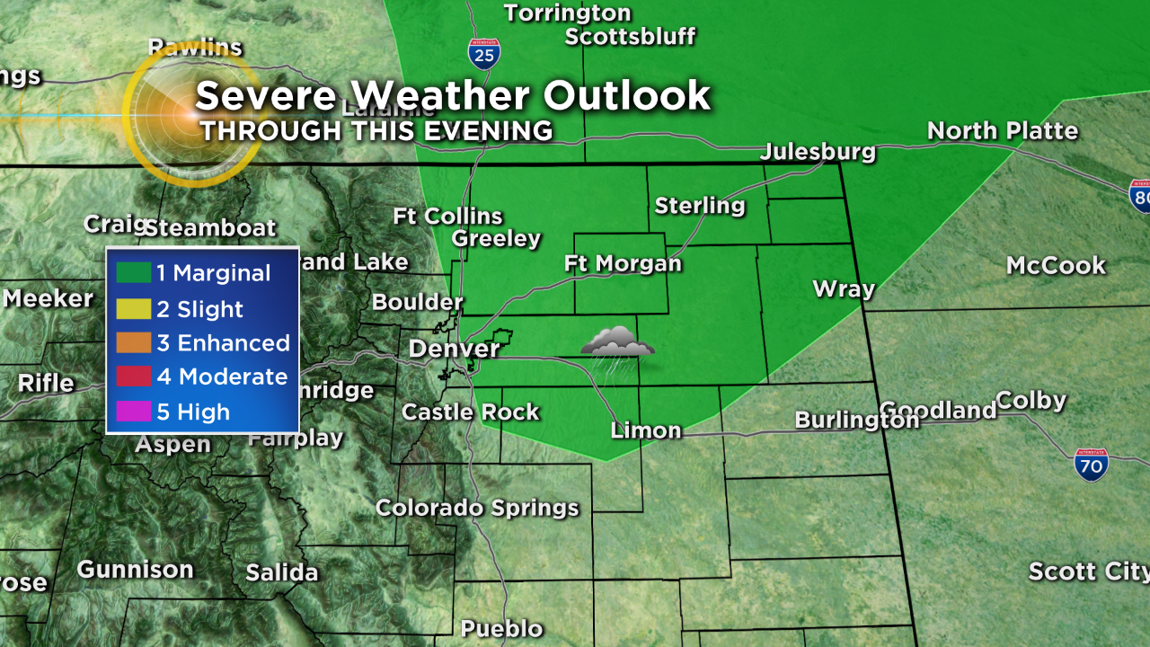
A few could turn strong to severe on the northeast plains, especially in areas to the north and east of downtown Denver. Hail up to one inch in diameter will be possible in these areas.
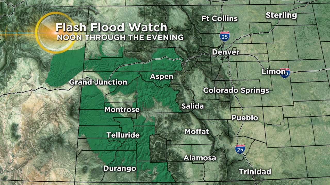
The rest of the state has potential to see locally heavy rain and that could lead to difficult travel at times. We saw a large mudslide Friday afternoon on Interstate 70 near Glenwood Springs as well as additional problems in parts of the San Juan Mountains in the southwest.
The National Weather Service has placed much of west-central and southwest Colorado under a Flash Flood Watch starting at noon today because of the heavy rain threat. The watch will last into the evening hours.
High temperatures today will range from the 60s and 70s in the mountains to the 80s and 90s on the eastern plains and western slope. Highs around Denver will range from 87 to 92 degrees.
Some warmer and drier air will work into Colorado starting Sunday and that means we could see a pretty hot week ahead with widespread 90s in the lower elevations and 70s and 80s in the high country.