Denver Weather: Cool For July With More PM Storms, Heavy Rain Possible
DENVER (CBS4) - Saturday's cold front brought a much cooler and more humid air mass into eastern Colorado which set the stage for slow moving showers and storms. A few areas along the Front Range experienced flash flooding Saturday afternoon. A repeat scenario is possible again today.

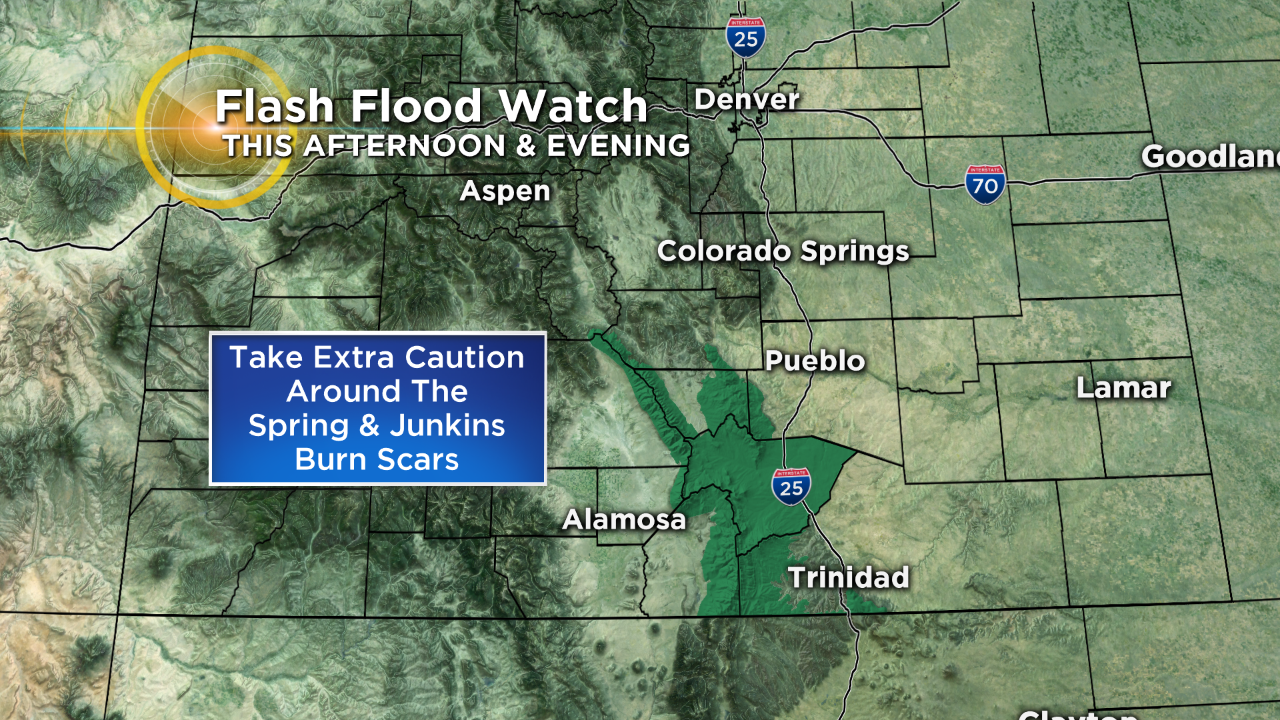
The National Weather Service has issued a Flash Flood Watch for portions of the Sangre de Cristo Mountains in south-central Colorado through this evening. Extra caution is needed around the burn scars from the last few years.
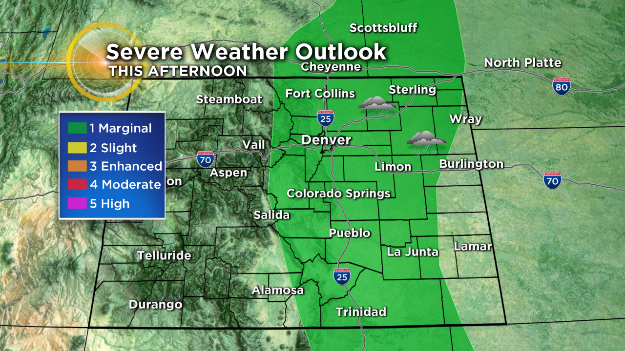
There is a very small (marginal) risk for a few severe thunderstorms to develop this afternoon along and east of the Continental Divide. The main threat other than locally heavy rain from these storms would be large hail.
The weather story today will be much different in western Colorado where the air is drier and the temperatures will be much warmer. A few isolated storms are possible on the western slope but nothing widespread is anticipated.
Monday looks to be a complete repeat of the weekend with hot and dry conditions in the west and cooler than normal conditions in the east with a continued chance for afternoon and evening storms. Starting Tuesday we will see temperatures warm slightly statewide with a slight decrease in moisture levels, although storm chances will not go away entirely.