Denver Weather: Big Changes Arrive Saturday With Strong Summer Cold Front
DENVER (CBS4) - After two days with record territory high temperatures and several places reaching the triple digits, we'll cool off significantly this weekend thanks to a pair of summer cold fronts.
The first one will move in today and it will be responsible for a wide variety of temperatures over eastern Colorado. The front doesn't have a lot of speed and isn't traveling in a clean straight line, so that means temperatures will be all over the place today.
If you are behind the front it will be a bit more humid with more cloud cover and cooler temps. Highs in the upper 70s and lower 80s. Ahead of the front it will be mostly sunny and hot with highs in the 90s to low 100s. For a place like Denver, which will be in between, there will likely be a lot of variation across the city.
Mountain highs today will be in the 60s and 70s with lower elevations and high valleys in the 80s and 90s.
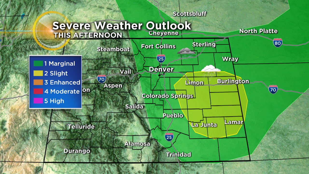
In addition to the front there is a weather system over Utah that will combine with the front and daytime heating to help trigger widespread showers and thunderstorms this afternoon and evening. Some will be strong to severe with the potential for locally heavy rain and large hail.
After today's cold front a second surge of cooler air will arrive tomorrow and that should knock our temperatures back even more for the first part of the new week. It will also keep scattered showers and storms in our forecast.
By Tuesday and Wednesday it looks like temperatures will get back to where they should be for this time of year which is close to 90 degrees each afternoon.