Denver Weather: Hot Weather Continues, Daily Storm Chances Return
DENVER (CBS4) - For last several days the Front Range and most of Colorado has been mainly dry. A few storms managed to develop late Thursday and few more are expected late Friday before better thunderstorm chances develop this weekend.
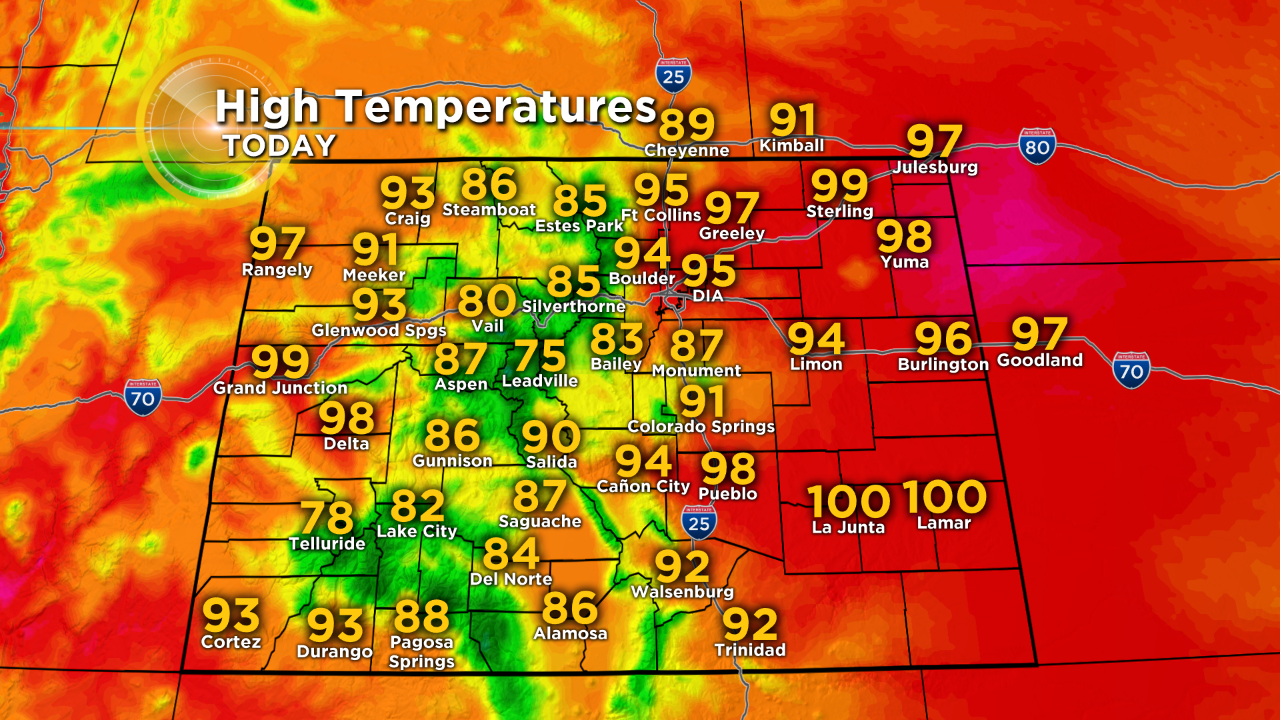
High temperatures will also remain hot with highs in the 90s for the foreseeable future. And that's quite common for this time of year. In fact, we have now entered the hottest period of the year in the Denver metro area. From July 12 through August 1 the normal high temperature is 90 degrees which is our highest normal high of the year.
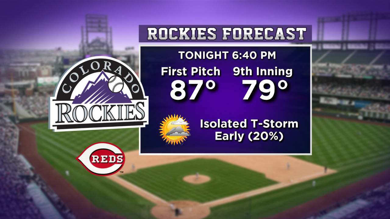
Isolated thunderstorms will first develop in the mountains Friday afternoon and then drift east into the Denver, Boulder, and Fort Collins areas during the late afternoon and evening on Friday. It's possible there could be a brief thunderstorm in the early innings of the Rockies game at Coors Field Friday evening.
A large area of high pressure responsible for the mainly dry weather this week will slowly move east toward Oklahoma this weekend. As it does, southwesterly winds on the west side of the high pressure will bring increasing moisture into the state. This is the "summer monsoon" we often start talking about this time of year. With the extra moisture, we'll have better chances for afternoon and evening thunderstorms this weekend.
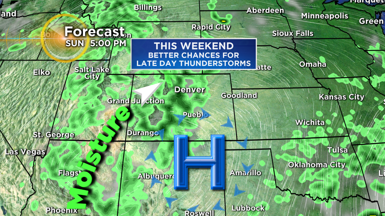
Thunderstorm chances reach 40% on Saturday and 30% on Sunday which is still considerably lower compared to storm chances we experienced earlier this summer.