Denver Weather: One Final Cool, Wet Day Before Summer Temps Return
DENVER (CBS4) - Today will be the final day of wet and chilly weather around Colorado. If you are planning to play in the mountains you may still find snow in elevations above 9,000 feet. The best chance for this would be along and north of Interstate 70.
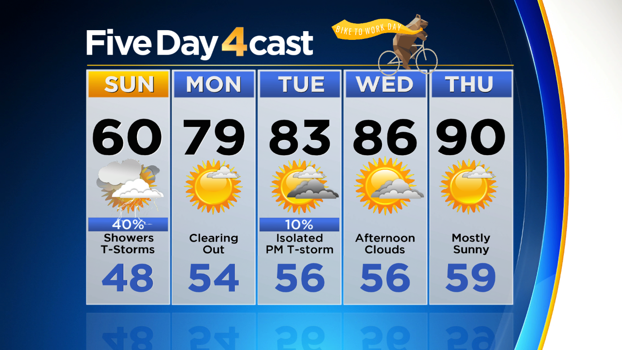
Your Sunday forecast calls for more clouds than sunshine with the potential for showers or thunderstorms at any point between the late morning and mid-evening hours. It shouldn't rain all day but there is the potential to see a few different waves of moisture roll through.
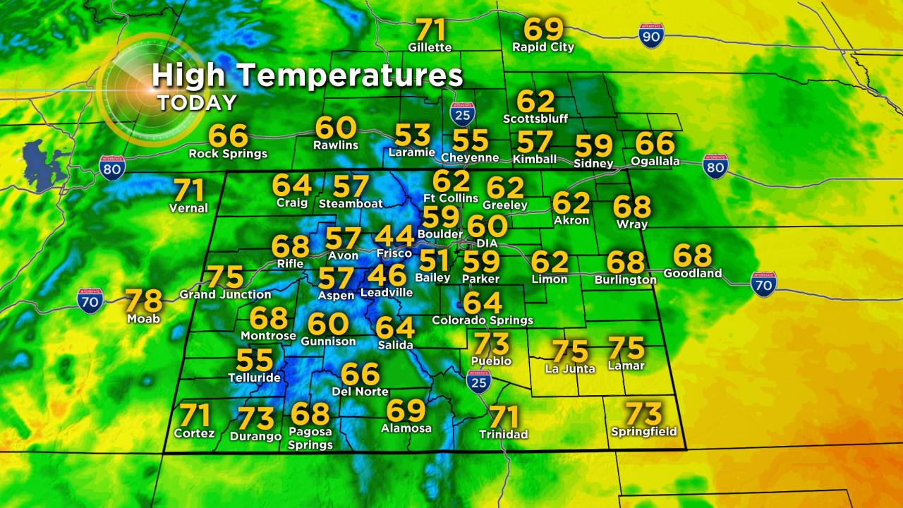
Extreme southern and southwest Colorado will miss most of this action today and should have a partly to mostly sunny day along with the warmest weather.
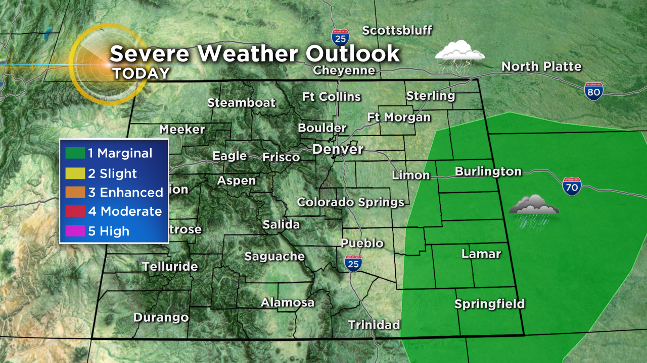
On Saturday we saw a few strong to severe thunderstorms develop around the region, mostly confined to the southeast plains. If any pop up today that is where we would expect them to develop. Large hail would be the primary threat.
If you are tired of this unusually cool and wet weather I have some good news! Our summer storm will move away while you sleep tonight and that will allow warmer, drier air to move into the state starting Monday.
The week ahead should not bring any major weather systems across Colorado. Other than the chance for those daily pop up showers or storms it will be dry for most of us with temperatures climbing back to where they should be for this time of year.
Denver has the potential to see the first 90 degree readings of the season by the last half of the week. It may be a few days late but summer WILL finally arrive into Colorado!