Denver Weather: Severe T-Storm Watch South, Southeast Metro Denver
DENVER (CBS4) - An unusually strong summer cold front moving through Colorado is responsible for a wild swing in our weather as we celebrate the Summer Solstice. Everything from mountain snow to strong storms on the plains is in the forecast.
At one point most of the Denver metro area had a threat for strong to severe thunderstorms with the potential to produce large hail. But morning cloud cover limited heating. That, combined with a lack of surface moisture, is reducing the threat for large storms. While our chance is not zero, it is much lower than we previously thought early Friday morning.
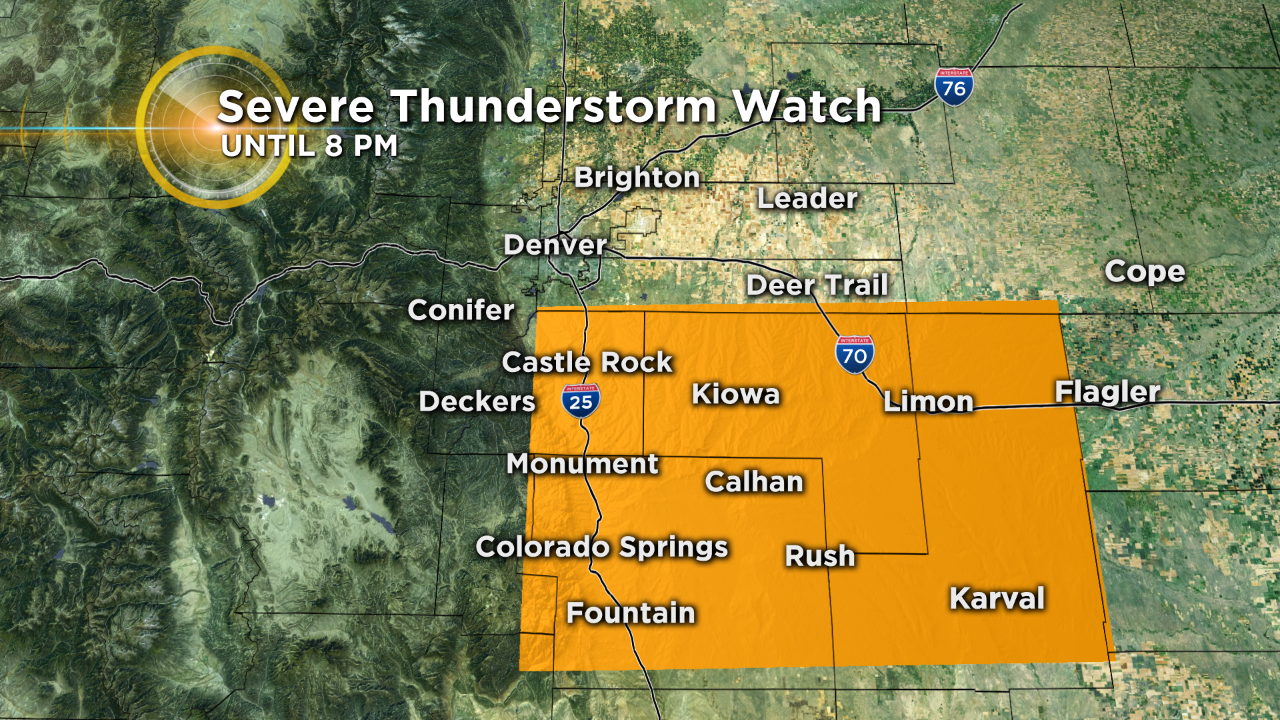
However just south and southeast of downtown Denver, where there was more morning sunshine and the surface moisture is higher, storm chances still exist. Because of this the National Weather Service has issued a Severe Thunderstorm Watch until 8 pm.
Once the severe storms move away we will have an ongoing chance for showers and thunderstorms through the entire weekend with temperatures running 20-30 degrees below normal.
The other side to this weather story will be in the mountains where a pretty respectable summer snow is anticipated. There's a Winter Weather Advisory in effect starting tonight. Some places above tree line could see up to 10 inches of snow!

After a very cool first weekend of summer we will see normal to above normal temperatures return starting Monday. In fact Denver could see the first 90 degree reading of the season by the middle of next week!