Cool, Spiral-Shaped Cloud Over Denver May Have Started As Jet Contrail
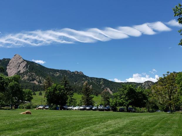
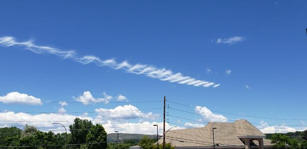
DENVER (CBS4) - Did you see the really cool, spiral-shaped cloud hovering along the Front Range early Wednesday afternoon? It was quite the talker on social media and while it's hard to say what caused this cool cloud I do have two theories.
Theory #1
There's a good chance that it was originally a jet contrail that became twisted and reshaped by atmospheric wind. When I posed this theory to several who live in the area they said they were confident there was no jet traffic overhead at the time.
But keep in mind a contrail at this altitude would not have been created by a plane flying into or out of Denver. It would've been created by a flight at cruising altitude passing high over the Front Range.
Also, if this cloud was the result of a contrail, it wouldn't have necessarily formed directly overhead. It could have been from a plane that was several miles away and it drifted into the region, constantly being twisted and reshaped by wind at that altitude.
Theory #2
If it wasn't an old jet contrail being reshaped by the wind then my next best guess is something along the lines of a lenticular cloud mixed with the conditions that create a Kelvin–Helmholtz wave cloud. Essentially there was enough moisture at that altitude to create a cloud, but the stability of the atmosphere was such that it could only grow to a shallow depth.
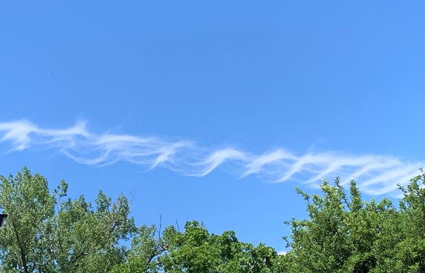
Add in a lot of wind shear between the bottom and the top of the cloud, which is a change of speed or direction with height, and the air was essentially rotating on a horizontal axis, making the cloud have a cool spiral, or helix shape.
While it's nearly impossible to say for sure, it's fun to think of possible causes. We are so lucky to live in such a beautiful state and in the shadow of mountains that interact with our atmosphere, giving us so many cool things to see in the sky.