Denver Weather: Tornado Warning Issued For Part Of Northeast Colorado
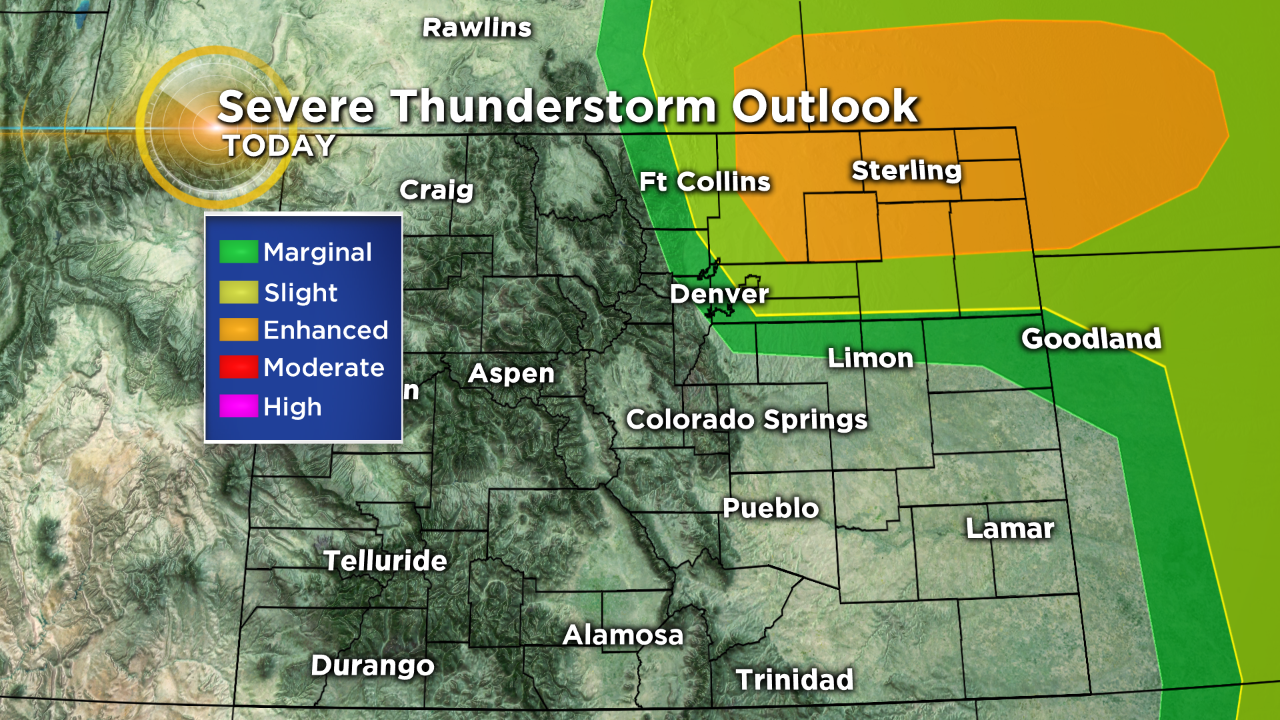
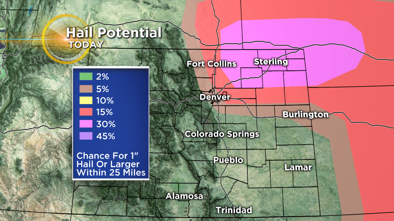
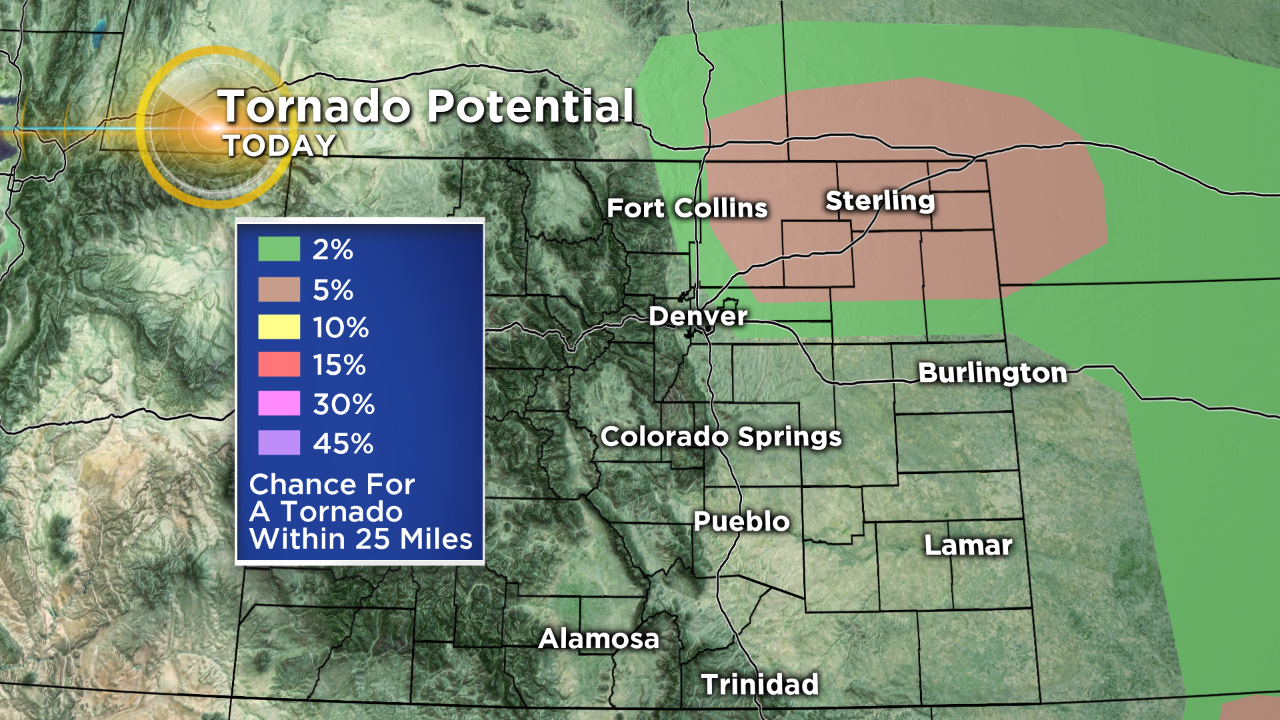
DENVER (CBS4) - Another very busy weather day is shaping up for the Front Range and northeast plains with the potential for strong to severe thunderstorms. Today's main threats are large hail and tornadoes.
"Tornado Warning for areas of NE CO in Weld, Morgan, and Logan counties. Large hail and confirmed tornado. Get inside if you're in this area!" CBS Meteorologist Lauren Whitney warned at 3 p.m. That alert expired at 3:30 p.m., but another went into effect a few minutes later a little farther east.
Whitney said the Tornado Warning was in effect at 4:30 p.m.
"Thunderstorms will continue to move north and northeast across portions of northeastern Colorado through the afternoon. Hail up to 3 inches in diameter, strong winds to 60 mph and tornadoes will be possible with the stronger storms," the National Weather Service in Boulder tweeted at 3:45 p.m.
Earlier in the afternoon, a tornado warning was issued that included Adams County. That was effect from about 1:45 p.m. until 2:15 p.m.
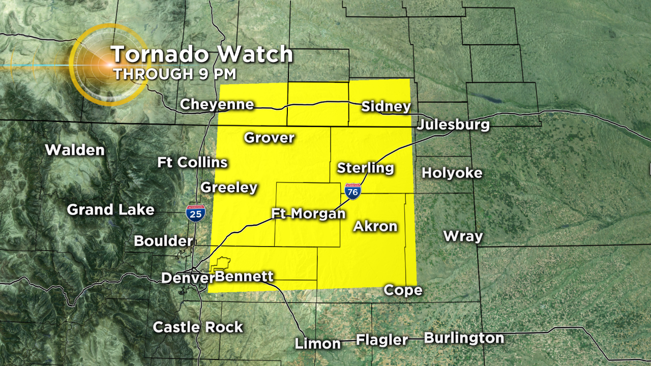
The National Weather Service has issued a Tornado Watch for most of northeast Colorado until 9 p.m., including Denver International Airport, Brighton, Greeley, Sterling, Fort Morgan and Akron.
RELATED: Several Tornadoes Disrupt Memorial Weekend
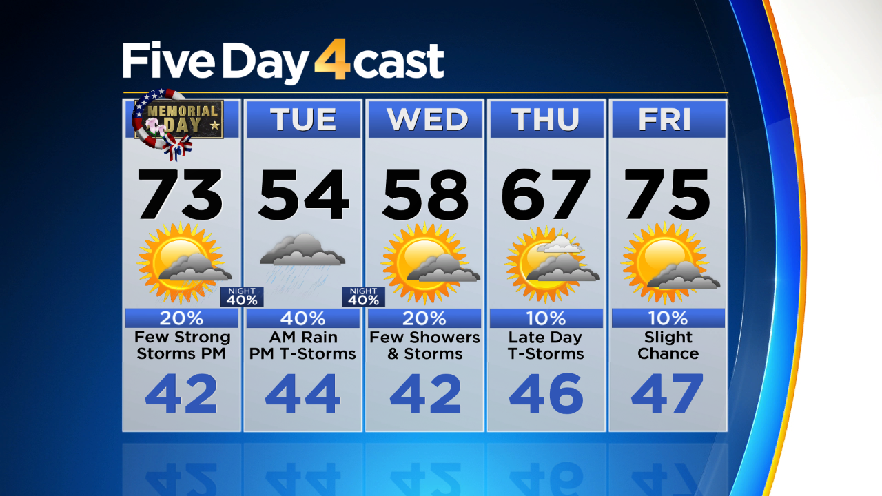
Tonight the weather story will turn to colder air moving into the state as an area of low pressure arrives from the southwest.
Snow is expected in the mountains and it could accumulate to several inches above 9,000 feet. The National Weather Service has issued a Winter Storm Watch for most of the mountains starting tonight and lasting into the day on Tuesday.
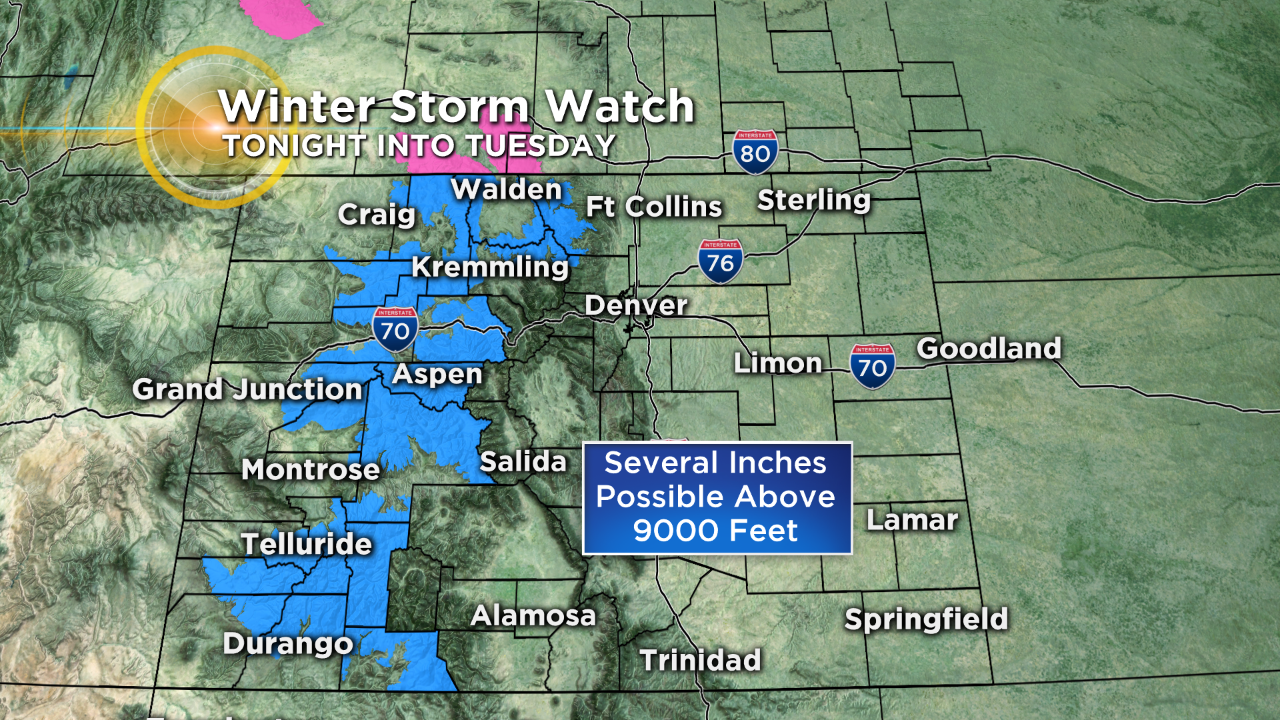
Tuesday and most of Wednesday will be cloudy, cool and wet at times across Colorado as the low pressure moves by. Some warmer and drier weather is anticipated by the upcoming weekend.