Denver Weather: Severe Storms Expected Today Along, East Of I-25
DENVER (CBS4) - While you were sleeping last night a plume of moisture moved out of Kansas and toward the Front Range foothills. If the dew point on your home weather station is registering in the upper 40s or higher then you are inside the humid air mass and will have the risk to see thunderstorms later today.
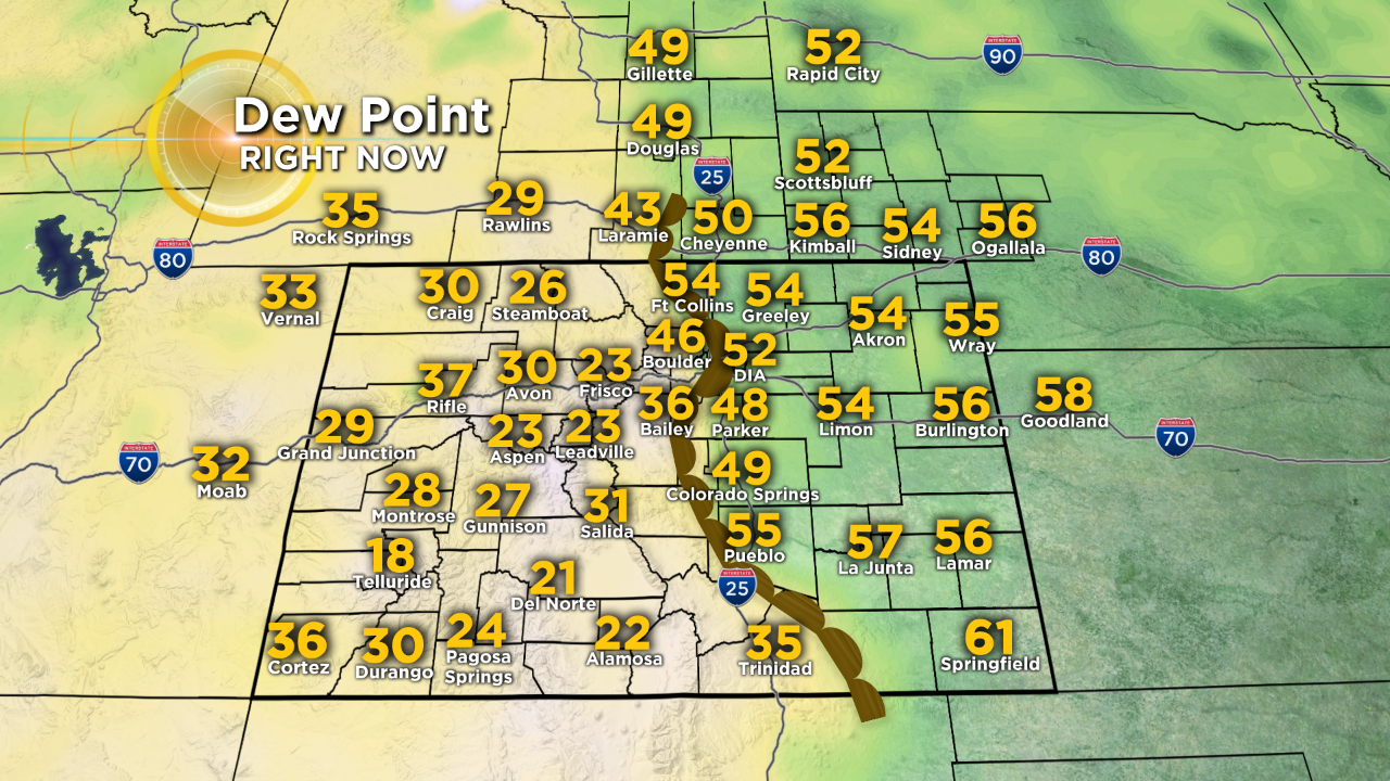
The map above showed dew point temperatures as of 8 a.m. and you can see a very sharp boundary of dry air vs. humid air right along the base of the Front Range Foothills. We track the dew point in meteorology because it is a measure of moisture in the air, and that is important because moisture contains potential energy called latent heat, which gets released back to the atmosphere as clouds build.
We had an awesome view of this low-level moisture sitting over the eastern plains from a camera on top of Pikes Peak during the CBS4 Morning News.

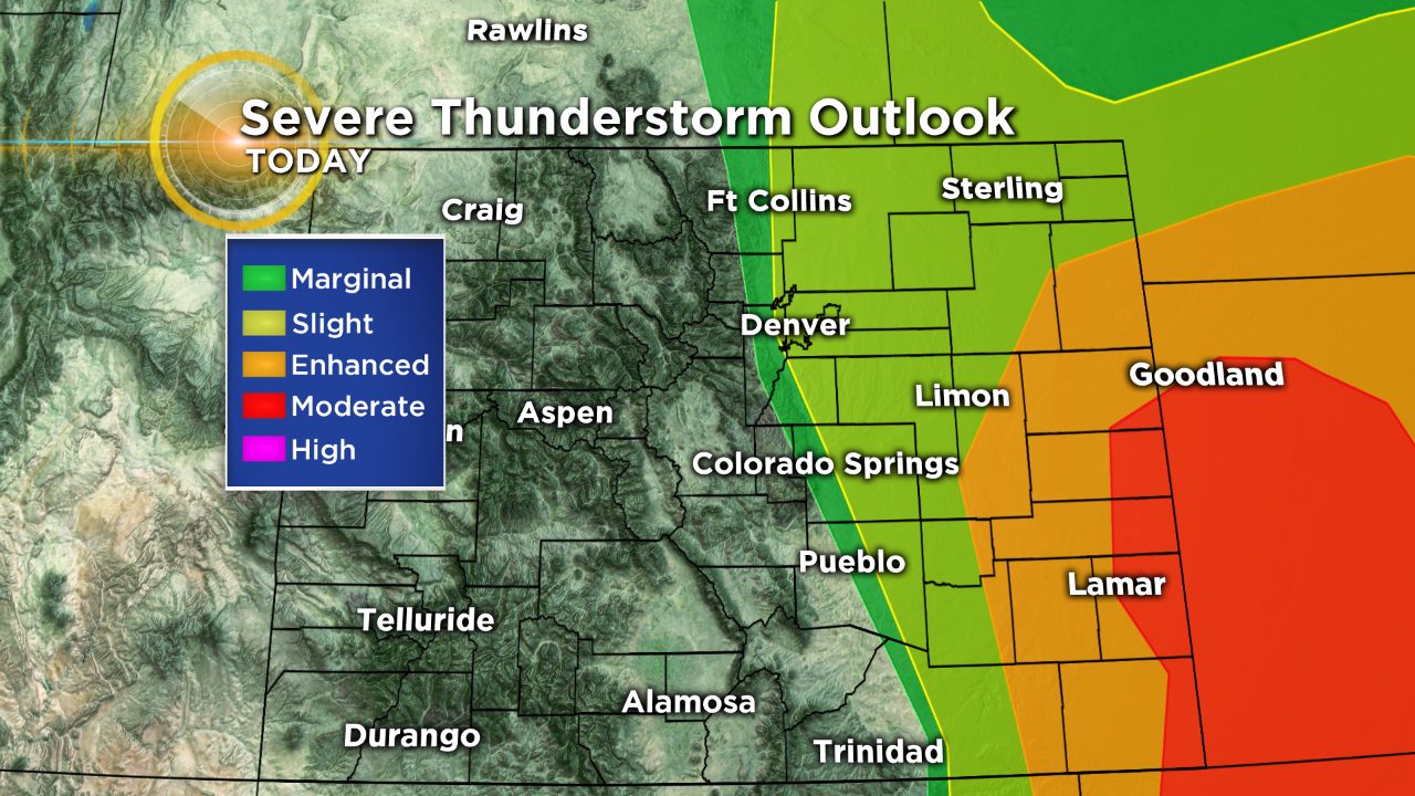
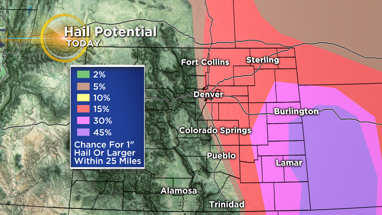
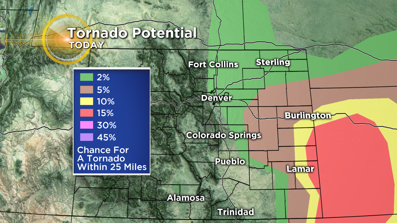
By this afternoon the humid air will help fuel strong to severe thunderstorms as we reach peak heating. While everyone along and east of Interstate 25 is at risk, the greatest threat is near the Kansas state line. It's important to note that storms will be scattered so not everyone will see one. But where they develop they could become severe.

Looking ahead to Monday an area of low pressure will approach Colorado from the southwest and it will bring another chance for showers and thunderstorms, along with much cooler temperatures. By Monday night and Tuesday morning we'll see snow once again in the high country and it could pile up to several inches above 10,000 feet. Light snow showers will be possible in the foothills west of Denver before sunrise on Tuesday.