Denver Weather: AM Fog, Strong PM T-Storms Added To Sunday's Forecast
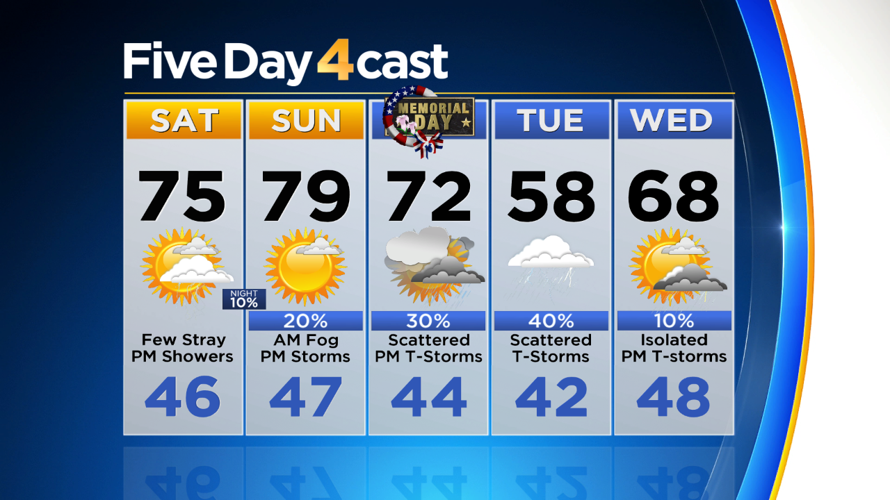
DENVER (CBS4) - Overall the holiday weekend forecast is still looking good but we had to tweak a few things, especially on Sunday. Mild temperatures are still on track thanks to southwest winds bringing warm air into the state. Highs will be in the 60s and 70s for the lower elevations through Monday with some lower 80s on the eastern plains. Anticipate daily highs in the 40s and 50s for mountain areas.
Here's where the change comes in. New weather data shows a surge of moisture potentially coming into eastern Colorado late tonight. If that happens we will wake up to some low clouds and maybe even patchy fog along and east of Interstate 25. That moisture will also set the stage for a few strong to severe t-storms during the afternoon hours on Sunday.
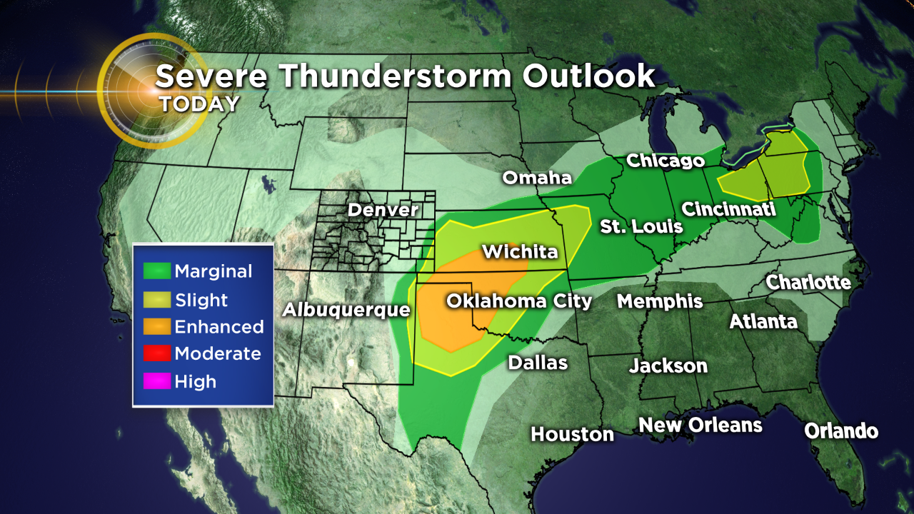
The potential for severe storms Sunday afternoon will depend on how much moisture backs into eastern Colorado tonight. Right now it looks like the best chance for storms will be east of Denver and the I-25 Urban Corridor but again, that is subject to change. Any storms that develop tomorrow will have the potential for large hail, damaging wind and isolated tornadoes.
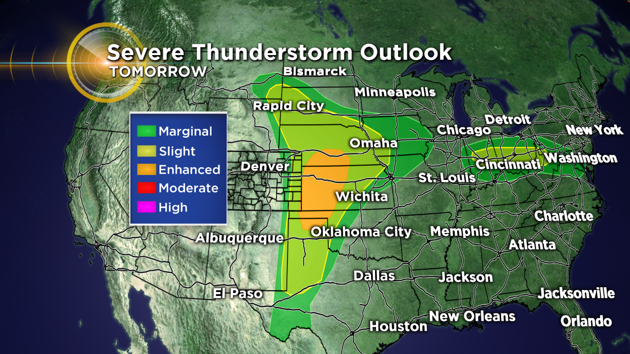
We'll keep a chance for storms in the forecast for Monday as cooler air moves into the state. By Monday night and Tuesday we will see snow move back into the mountains and it could accumulate above 8,000 feet.