Colorado Weather: Advisories, Watches Issued Ahead Of May Snow
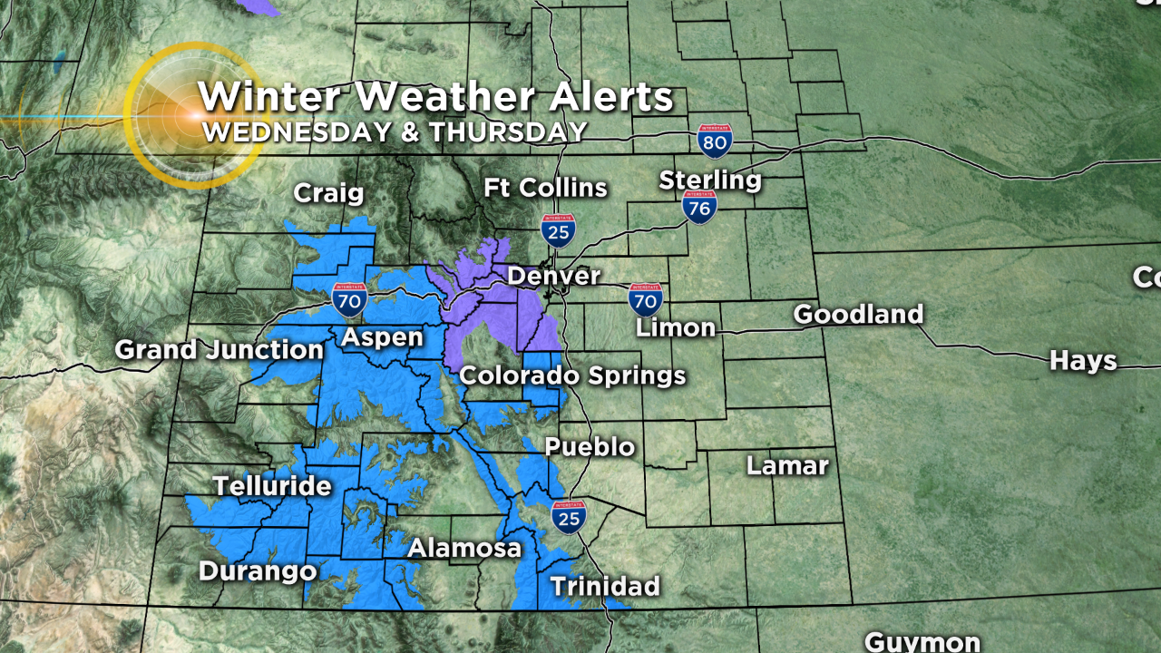
DENVER (CBS4) - A strong storm system will bring a dose of heavy, wet spring snow to parts of Colorado this week with some mountain locations expecting up to a foot or more of accumulation. There may even be enough snow in the foothills west of Denver to warrant breaking out the shovels.
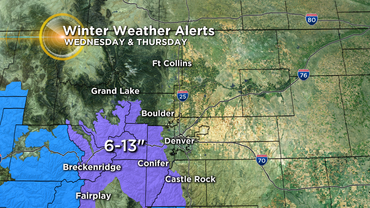
Computer forecast models give a range of 6-13 inches of snow for places like Evergreen, Conifer, Bailey, Idaho Springs and Georgetown. The Front Range Mountains and the adjacent foothills have been placed under a Winter Weather Advisory from noon on Wednesday to 6 p.m. on Thursday.
As of Tuesday evening the National Weather Service had placed most all mountain ranges along and south of Interstate 70 under a Winter Storm Watch. A watch means there is still some uncertainty in the potential snow totals.
By early Thursday morning there is even the possibility that some wet snow could fall across elevations as low as 5,000 feet, which would include metro Denver and the Interstate 25 urban corridor.
Keep in mind that no matter where you live a heavy, wet snow this time of year will rarely measure up to the highest potential because of melting and settling.