Denver Weather: Another Gloomy Day! But Brighter, Warmer Weather Ahead
DENVER (CBS4) - For the third day in a row, Wednesday will include mostly cloudy skies, much cooler than usual temperatures, and areas of rain and snow throughout most of Colorado.
The gloomy weather is the result of several upper weather disturbances moving across the state in recent days. The final disturbance will influence Colorado's weather on Wednesday and Thursday before moving into Kansas by early Friday morning. Until it moves away, Denver and the Front Range have a 40% chance for additional rain showers and possibly a few rumbles of thunder on Wednesday followed by a 30% chance Wednesday night and Thursday. Then sunny and dry weather for Friday and the weekend.
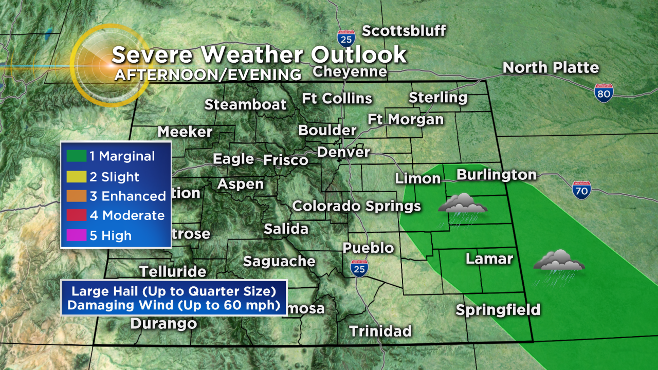
In addition to the chance for additional rain at lower elevations on Wednesday, a few thunderstorms are possible especially in southeast Colorado where there is a slight chance for a severe storm or two. The primary concerns are wind up to 60 mph and hail up to the size of quarters.
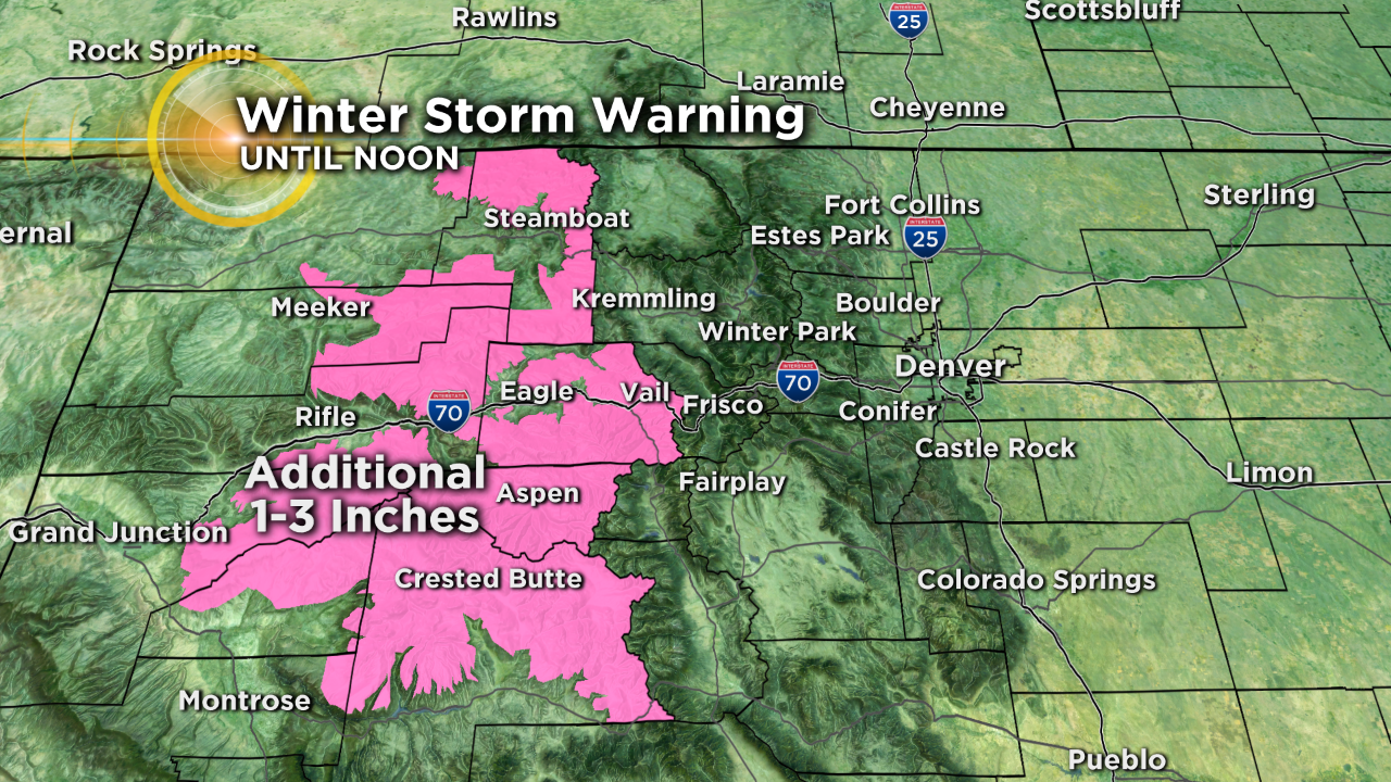
Meanwhile the mountains of Colorado will continue to see snow showers through Wednesday evening but the snow will be lighter compared to the last couple of days. A Winter Storm Warning is set to expire at noon for the mountains west of Vail Pass.
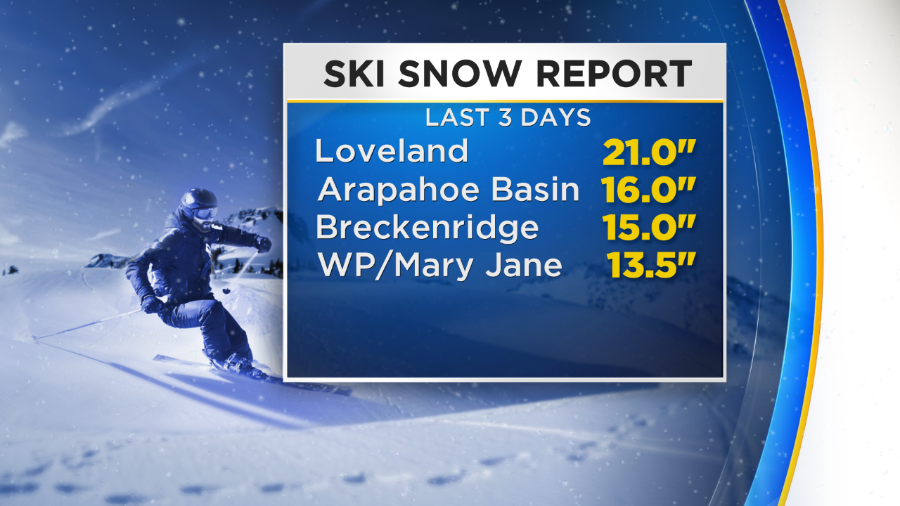
Regardless of how minor additional accumulation is on Wednesday, it will be on top of what has been very impressive snowfall for this time of year. Loveland ski area has seen near 3 feet of spring snow since Sunday.
Drier and much warmer weather will arrive Friday and stay for the weekend.