Denver Weather: Record-Breaking Storm Moves Away But Gusty Winds Continue
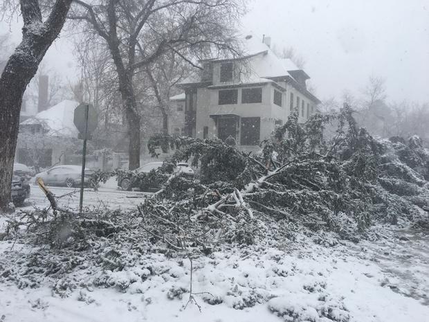
DENVER (CBS4) - The intense storm responsible for possibly the lowest barometric ever observed in Colorado and record precipitation amid blizzard conditions in the Denver metro area is slowly moving away from the state.
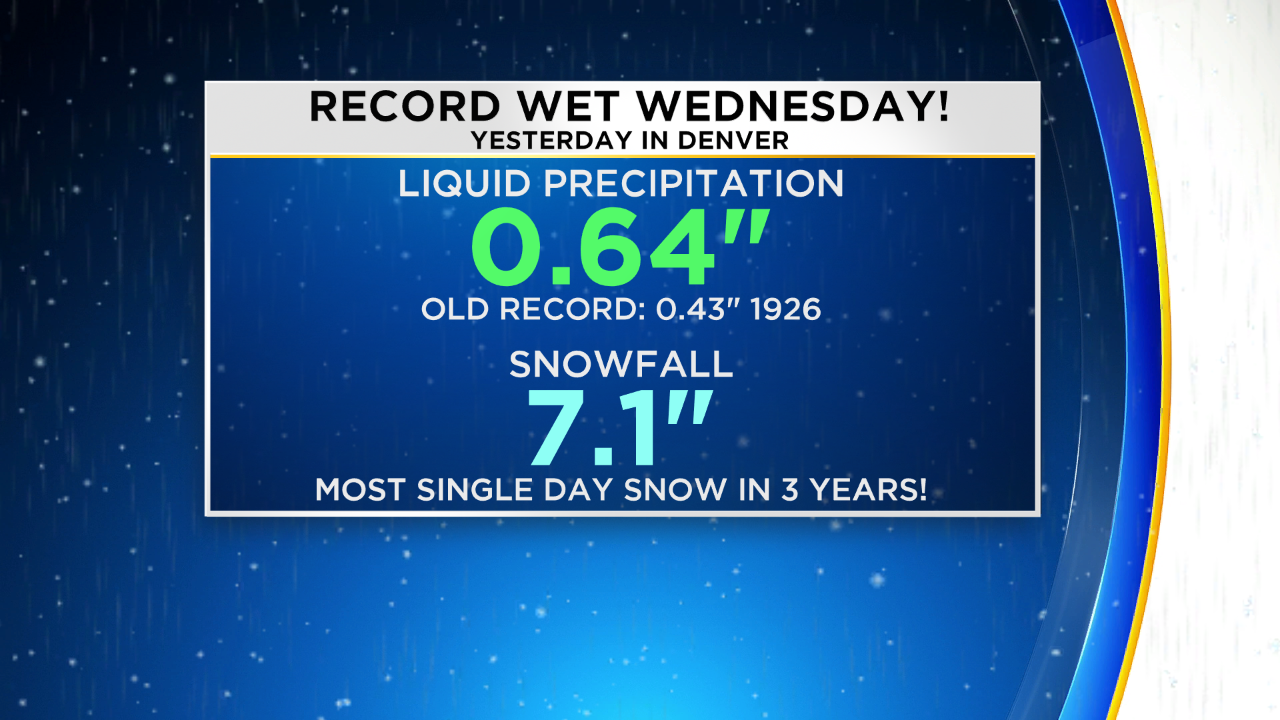
Denver officially received 0.64 inches of liquid precipitation on Wednesday including the early morning rain and wet snow that followed in the storm deemed a bomb cyclone. It was enough rain and snow to crush the previous record for March 13 which was 0.43" set 93 years ago in 1926.
Snowfall was also impressive but feel far short of the record. Nevertheless, 7.1 inches of snow officially feel in Denver which was the most snow in a single day in almost 3 years. The last day we had more snow was on April 16, 2016 when 11.8 inches fell in the city.
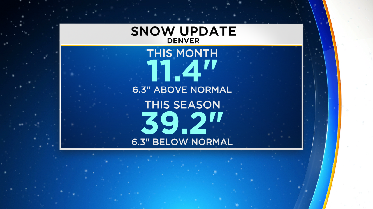
This month we've now measured 11.4 inches of snow in Denver which is more than half a foot above normal through March 14. For the season we're close to 40 inches which is only about 6 inches below normal. It's a tremendous improvement from a month ago.
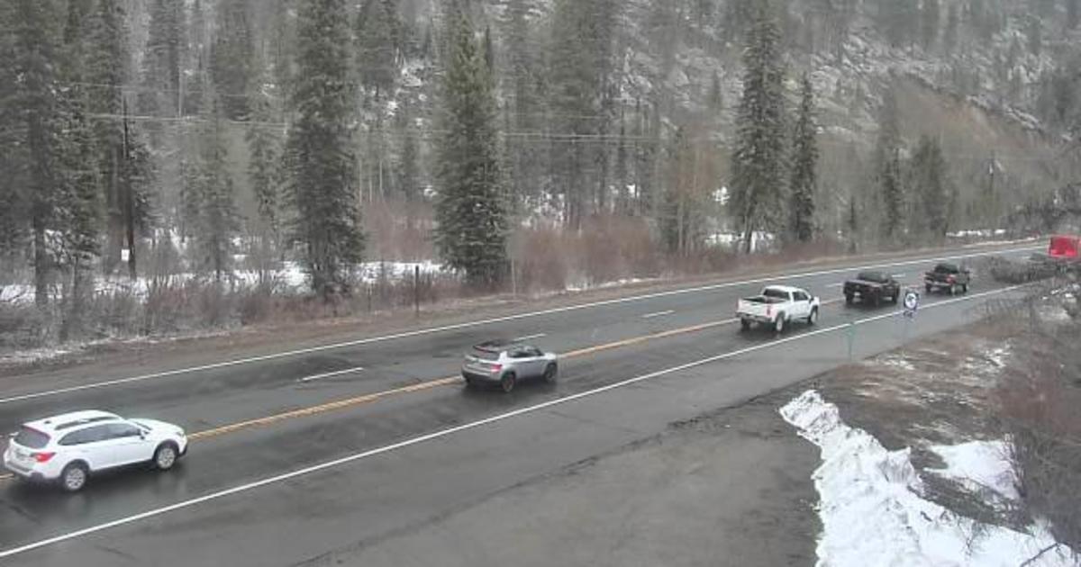
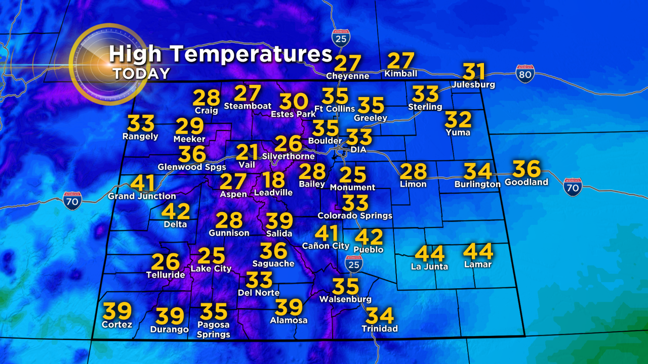
Overall Thursday will be a windy and cold day for everyone along and east of the Front Range. Temperatures will be stuck in the 30s for most neighborhoods around Denver, Boulder, and Fort Collins. Wind gusts up to 35 mph in the metro area will make it feel even colder. On the Eastern Plains gusts could still exceed 60 mph through much of the morning on Thursday.
Improving weather will finally arrive on Friday with mostly sunny skies and somewhat warmer temperatures in the afternoon. A slow warming trend will continue through the weekend.