'Bomb Cyclone' Delivers Category 2 Hurricane Wind Gust To Colorado Springs
By Madison Park, Allie Mazurek and Judson Jones, CNN
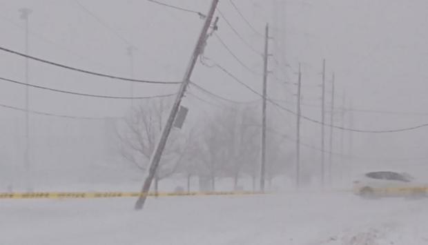
(CNN) - A ferocious winter storm -- a "bomb cyclone" -- unleashed a 97-mph wind gust equivalent to a Category 2 hurricane in Colorado Springs on Wednesday as it roared across the state on the way to the Great Plains and parts of the Midwest, bringing blizzard conditions and a flood threat to a swath of the United States.
A bomb cyclone happens when there's a rapid pressure drop, with a decrease of at least 24 millibars (which measures atmospheric pressure) over 24 hours known as bombogenesis. This storm has dropped 33 millibars since Tuesday morning and continues to strengthen.
Denver International Airport saw a gust of 75 mph, which is equivalent to a Category 1 hurricane.
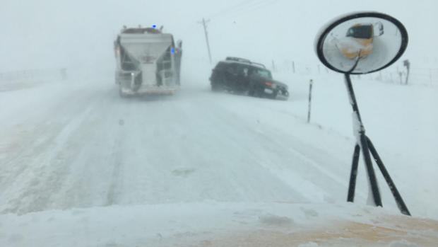
The city's weather was so severe that police were unable to respond to the high volume of motor vehicle accidents, according to a tweet by Denver's Emergency Management Office.
The El Paso County Sheriff's Office in Colorado said more than 500 motorists were stranded in the storm, according to the county Facebook page.
In Elbert County, about 70 miles southeast of Denver, county manager Sam Albrecht said first responders were scrambling to rescue stranded motorists on highways and roads.
"We are at the point where we are rescuing rescuers out there," Albrecht told CNN.
RELATED: Gov. Jared Polis Declares Emergency In Bomb Cyclone, Blizzard Conditions
Albrecht said he did not have an estimate of the number of stranded motorists and that the county was seeking assistance from the state.
"We are just answering the phones and writing down on the board the stranded and crossing them off when we get to them," he said.
Heavy winds were felt as far away as Rick Husband Amarillo International Airport in Texas, where there was a gust of 80 mph, comparable to a Category 1, according to the National Weather Service.
Further pressure drops later Wednesday should be equivalent to what one would typically find in Category 2 hurricane.
In Colorado, at least 184,000 Xcel Energy customers were affected by weather-related power outages, company spokeswoman Michelle Aguayo said. Nearly 5,000 people with other utility companies were also without power, officials said.
In Texas, more than 69,000 people had no power, according to Jen Myers, spokeswoman for provider Oncor. Myers said the sudden wind gusts hit the state with unusual force.
"We're pretty used to seeing Texas storms knock out power, but they tend to be localized," she said. "This was a very widespread event. Everybody's out working to restore power, and all of our crews are out in full force to make sure we can get the power on as soon as possible."
In New Mexico, heavy winds contributed to the derailment of a 26-car train near the village of Logan, according to a tweet from the state police. No injuries were reported.
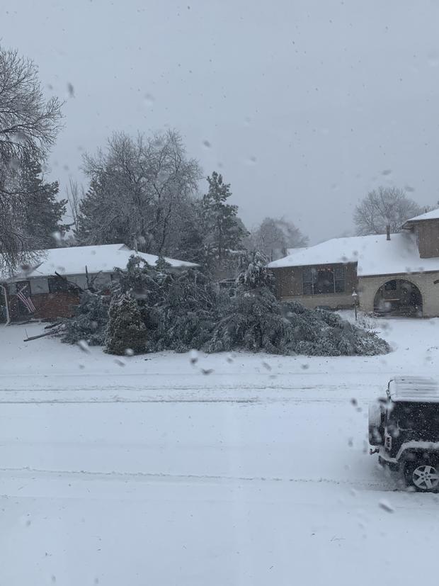
The massive storm was walloping the Rockies. By early afternoon, more than 9 inches of snow had been reported west of Boulder, Colorado, and winds gusting above 50 mph were whipping through central portions of the state. Gusts of 75 and 80 mph were reported at Denver International Airport, the National Weather Service said.
"And yes, that is the equivalent of a Category 1 hurricane! This is a serious blizzard! DO NOT EVEN ATTEMPT TO DRIVE IN THIS STORM!" the weather service's office in Boulder said on Twitter.
PHOTO GALLERY: March Blizzard 2019
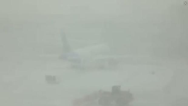
Hundreds of flights bound for, or departing from, the Denver airport were canceled. Thousands of power outages were reported in the Denver area alone.
The storm is on its way to the central and northern Plains and the Upper Midwest with blizzard conditions. Hazards include heavy snow and severe storms with possible tornadoes and flooding into Thursday.
Blizzard and winter storm warnings are in effect for portions of Colorado, Wyoming, Nebraska and South Dakota.
Watches, warnings and advisories for the storm cover about 1.5 million square miles, which is roughly half of the area of the continental United States -- and they stretch from the Mexican border to the Canadian border.
Travel will be dangerous, if not impossible, at times, across areas where the blizzard warning has been issued. Severe storms capable of producing damaging winds, hail, and tornadoes are forecast from the southern Plains and into the Mississippi River Valley. More than 55 people million are under a high wind threat; more than 10 million are under winter storm threats; and more than 17 million are under a flood threat.
Travel and schools affected
More than 1,900 US flights had been canceled by Wednesday afternoon, according to FlightAware. The majority of those cancellations were flights destined for or originating at Denver International Airport (DIA), where a blizzard warning is in effect.
Denver itself is expected to get snow accumulations of about 5 to 8 inches.
Multiple Colorado school districts were closed. That includes Denver Public Schools, which cited "severe weather and road conditions."
Wyoming had closed state offices in Cheyenne, while South Dakota's governor ordered state offices closed in 39 central and western counties because of the storm.
In Nebraska, officials closed a roughly 130-mile stretch of westbound Interstate 80, from Ogallala to the state line with Wyoming, because of the blizzard.
Thunderstorms across portions of the southern Plains will make way for sustained winds of 35 to 45 mph, akin to the strength of a low-end tropical storm.
Gusts up to 110 mph
Wind gusts of 50 to 70 mph are expected through Thursday morning across Colorado, New Mexico, Texas and Oklahoma, CNN meteorologist Monica Garrett said. Some areas could see gusts as strong as 110 mph.
The storm is forecast to rapidly intensify overnight east of the Colorado Rockies and trek slowly northeast through Thursday, bringing a variety of extreme weather from New Mexico to the Midwest. Snow is expected to taper off by midday Thursday, but strong winds may persist through the evening.
In addition, flood watches have been issued across the Midwest and Great Plains amid concerns that heavy rains will melt snowpack and trigger significant flooding. Flash flooding is possible if ice jams clog rivers and streams, the weather service noted.
The-CNN-Wire
™ & © 2019 Cable News Network, Inc., a Time Warner Company. All rights reserved.