Denver Weather: Widespread Snow, Bitter Cold Will Grip Region Today
DENVER (CBS4) - Colorado is in for an arctic blast this weekend as a strong cold front moving in from the north combines with a wet Pacific storm moving in from the west. The two will join forces over the central Rockies to produce a prolonged period of snow and bitter cold.
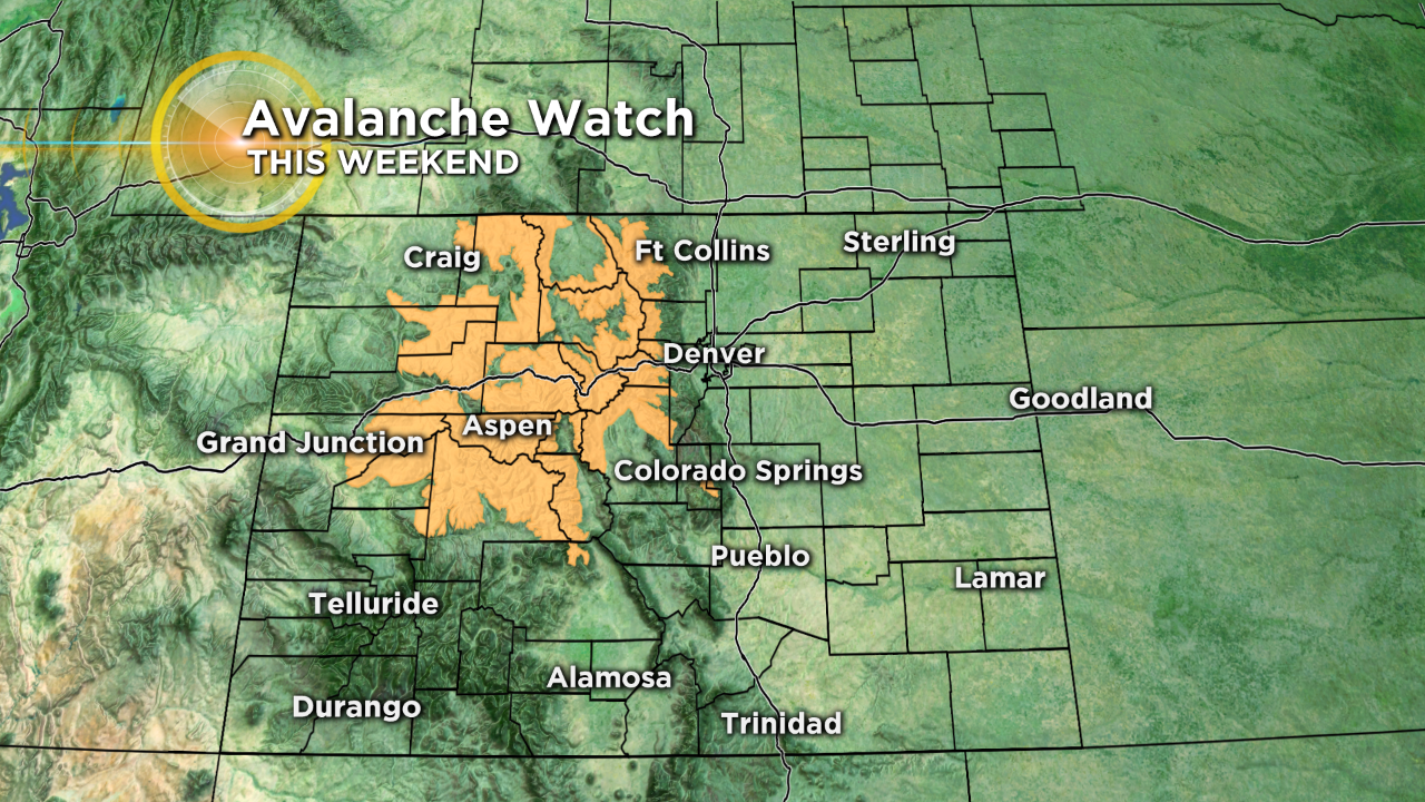
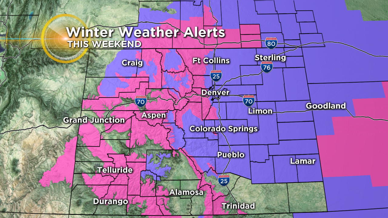
Winter storm warnings (pink) are in effect for most all mountain locations in Colorado. Winter weather advisories (purple) cover most lower elevations, including Denver, Greeley, Boulder, Fort Collins, Colorado Springs and Pueblo.
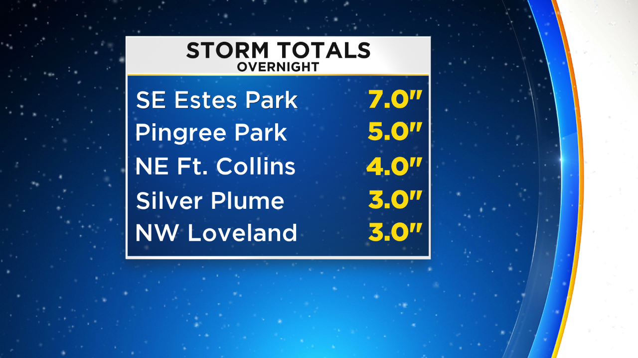
Northern Colorado saw a little "appetizer" last night as a narrow band of snow developed near the Wyoming state line and left anywhere from 3 to 8 inches of snow from Steamboat Springs to Estes Park, Fort Collins and Loveland. We even saw a total over 9 inches from our CBS4 Weather Watcher in Walden. Around an inch of snow fell in the Greeley vicinity.
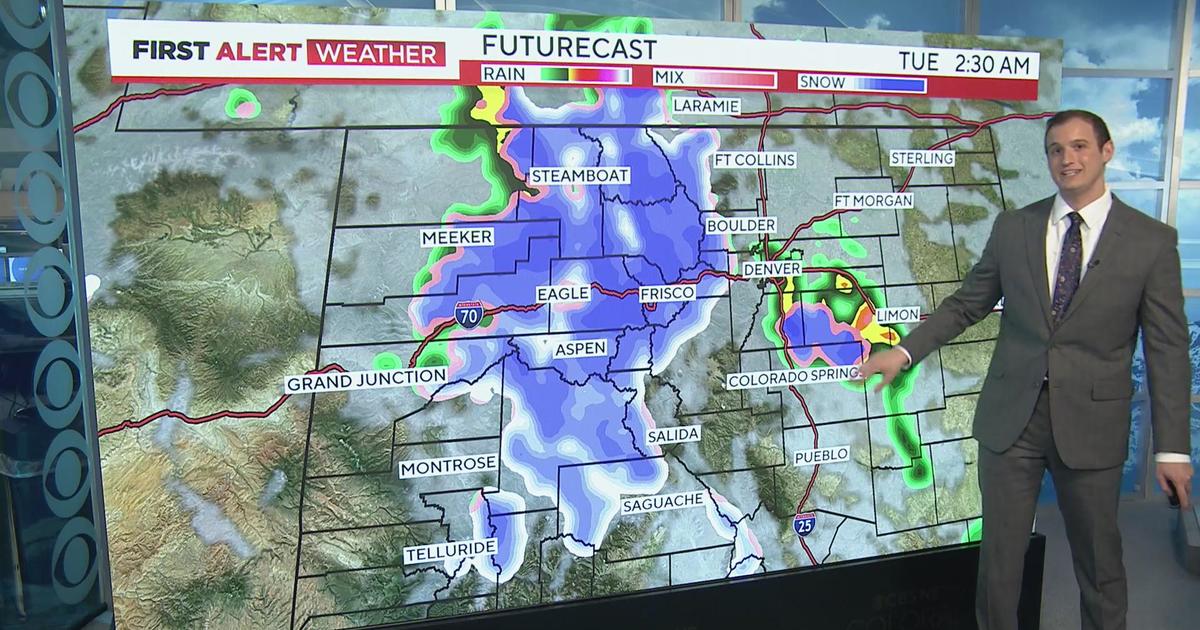
Temperatures will fall throughout the day on Saturday as an arctic front moves across the state. Widespread snow is expected to develop behind it with waves of snow possible through Monday morning for many areas.
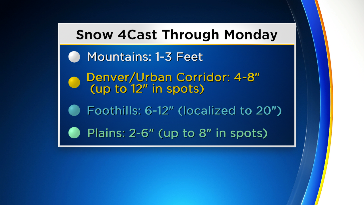
By the time all is said and done we will see many mountain towns reporting totals between 1-3 feet, with up to a foot in the foothills and several inches across the I-25 urban corridor and on the eastern plains.
Wintry travel can be expected statewide this weekend with little improvement on the roads during the day on Sunday due to the bitter cold. By Monday morning many places in northeast Colorado should fall to or below zero. It will be some of the coldest early March air in over 40 years.
Users of the backcountry are encouraged to pay close attention to rapidly changing conditions this weekend with the forecast for heavy mountain snow. We anticipate a sharp rise in the avalanche danger by tomorrow.