Denver Weather: Spring? Not Exactly. March Starts With Another Arctic Blast
DENVER (CBS4) - Meteorological spring starts Friday. And just as it does, an arctic cold front in Nebraska will start moving west straight for Denver and the Front Range.
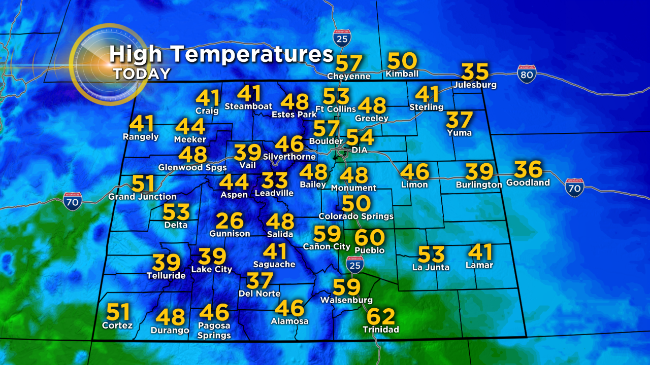
First, the good news if you've been hoping for milder weather. High temperatures along the urban corridor will reach the lower and middle 50s on Thursday. In many neighborhoods it will be the warmest day in two weeks.
The arctic cold front will slowly arrive Friday afternoon so temperatures should still manage to reach the upper 40s to near 50 degrees on Friday before the front arrives. After about 1 p.m. there is a slight chance for a light rain/snow mix in the metro area followed by a somewhat better chance for light snow Friday night through Saturday.
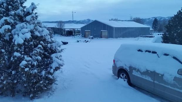
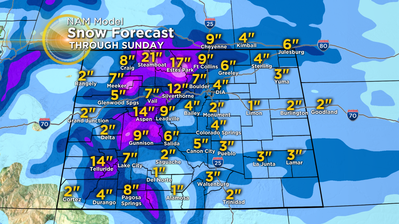
Then our best chance for snow along the Front Range arrives Saturday night with the potential for 3-7 inches of accumulation around Denver, Boulder, and Fort Collins. Meanwhile mountain areas north of I-70 will see a tremendous amount of snow through the weekend with up to 36 inches possible in the Rabbit Ears Pass region. Travel could be come impossible along US 40 over the pass on Friday and Saturday. Farther south the I-70 mountain corridor should see at least 6-12 of snow from Thursday night through Sunday morning.
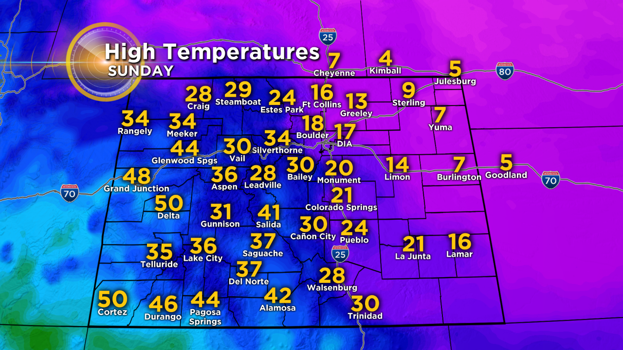
Flurries may linger into Sunday but the bigger story for Sunday will be the COLD. Morning lows will be in the single digits and afternoon highs will struggle to reach the upper teens!