Denver Weather: February Starts Mild Before Blast Of Cold Next Week
DENVER (CBS4) - The first few days of February will be 10 to 15 degrees above normal for Denver and most of the Front Range. It will stay cooler in areas with significant snow still on the ground such as on the Palmer Divide.
High temperatures will be in the mid 50s on Friday followed by highs close to 60° for both Saturday and Super Bowl Sunday. Saturday will be sunny while Sunday may include some large mountain wave clouds along the Front Range that may block much of the sun. It stays dry all weekend at lower elevations but the mountains will see snow on Sunday. While the chance for snow is high, snow amounts will be relatively low compared to recent storms.
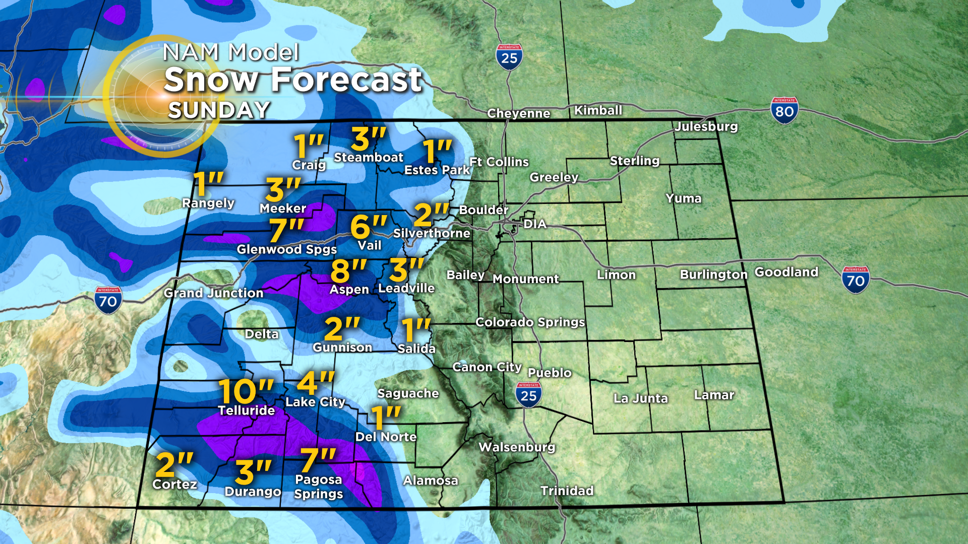
Amounts vary depending on which weather model you look at but generally speaking we expect no more than a few inches in Summit County and 3-6 inches on average for mountains west of Vail Pass. Isolated higher amounts are possible in the San Juan Mountains in southwest Colorado.
Behind this storm the weather pattern will shift to allow much colder air to invade the Denver metro area by the middle of the next week. High temperatures will drop into the 30s next Wednesday.
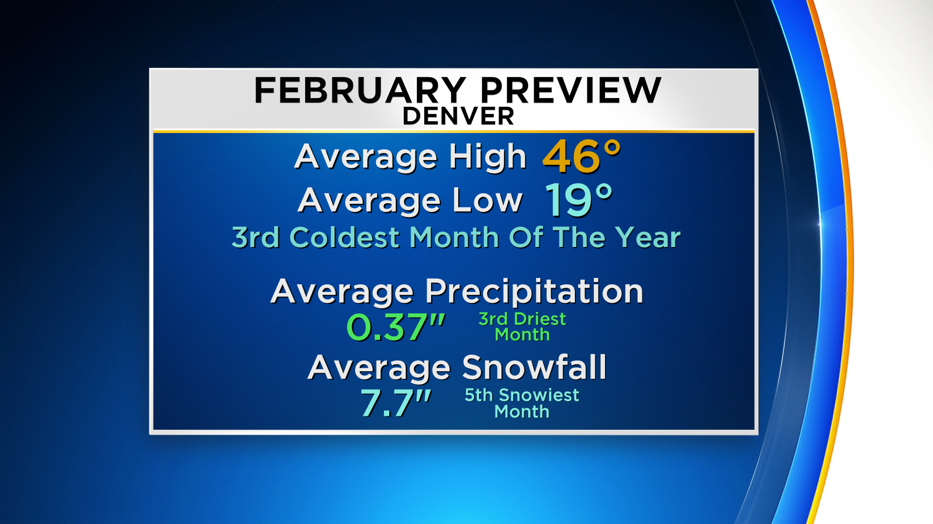
And by the way, February is usually our third coldest month of the year in Denver after December and January. It's also among our drier months with less than 0.50" of liquid precipitation (including melted snow) on average. February can also include huge temperature swings from severe cold to spring-like temperatures in the 60s and even lower 70s. The mild temperatures can give a false sense that spring is arriving early but our snowiest months March and April are still ahead.