Relentless Wind Kept A Large Stretch Of I-70 Closed
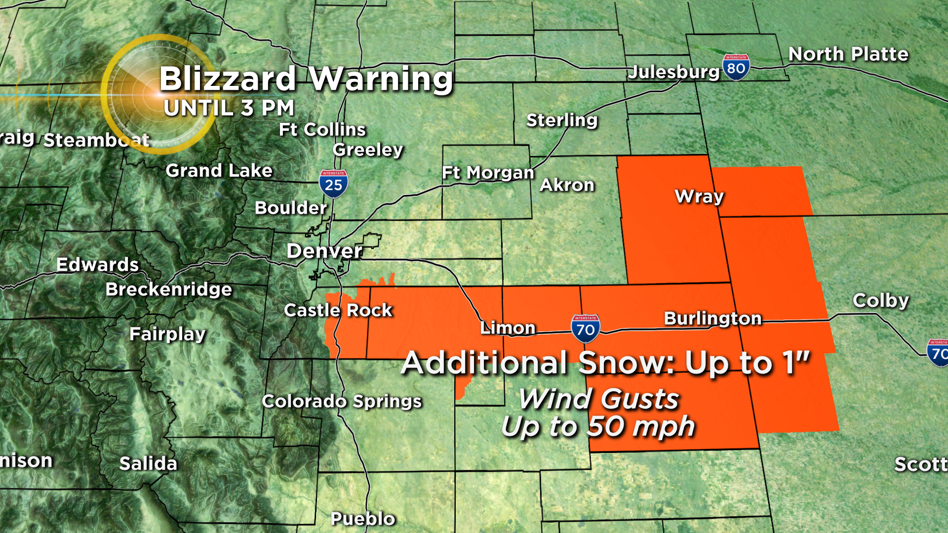
DENVER (CBS4) - The winter storm responsible for blizzard conditions on Colorado's Eastern Plains and Palmer Divide will gradually move east into Kansas late Tuesday. A Blizzard Warning continued for the Interstate 70 corridor east of Deer Trail until 3 p.m.
Additional new snow will be negligible but wind gusts to 50 mph will continue to create whiteouts.
As of 3:15 p.m. on Tuesday, I-70 reopened in both directions between Airpark Road in Aurora to the Kansas state line.
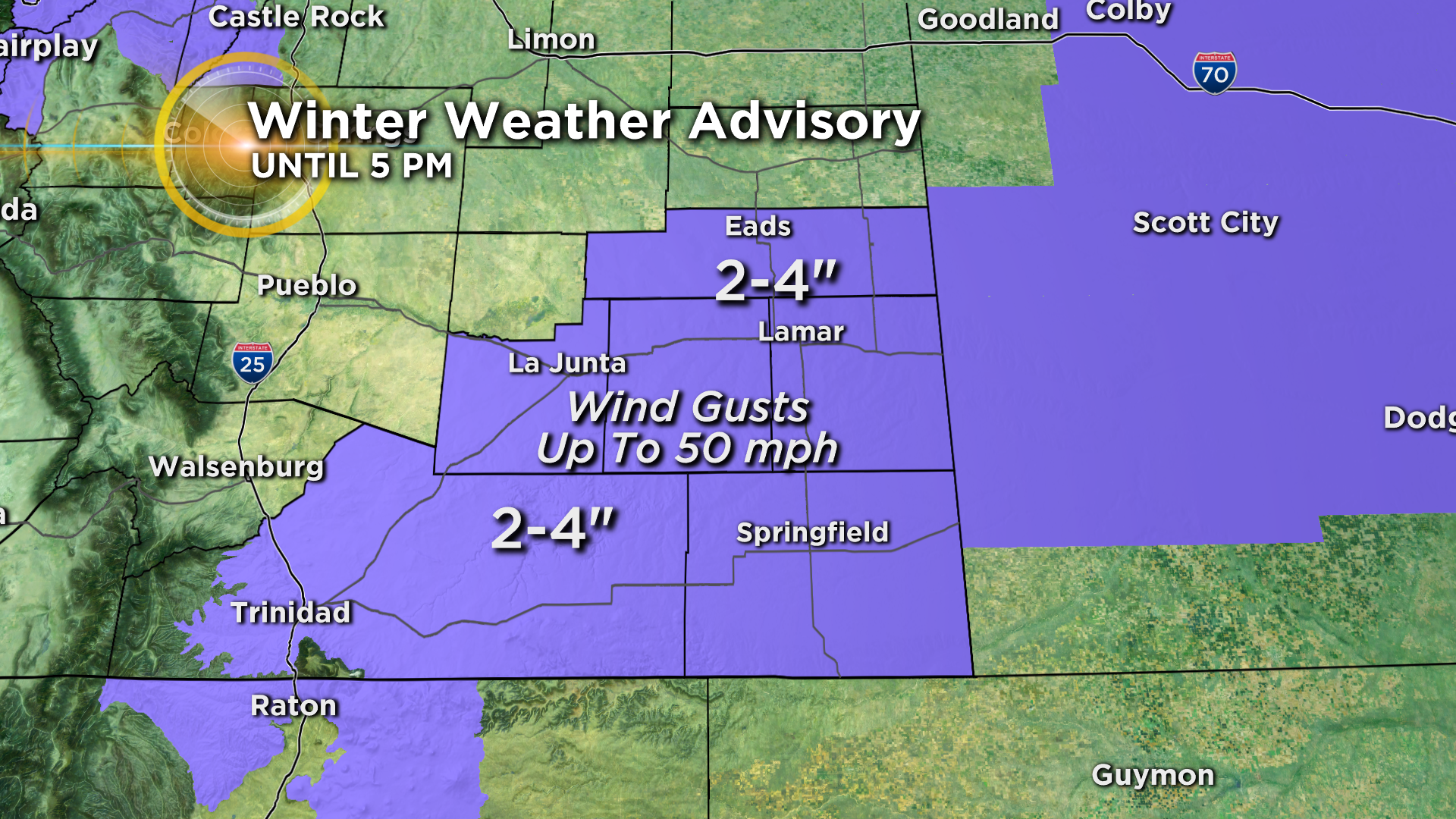
Snow is expected to end completely for most of Colorado by mid afternoon but will linger longer in the southeast corner of the state where a Winter Weather Advisory continues through 5 p.m. Locations such as Lamar, La Junta, Springfield, and Trinidad will see 2 to 4 inches of snow along with wind gusts up to 50 mph.
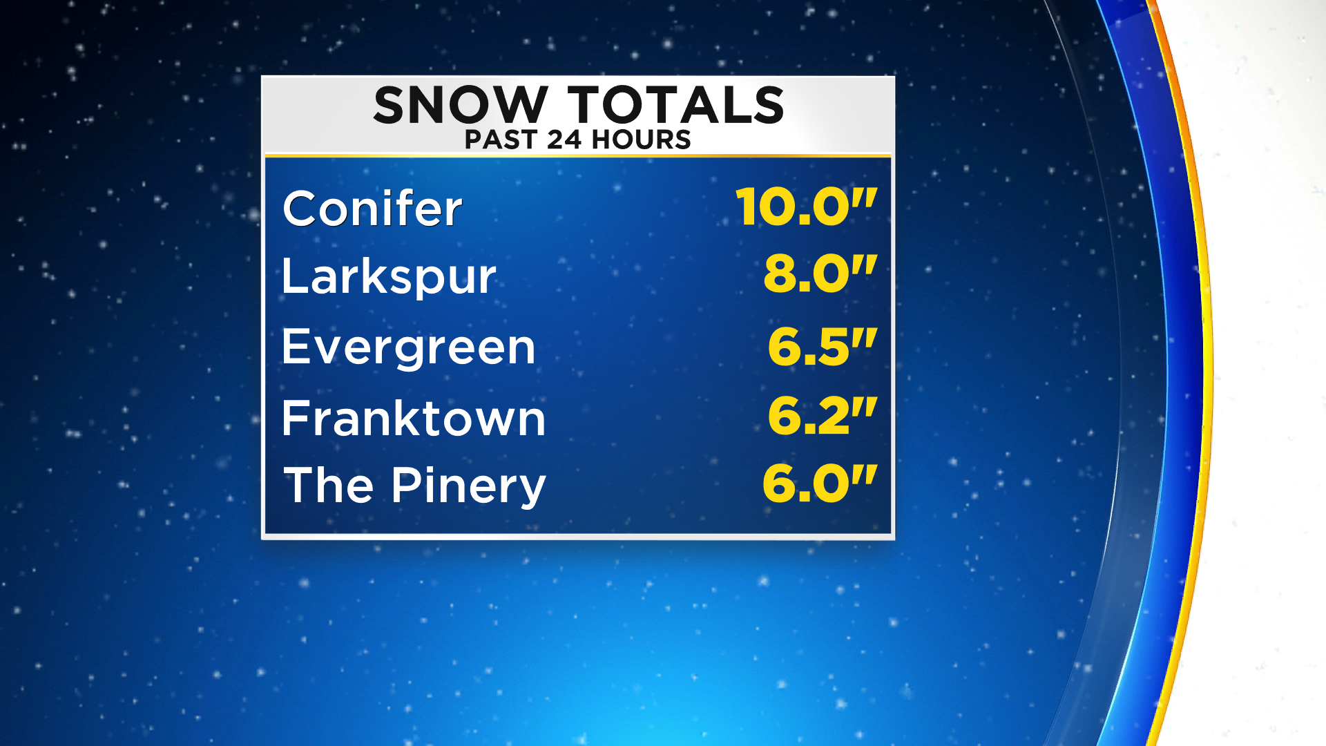
Meanwhile, for Denver and the Front Range, snow totals have been minimal for most neighborhoods with less than 2 inches. Officially Denver reported 1.3" of snow Tuesday morning as measured at DIA. Much higher totals have been reported in the foothills of Jefferson County as well as much of Douglas County above above 6,100 feet.
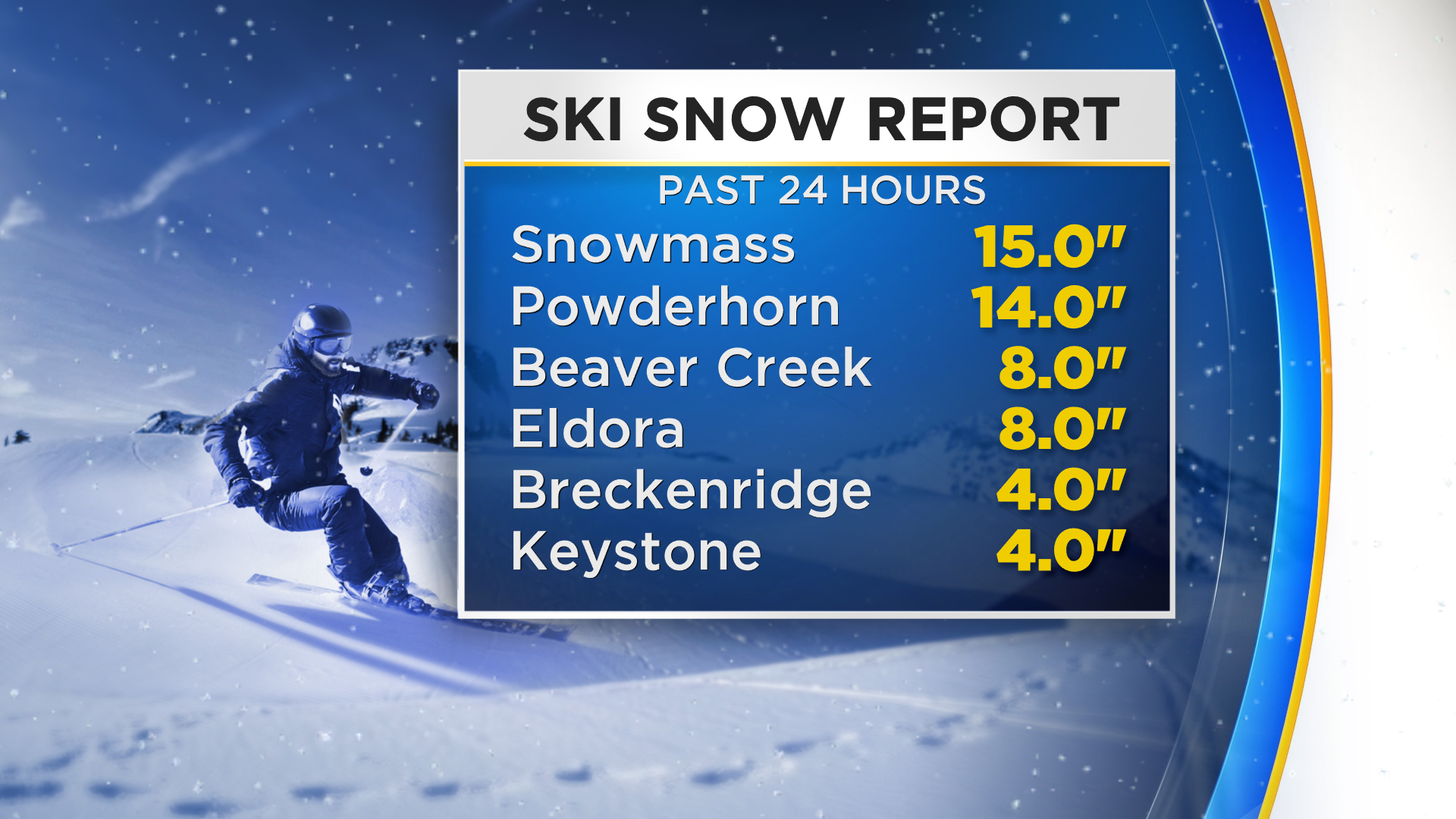
The mountains also did well with this latest storm with most ski areas in Colorado reporting at least a couple inches of snow and some in western Colorado reporting more than a foot.
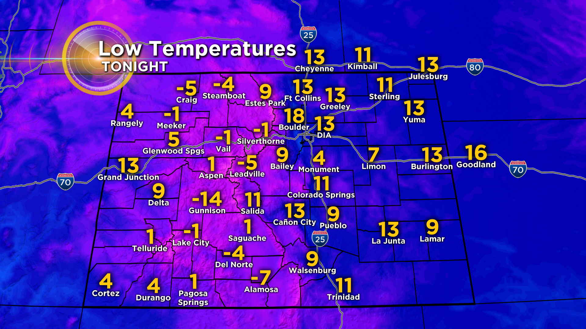
Once the snow ends completely, it will stay cold and windy through the afternoon on Tuesday despite some sunshine. Temperatures will struggle to climb above freezing in the metro area and wind chill temperatures will stay in the teens for much of the day. Then the wind will calm down Tuesday night will make for a cold night statewide.