Warm And Breezy Before Weekend Snow
DENVER (CBS4) - A small chance for snow and some wind will return to the mountains for the first day of winter on Friday (the winter solstice will occur at 3:23 p.m. MT). But the urban corridor and the Eastern Plains will remain dry with temperatures soaring about 20 degrees above normal. It could be warmest day of the entire month in many neighborhoods with highs in the lower 60s around Denver and Boulder, and upper 50s around Fort Collins and Greeley.
Saturday will bring colder temperatures and a good chance for snow in the mountains. And by late Saturday, a few flurries could reach far enough east to fly around the Denver area. Absolutely no accumulation in the metro area for the weekend.
Mainly dry weather will prevail across most of Colorado on Sunday and for Christmas Eve and Christmas Day. It's certainly possible there could be occasional light snow in the mountains during this period but nothing substantial.
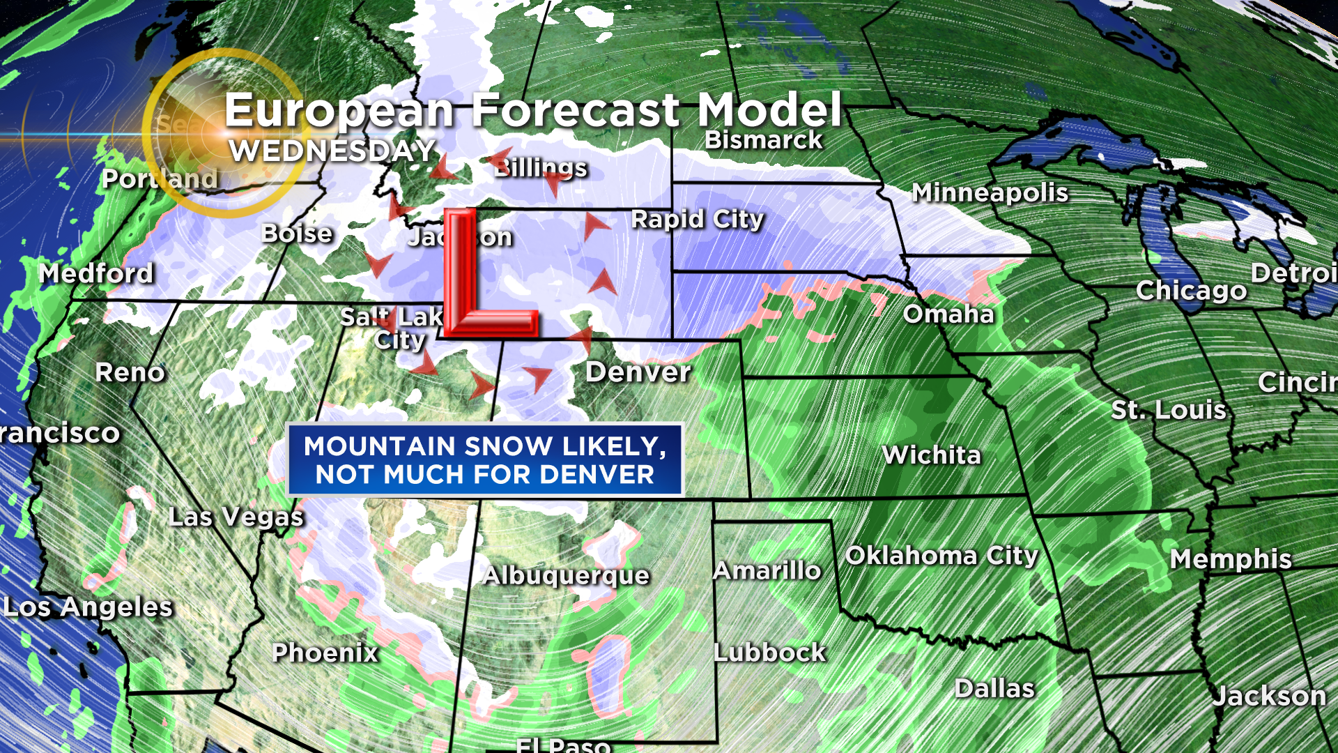
A much strong storm will move into the Rocky Mountain region next Tuesday night into Wednesday. What is unknown at this time is the exact track the storm will take. Some long-range weather models including the "ECMWF" European model insist the storm will track mainly across Wyoming which would bring our mountains a lot of snow but not much if anything for Denver.
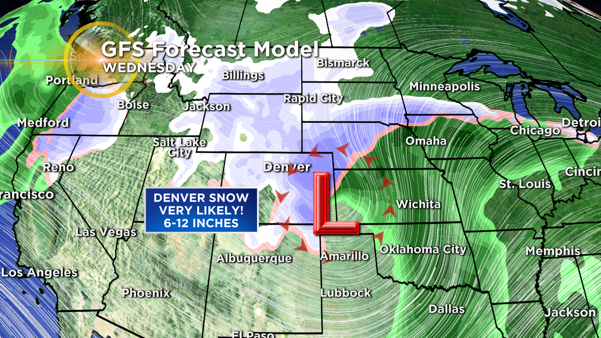
Meanwhile, the "GFS" American model sets the storm up over southeast Colorado which would promote significant upslope along the Front Range and therefore a significant amount of snow. Possible a foot. Or more! In Denver. We'll keep you posted.


Ashton Altieri is a Certified Broadcast Meteorologist. Watch him on the CBS4 Morning News weekdays from 4:30 a.m. to 7 a.m. Connect with Ashton on Facebook and on Twitter @AshtonCBS4.