Bigger Storms & Cooler Heading For The Weekend
DENVER (CBS4) -
Another hot day in Colorado, especially for the eastern side of the state. We reached the mid 80s today, a few degrees warmer than yesterday. We've had strong winds ahead of a cold front that will work it's way through early on Friday morning.
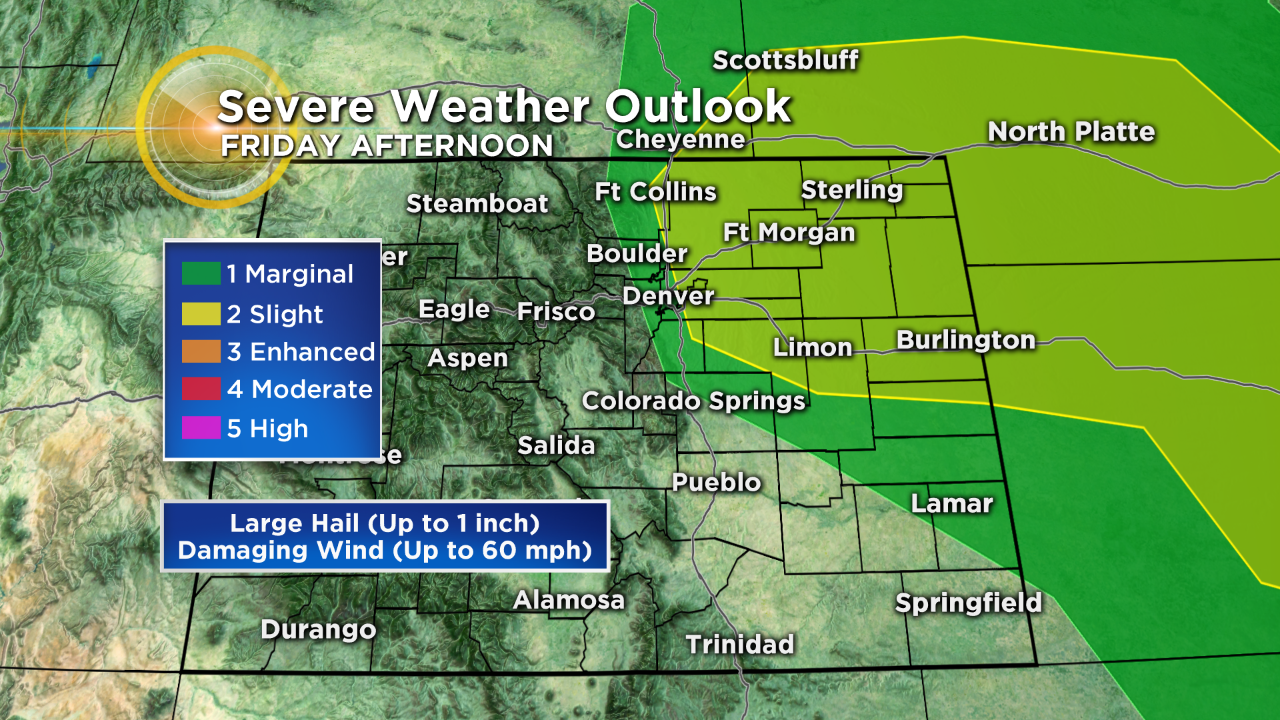
Severe thunderstorms are possible in northeastern Colorado well into Thursday night. They will be capable of producing large hail, damaging wind, and perhaps a weak tornado.
Big changes roll into the Front Range on Friday with that cold front. The front will cause scattered showers and thunderstorms to develop in the afternoon and some storms could be severe from Denver to the east. The primary concern is large hail.
Storms should end for the Denver area by the Friday night, but the eastern plains could see strong storms well into the night. Heavy rain is possible on Saturday, along with much cooler temperatures. Highs will drop to the mid to low 50s on Saturday!
In the mountains, the cold front will drop the snow level as low as 9,000 feet by Saturday morning. And for the higher mountains above 10,000 feet, we could see 4-8 inches of snow.
We'll be drier on Sunday, but there will still be a chance for isolated thunderstorms in the afternoon.


Watch meteorologist Lauren Whitney on CBS4 News on weekday evenings at 5, 6, 6:30 and 10 p.m. Check out her bio, connect with her on Facebook or follow her on Twitter @LaurenCBS4.