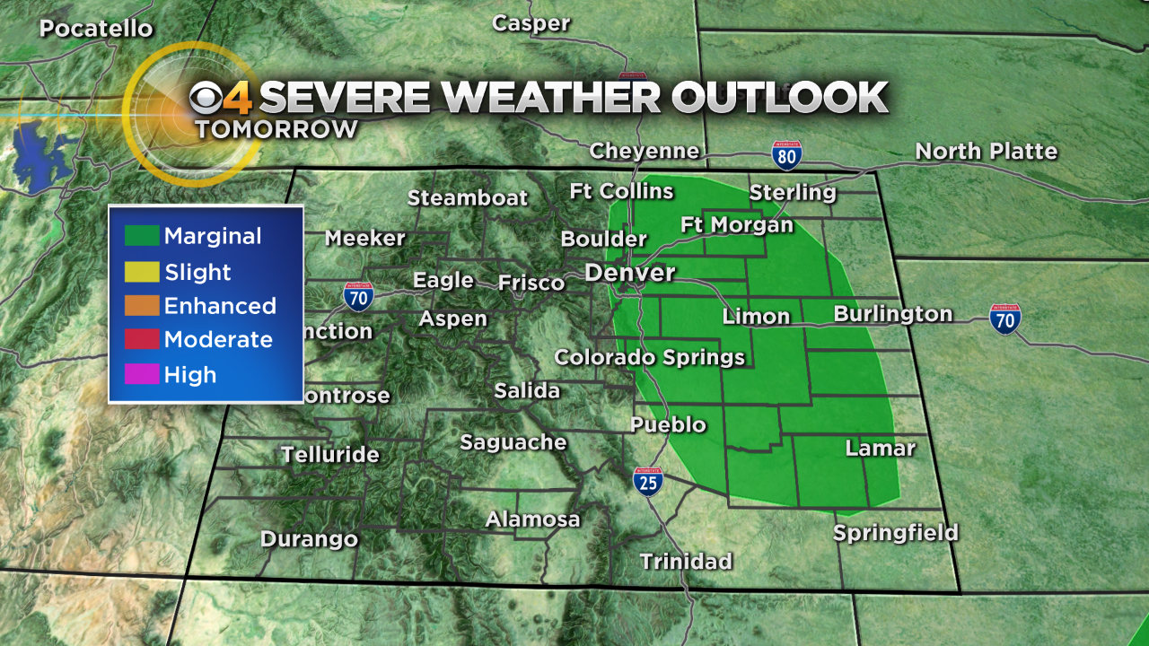
More Severe Storms Possible
DENVER (CBS4) - Colorado is stuck in a pattern of morning fog and drizzle with afternoon thunderstorms through the beginning of the week ahead.
Saturday's storms had enough lift to produce hail in some spots of the Front Range and Eastern Plains. Many storms in and around the Berthoud up into northern Weld and Larimer Counties along with heavy rain and damaging winds. Strong storms also pelted areas near Deer Trail and Last Chance with up to 1 inch diameter hail, strong winds and flooding rains.

The same cut-off low spinning over Nevada and cold air pushing down the east side of the Rockies will be locked in place for Monday. This will create another day similar to what we have seen this weekend. Cloudy, foggy and drizzly to start the day and possible severe storms by afternoon and evening.
Temperatures will warm as the week goes on with every day this week having a chance for afternoon showers and thunderstorms.


Meteorologist Dave Aguilera is a Colorado native and has been forecasting weather in the Rocky Mountain region for over 25 years! Connect with Dave on Facebook and on Twitter @DaveAgCBS.