Warm Weekend Ahead With Scattered T-Storms Possible
By Chris Spears and Dave Aguilera
DENVER (CBS4) - The last weekend of April 2018 will be on the warm side around Colorado.
There will be a small threat for some scattered afternoon and evening showers or thunderstorms late Saturday.
The best chance will be over the mountains and foothills south of Interstate 70 but one or two could roll through metro Denver too.
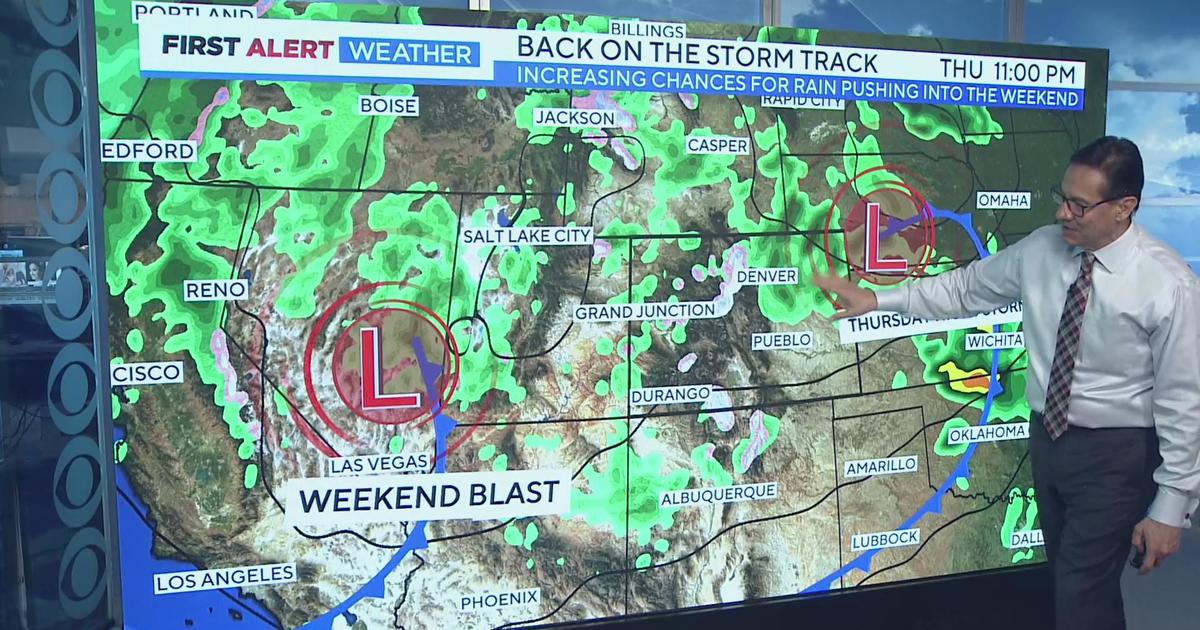
A new area of low pressure will approach Colorado from the west during the day on Sunday and out ahead of it southerly winds will really warm things up.
Some places, including Denver, will be within a few degrees of the daily record high.
The warmth and our dry conditions will mean an increase in fire danger for much of the state.
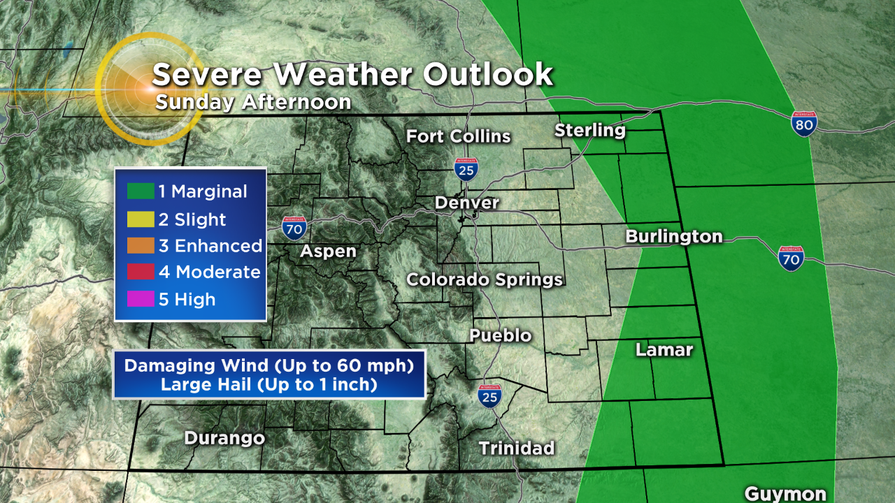
By late Sunday afternoon there could be a few strong to severe t-storms on the far eastern plains.
As the area of low pressure crosses the Rockies next week we will see a big cool down and a better chance for rain statewide.


Meteorologist Chris Spears travels weekly in the CBS4 Mobile Weather Lab reporting about Colorado's weather and climate. Check out his bio, connect with him on Facebook or follow him on Twitter @ChrisCBS4.