Severe Thunderstorms Possible Tuesday Afternoon
Tuesday's elevated risk of severe weather could bring the strongest storms that we've seen in several weeks. The Storm Prediction Center in Norman, OK is forecasting large hail and damaging winds for parts of the northeastern plains.
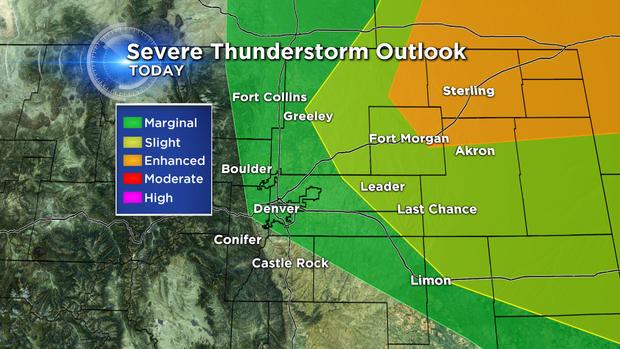
The "enhanced" area highlighted in orange has the highest likelihood of one inch diameter hail and larger. Some of the storms could also produce straight-line winds over 60 miles per hour. Property damage is possible from Ft. Morgan to Sterling and for other towns along the I-76 corridor. There's a 15 percent chance for similar storms in the yellow shaded "slight" risk category.
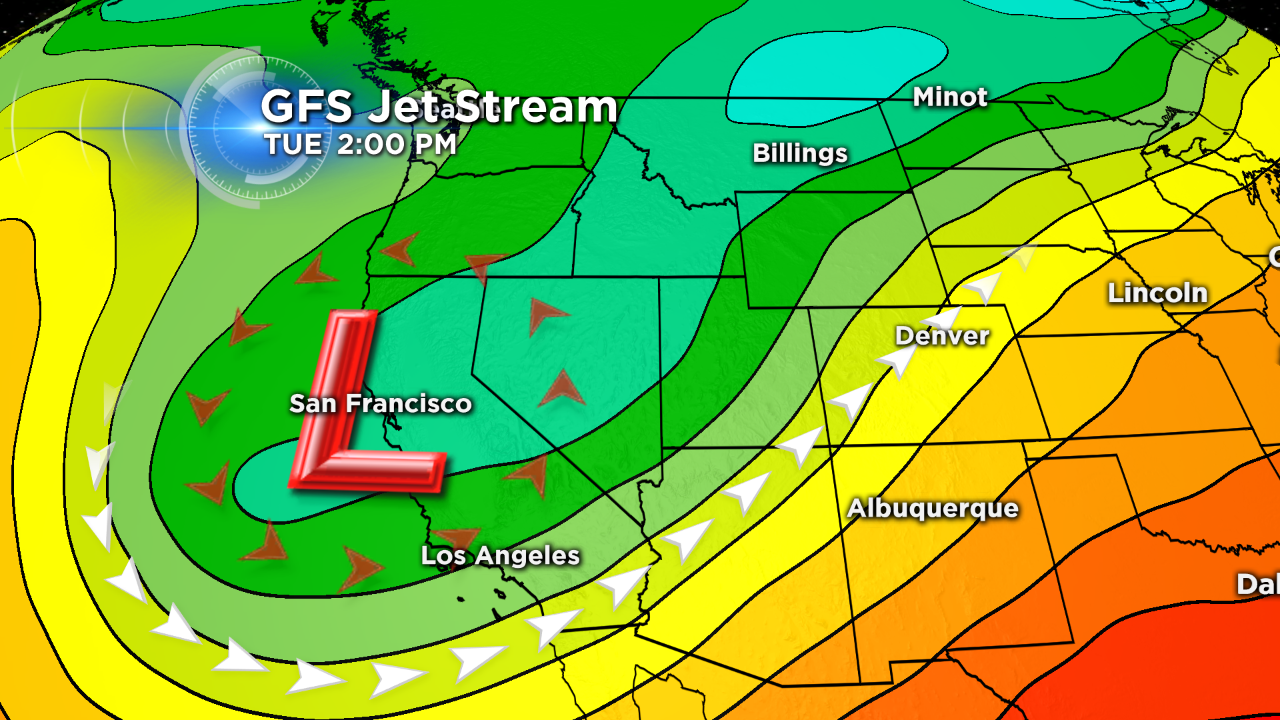
The atmosphere is expected to be very unstable Tuesday afternoon, especially when we reach the highest temps of the day. Scattered supercell thunderstorms will likely start around 3 p.m., then move northeast into Nebraska and Kansas. Several necessary ingredients will be present over northeastern Colorado to bring these severe storms. The computer models are predicting very fast jet stream winds from the southwest. There's even an area of "diffluence," or, air that's moving apart in the upper atmosphere. This helps the air rise vertically and is a signature of severe weather.
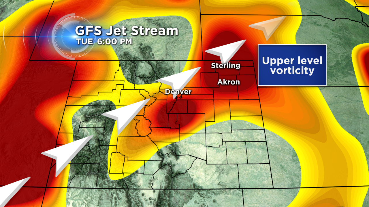
Embedded within the upper level flow are areas of spin and lift known as "vorticity." The European Model shows this disturbance over Sterling and Akron on Tuesday evening. This area will be watched carefully as organized storms with rotating updrafts could produce very large hail.
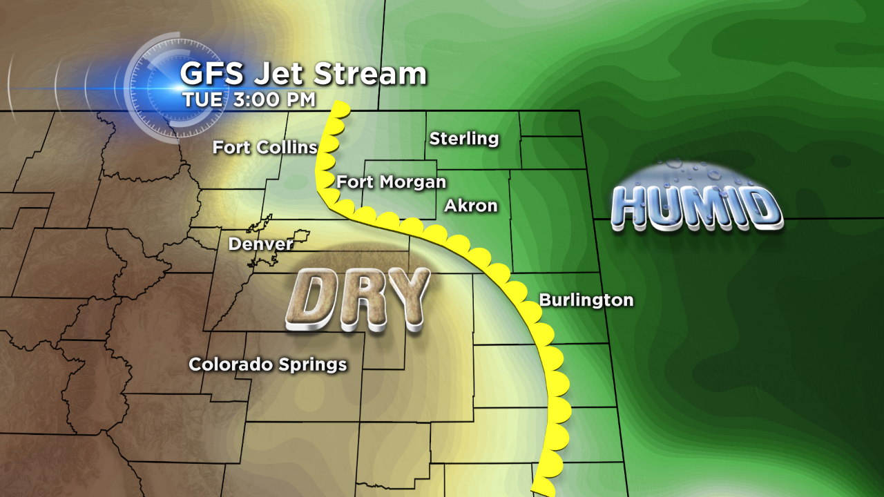
The last major component of our storm setup will be the dividing line between humid air from the Gulf of Mexico, and the dry air currently over central Colorado. The yellow icon separating these two air masses is known as a dry line. That's where the storms will probably begin on Tuesday afternoon as the lower atmosphere heats up. Relatively cold temperatures from 10,000–40,000 feet will allow the air to abruptly rise through the atmosphere and quickly create thunderstorms.
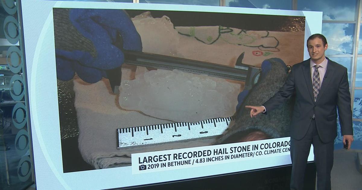
Colorado is home to the second highest incidence of hail damage in the country, we'll likely live up to our reputation on Tuesday afternoon.
Justin McHeffey provides nightly reports from the Mobile Weather Lab. He travels Colorado in search of Mother Nature's most powerful and beautiful conditions. Like his Facebook page Meteorologist Justin McHeffey and follow him on Twitter @WeatherMcHeffey.