By Justin McHeffey
DENVER (CBS4) - Winter weather returns to the metro area and all of the high country Wednesday night. Two upper level disturbances are spinning across the southwestern U.S., that means snow is heading our way. Denver's high temperatures are expected to fall 25 degrees between now and Saturday with accumulating snowfall in the city.
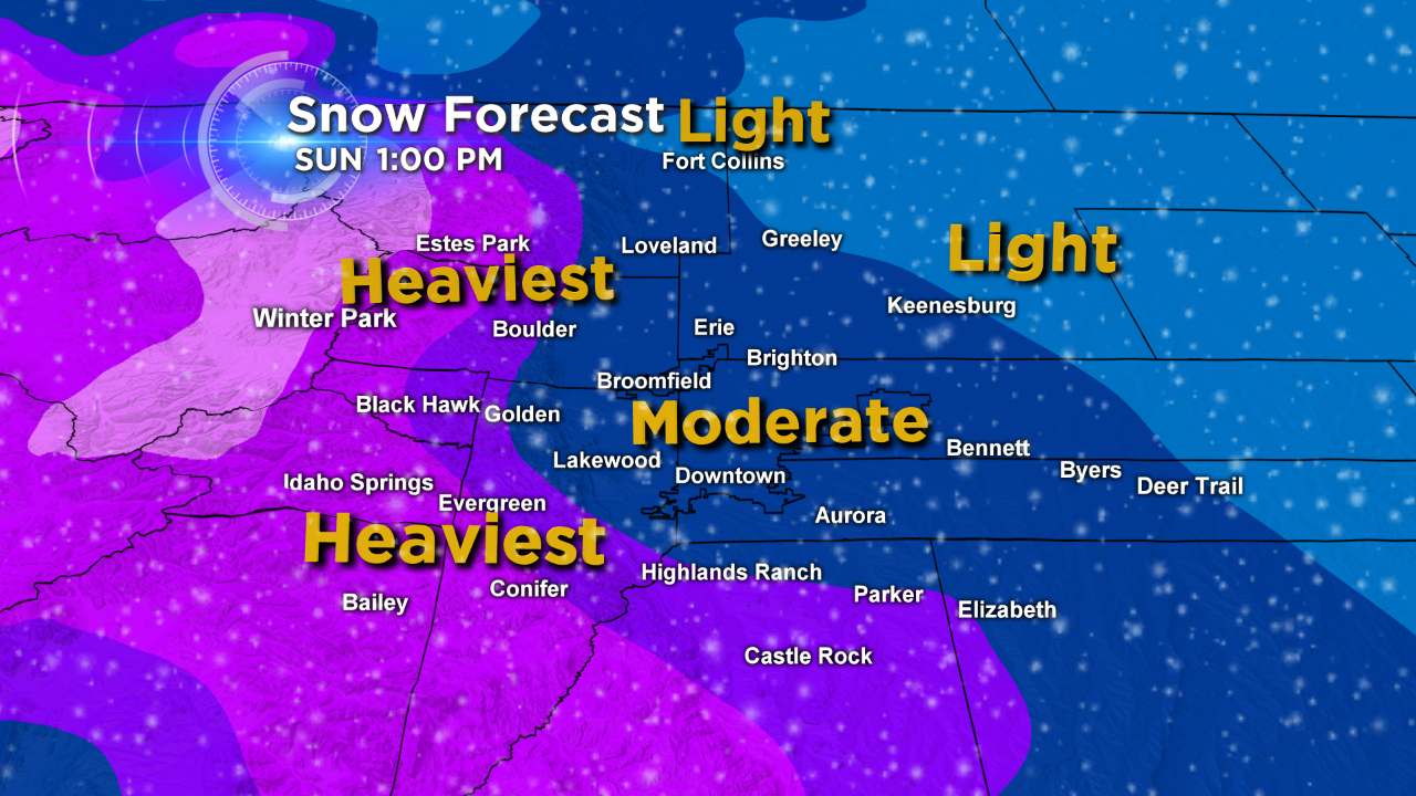
Amounts will be varied across the I-25 corridor, but we expect consistent snow Thursday morning through Friday afternoon. Central Denver and the suburbs are expecting moderate snowfall through this time frame, the foothills will end up with the most. Two-5" are likely for the Denver metro area with 3-6" in the foothills.
Upslope winds develop along the Front Range late on Wednesday night behind a weak cold front. We'll likely see snowflakes in Denver during the morning commute Thursday. A surface low pressure slides across southeastern Colorado and should enhance the northeasterly moisture flow through the afternoon.
There's a conveyor belt of unstable air blowing into Colorado from the Pacific. This will keep the atmosphere nearly saturated from the base of the snow clouds upwards several thousand feet. That means we'll have the necessary airmass for snow in Denver, and the prolonged upslope winds should produce measurable snow for all locations along I-25.
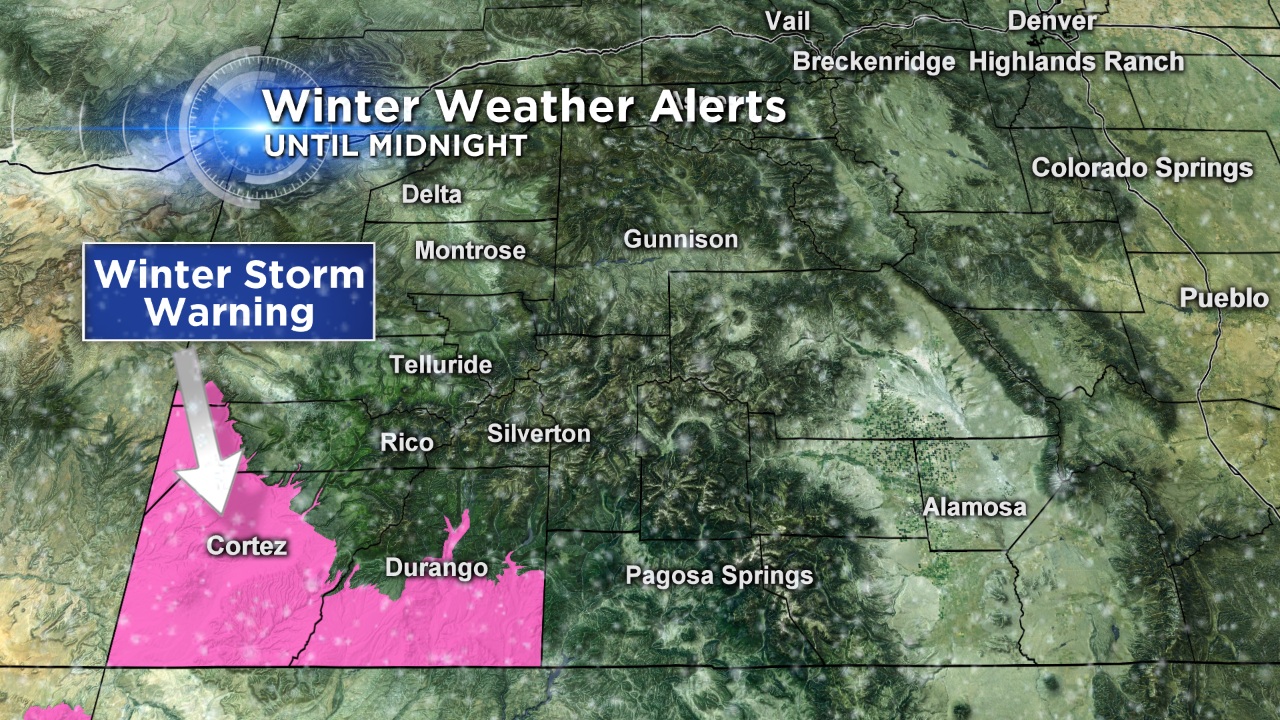
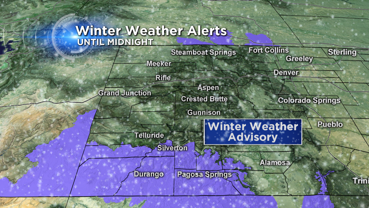
The mountains along and south of highway 50 will end up with the most out of the storm. A Winter Storm Warning remains in effect until midnight Wednesday for the extreme southwestern corner of the state. Also, a Weather Advisory is posted until midnight for the eastern and southern San Juan Mountains as well as the Animas River basin.
Although the Interstate 70 ski areas are not favored for the most snowfall, 4–8" will be found for most mountains between Wednesday night and Saturday morning. This is a conservative number, because southwest facing slopes could benefit with higher rates of snowfall Wednesday night, then by late Thursday the northwest flow will drop several inches for places like Steamboat Springs.
It's a tedious forecast since the main low pressure system is a little disjointed. We're analyzing smaller features within the wind pattern and trying to determine where the heaviest bands of snow will form.
Finally, the weekend will be cold in Denver behind the exiting system — we won't make it out of the 20s.
Justin McHeffey provides nightly reports from the Mobile Weather Lab. He travels Colorado in search of Mother Nature's most powerful and beautiful conditions. Like his Facebook page Meteorologist Justin McHeffey and follow him on Twitter @WeatherMcHeffey.