Next Week's Snowstorm Could Require A Snowplow
By Dave Aguilera and Chris Spears
DENVER (CBS4) - We're busy in Colorado's Weather Center tracking a developing snowstorm that is set to hit Colorado sometime late Monday and potentially lasting through Wednesday.
We know this storm is still a long way out, but because of the potential it is showing to be significant, we want you to be informed.
Current forecast models all show a strong winter storm entering the region early next week. But the models vary in their details of how long the storm will last and how much snow will fall.
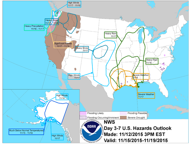
The lastest weather hazards map issued by NOAA's Climate Prediction Center is also showing the potential for heavy snow and high wind somewhere in eastern Colorado by next Tuesday.
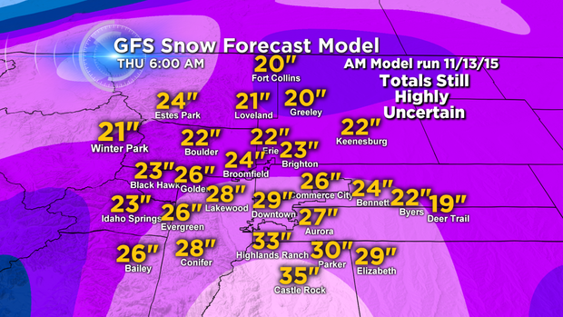
Should this storm slow down and stall out, as suggested by the Global Forecast System (GFS) model, there's the potential for this storm to set records and be measured in feet.
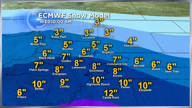
But if it moves faster, as suggested by other models, we'd be talking a much more manageable snowfall event.
Below is a snapshot of two forecast models ran on Friday morning that show the extreme variation in potential outcomes.
In a state like Colorado it's all about location, location, location. And that is key as to what the final outcome will be with the exact track of this storm.
Stay with CBS4 and Colorado's Weather Center all weekend for the latest forecast updates as we track this system.


