U.S. 34 Set To Reopen Soon After 2013 Floods: 'It's A Relief'
LARIMER COUNTY, Colo. (CBS4) - Five years after the floods of 2013, U.S. 34 is finally ready to reopen.
The highway from Loveland to Estes Park is scheduled to open to the general public on Thursday at 4 p.m.
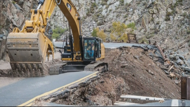
The Colorado Department of Transportation took CBS4 behind the scenes of its construction operation, which caused the canyon to be closed for years to the general public. Residents were given passes to utilize the highway.
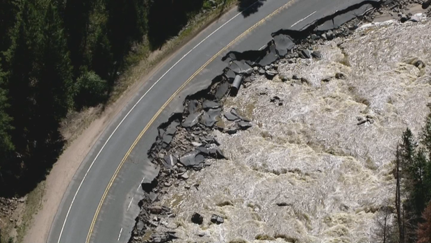
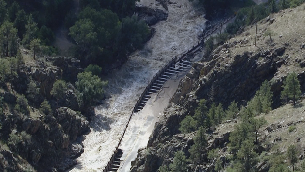
CDOT said closing the highway for five years not only helped save money, but also made the passage safe. At one point, the highway was destructed down to the width of an ATV.
CDOT said the nearly $300 million construction project should help improve the environment, social gains and the economy along the highway. They also said the improvements would help lower emergency response times and costs in any future floods.
"The 2013 flood event was the second largest air evacuation in the nation's history, second to hurricane Katrina," said James Usher, CDOT Project Director.
By closing the roadway, officials say they were able to better address the needs of the canyon in a short period of time.
"(CDOT was) able to shave a year and a half off the construction time frame," Usher said.
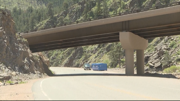
With U.S. 34 finally re-opening, CDOT warned those who would use the roadway to not expect many visual changes.
"(Most of the project) is all buried," Usher said.
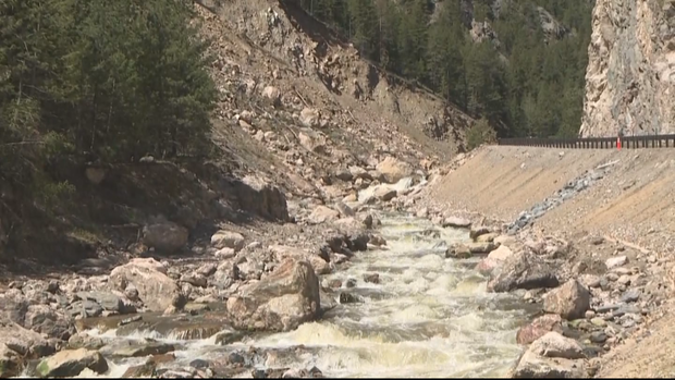
For example, crews redirected the river, using two large pipes. With the natural riverbed dried, they dug the base of the river deeper. Then, they brought in larger rocks and cemented them in to the ground. By doing so, Usher said the state was able to create a more stable bedrock.
"With that concrete, it really makes it a larger mass that will really help combat the erosive forces of the river," Usher said.
CDOT Regional Transportation Director Johnny Olson told CBS4's Dillon Thomas the most noticeable change to the landscape comes at the horseshoe.
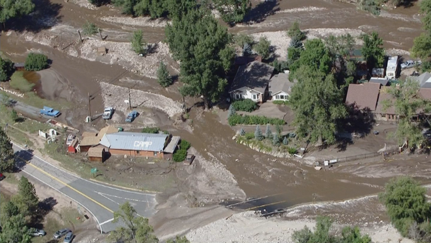
The original highway washed out during the floods of 1976 and 2013 along the horseshoe. The roadway was only feet above the river itself.
To avoid that issue in the future, crews blasted a portion of the mountain above. They then constructed a large bridge, which takes traffic up and over the river.
They plan to tear out the old highway giving the river a wider area to expand and slow water flow down.
"The more space we get for the river, it slows the river down," Usher said.
"It is going to give that river some chance to grow and to swell. It will also slow it down in areas for better fishing," Olson said.
With those changes, and many more, completed over the past five years, CDOT said future flooding should be insignificant, in comparison to what was seen in 2013. Olson said he was "95 percent confident" the damage done before would not be replicated. Usher said he believed the same.
"That is not going to happen again," Usher said.
"It is pretty amazing to see what they accomplished. It is also a relief to say we are done," Olson said.
Dillon Thomas is a reporter at CBS4 and a Colorado native. He believes everyone has a story, and would love to share yours! You can find more of his stories by following him on Twitter, @DillonMThomas.