Why Highest Snow Totals Could Hit South & East Of Downtown Denver
By Chris Spears
DENVER (CBS4) - We're tracking a typical spring-like winter storm crossing Colorado today and it will bring a variety of weather to Denver and the adjacent plains by Sunday evening.
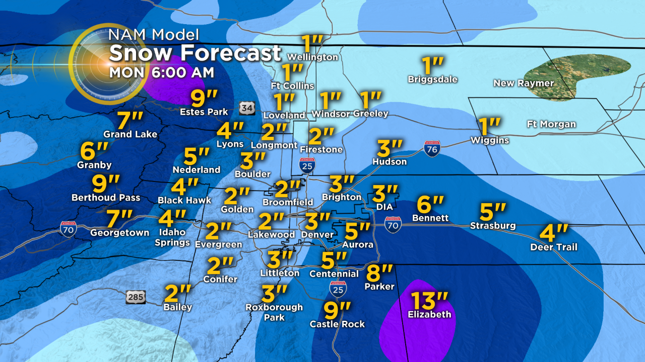
Rain showers and a few thunderstorms will give way to snow overnight with a wide variety of snow totals from north to south.
RELATED: Snow Begins Falling On Interstate 70 In Mountains Sunday Afternoon
There's the potential for as little as an inch or less of snow near the Wyoming state line to a half foot or more south and east of downtown Denver.
The reason for such variation? Glad you asked. The simple answer is wind and terrain.
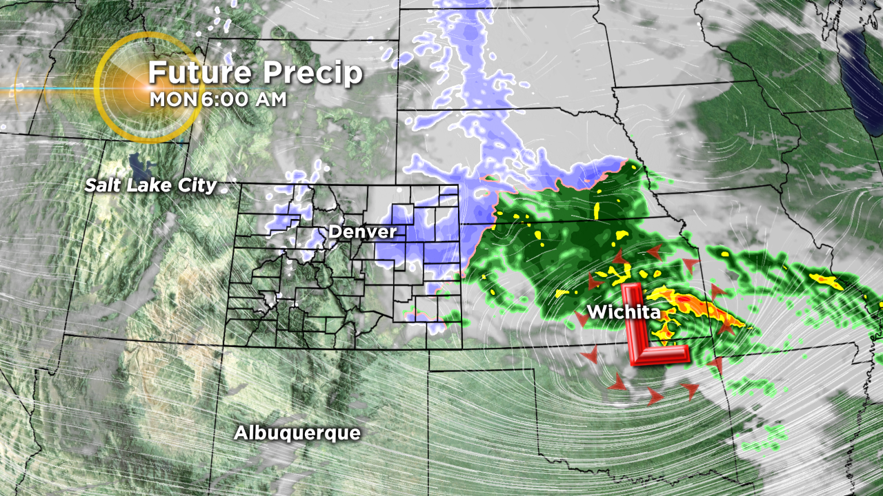
As the low pressure crosses Colorado and moves into the plains of Kansas it will intensify as it grabs warm, moist air from the Gulf of Mexico. The counter-clockwise circulation around this low will bring that moisture into Colorado on a northerly wind.
Because of two prominent terrain features that jut out of the Rockies and onto the eastern plains we will see a wide variety of weather conditions in a relatively small area.
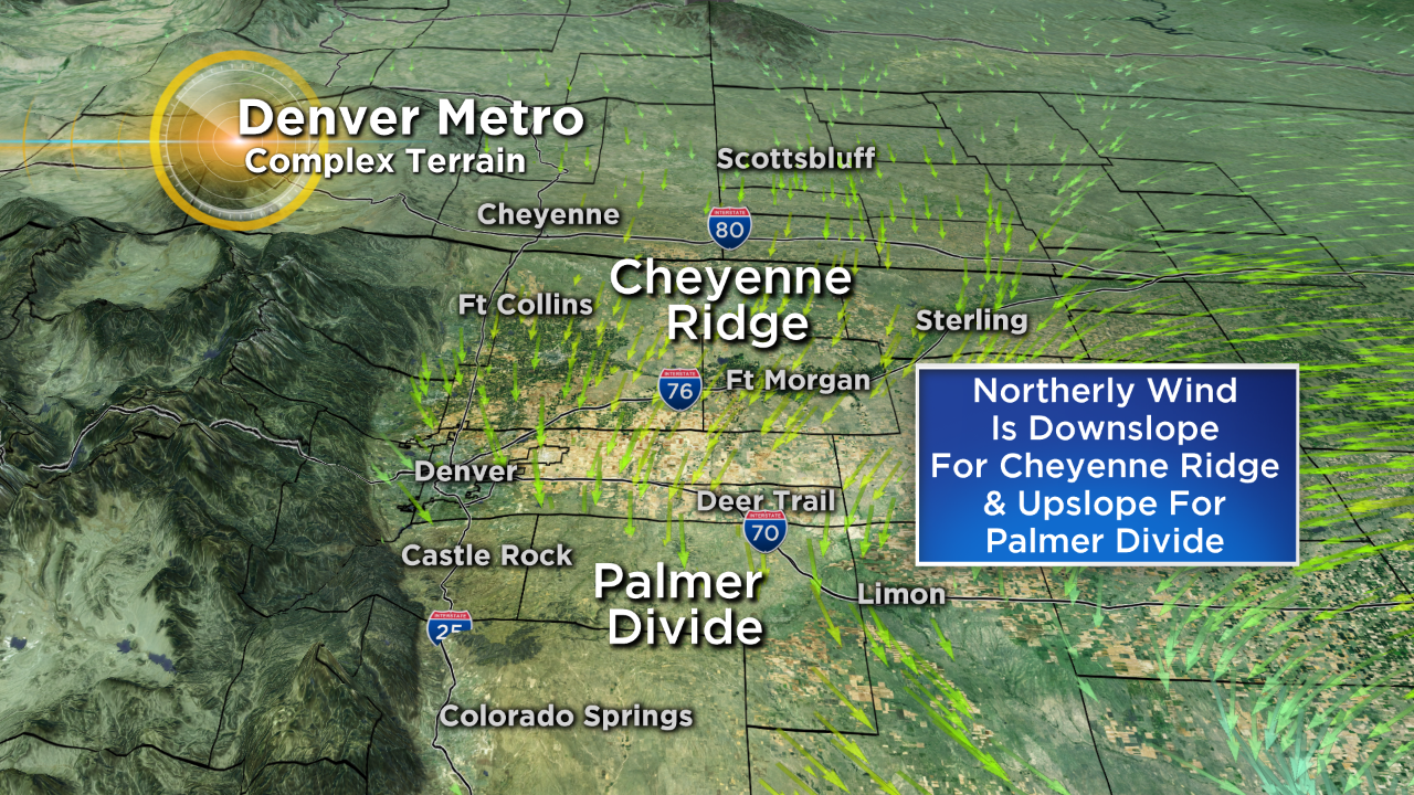
Areas of northern Colorado south of the Wyoming state line will see a northerly wind downslope off of the Cheyenne Ridge. This motion in the atmosphere creates slight warming and drying of the air which reduces potential snow totals.
Meanwhile, areas just south and east of Denver will see an upslope due to the Palmer Divide. When air is forced up by the land it enhances the rate of cooling and condensation and can help make more rain or snow.
And then you have Denver, stuck in the middle, which is why we often see such a wide variety of totals from north to south with this type of weather scenario.
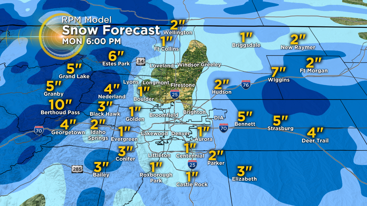
Computer models know this is happening and do their best to account for the land-wind interaction but there are also several other variables that will dictate the final outcome.
Hopefully you can see why two different computer models can have such a wide variety of solutions as they try to account for all of the variables of this storm.
Hopefully you can also see why slight shifts in the storm's track mean major shifts to the forecast for a place like Denver, which is surrounded by higher terrain on three sides.
The bottom line and take away messages include...
Of course all of this is based upon no major changes to the track of the storm as of this post.
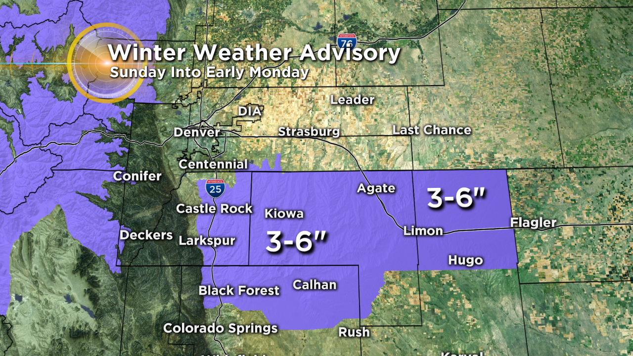
In addition to the snow strong gusty wind will likely create some areas of blowing and drifting snow with the potential for a tough commute in some areas by Monday morning.
Get the full forecast here.
Watch the latest forecast from Colorado's Weather Center:
Meteorologist Chris Spears travels weekly in the CBS4 Mobile Weather Lab reporting about Colorado's weather and climate. Check out his bio, connect with him on Facebook or follow him on Twitter @ChrisCBS4.