Turning Windy & Colder With Quick Mountain Snow
DENVER (CBS4) - Our windy weekend fired up more grass fires on Sunday. From Kiowa down to Fort Carson wind-driven wild fires put fire fighters to the test again to finish the weekend. This is the second day in a row of fires getting out of hand because of gusty chinook winds of 50 to 60 mph and even stronger in the foothills.
Fires on Saturday popped up from Washington County in northeast Colorado down to Pueblo in southern Colorado.
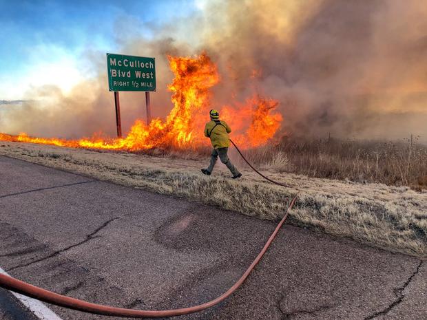
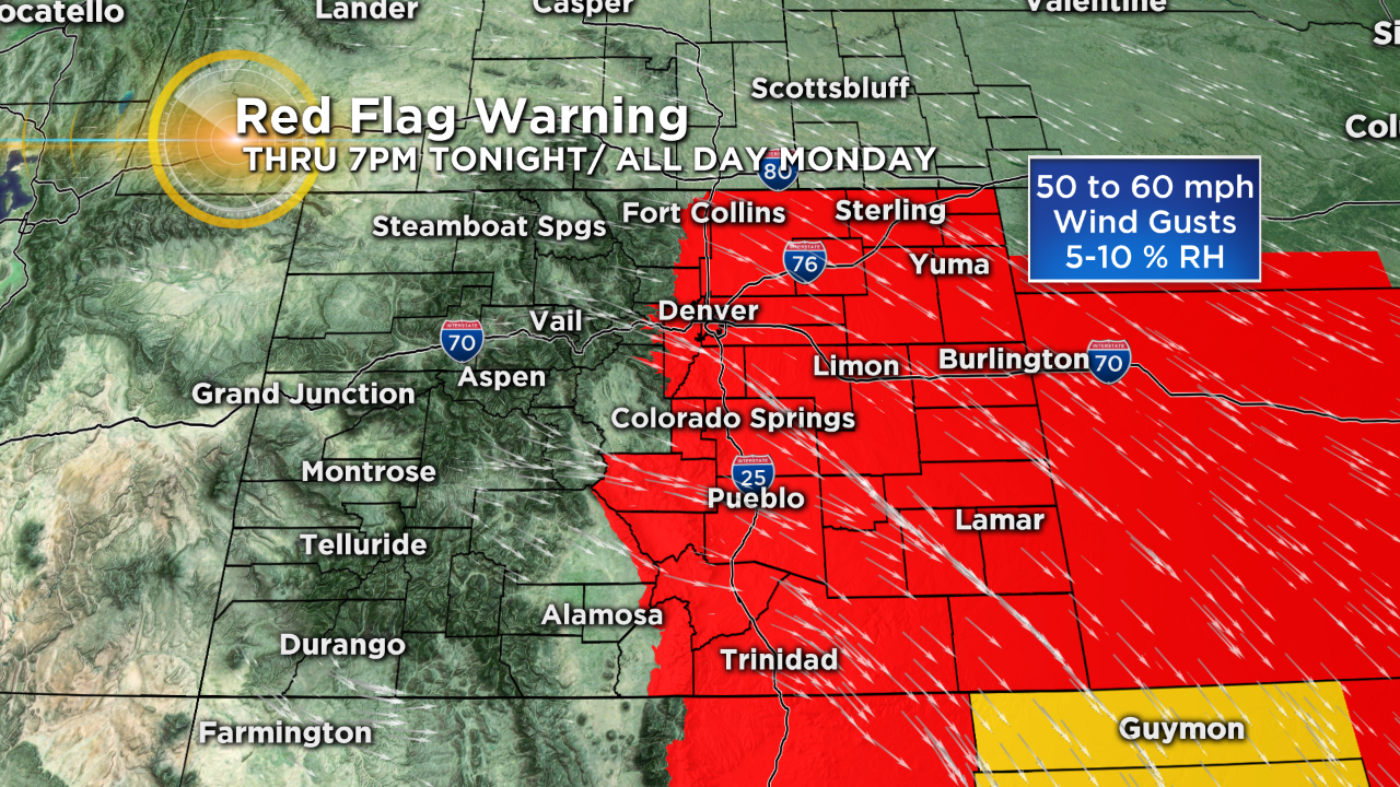
A cold front is ripping through the state Sunday night. This will rotate the strong winds from the southwest to the northwest on Monday. So we will trade windy and warm for windy and cold to start the week. There is a Red Flag Warning for almost all of eastern Colorado for Monday from 10am through 6pm.
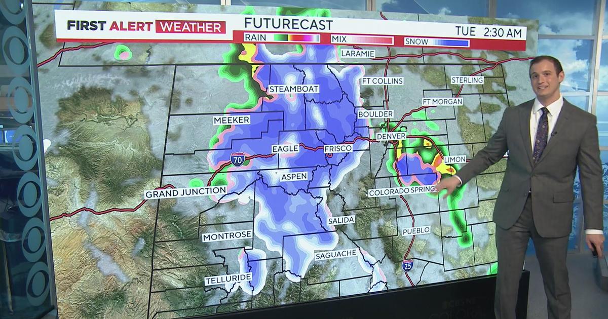
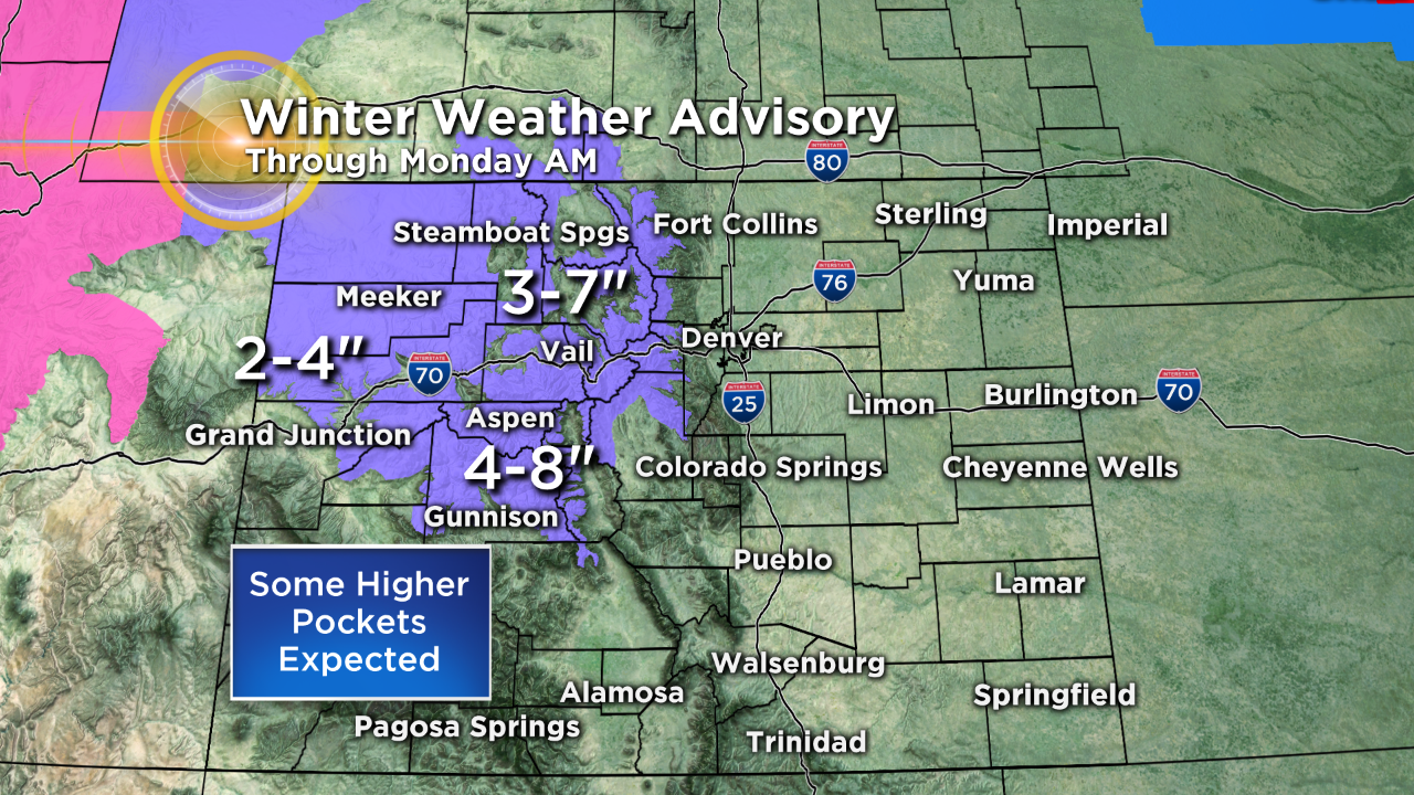
The main part of this storm system will move across Wyoming but we will see some snow in the northern and central mountains where a winter weather advisory has been issued.
Snow totals won't be too heavy but due to the wind we could see some minor travel issues at times.
Southwest Colorado will largely miss out on this snow maker but a few scattered light snow showers are possible.
And while we can't rule out a few rain or showers along and east of Interstate 25, most people will remain dry.


Meteorologist Chris Spears travels weekly in the CBS4 Mobile Weather Lab reporting about Colorado's weather and climate. Check out his bio, connect with him on Facebook or follow him on Twitter @ChrisCBS4.